Table of Contents
Places on Arda
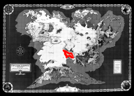
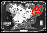
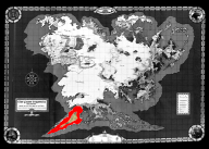
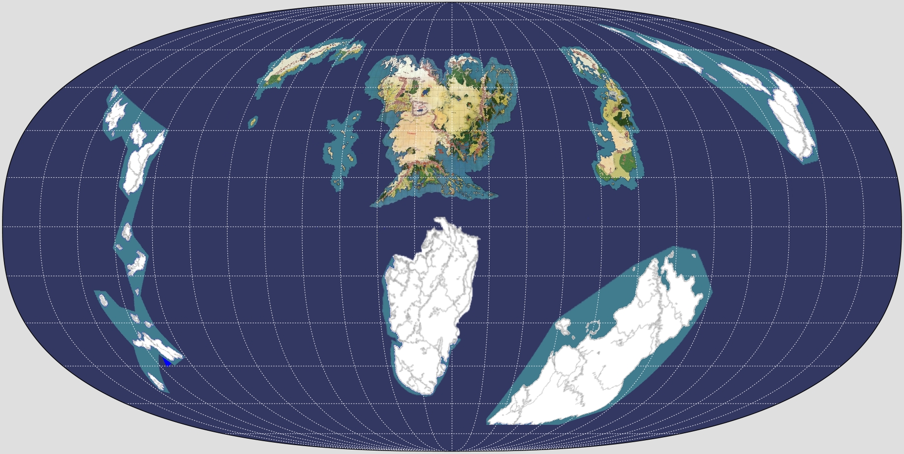
Arda is the third planet from Anor, its sun. For more on ArdaSpace, see Locations, Large Scale
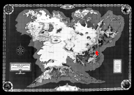
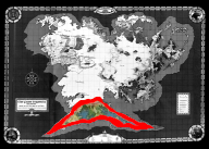
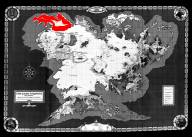
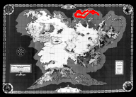
 Hyperelliptical projecton of Arda
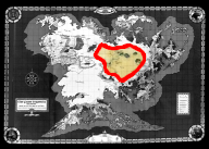
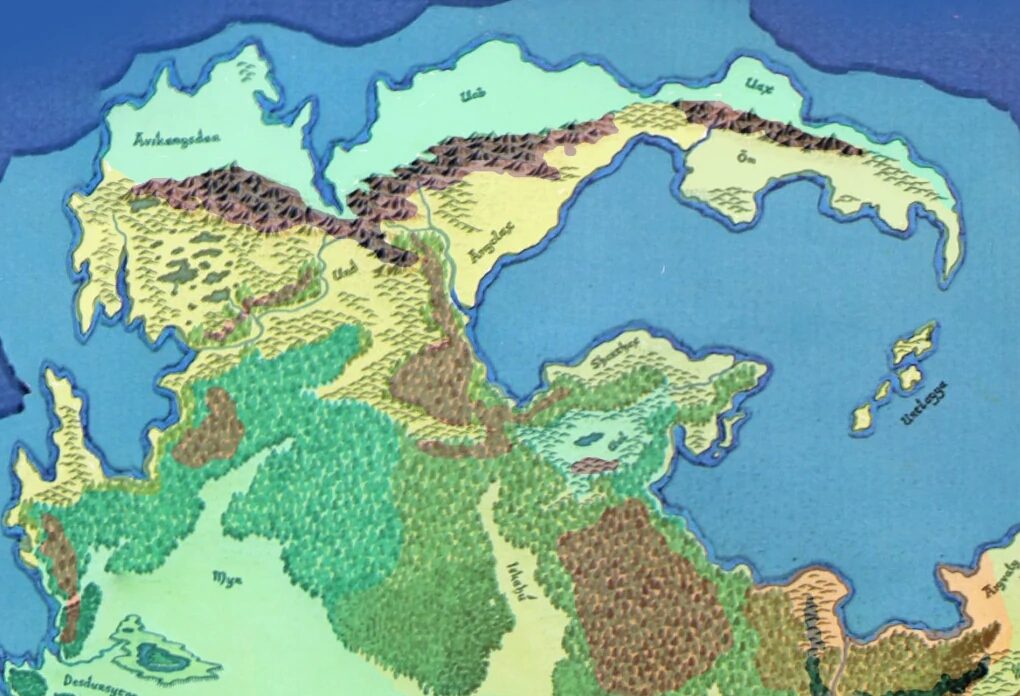
Middle Earth
(Q) Endórë
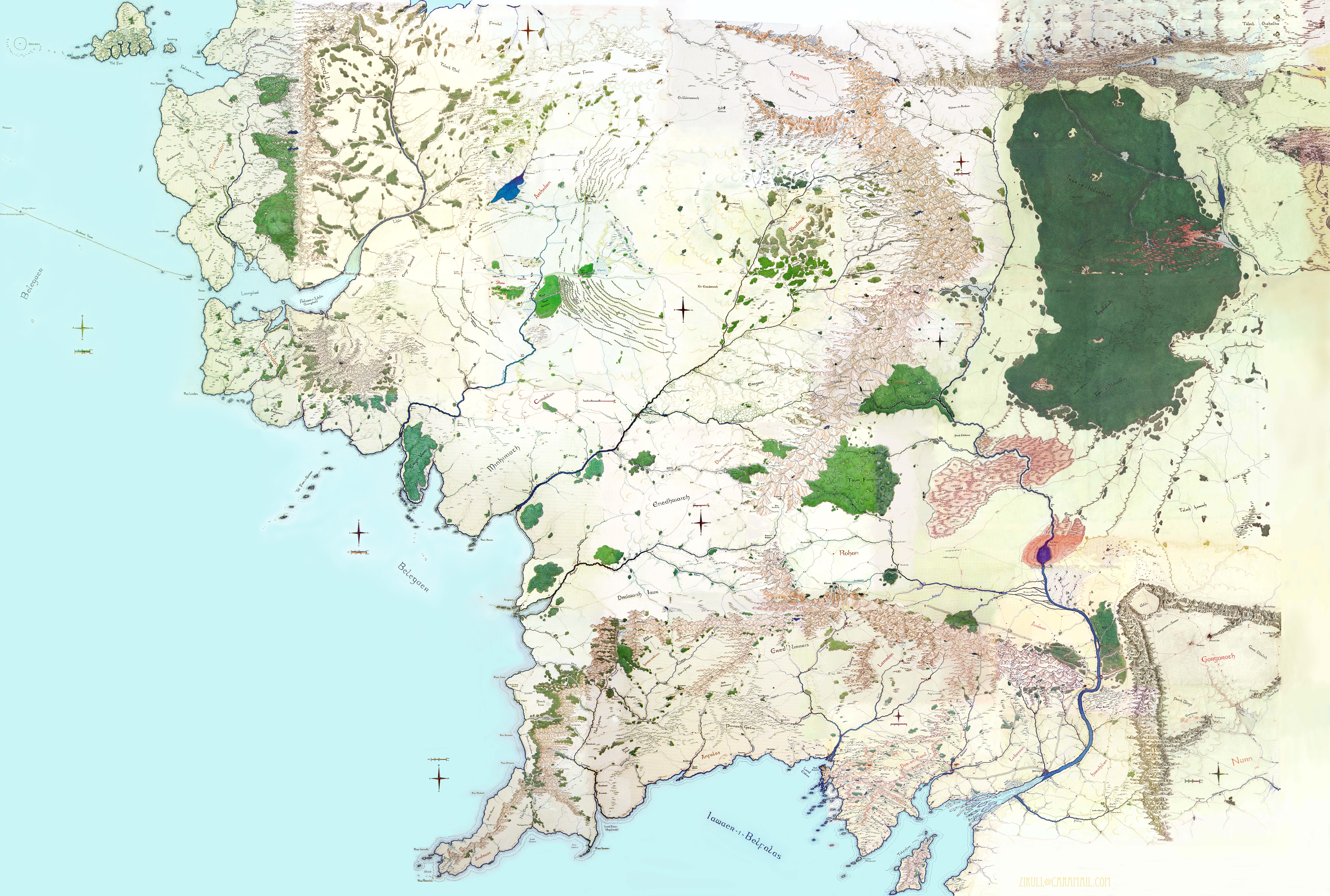
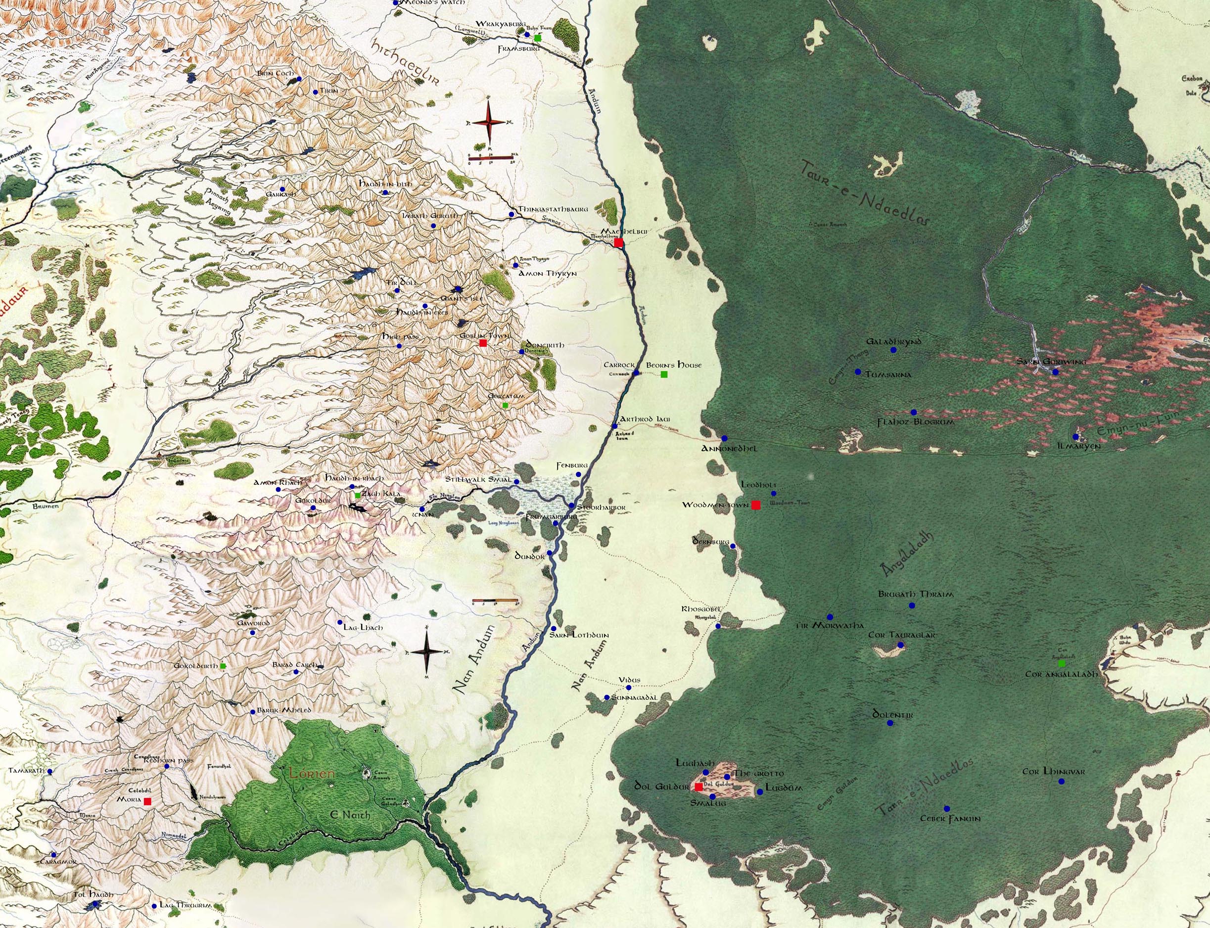
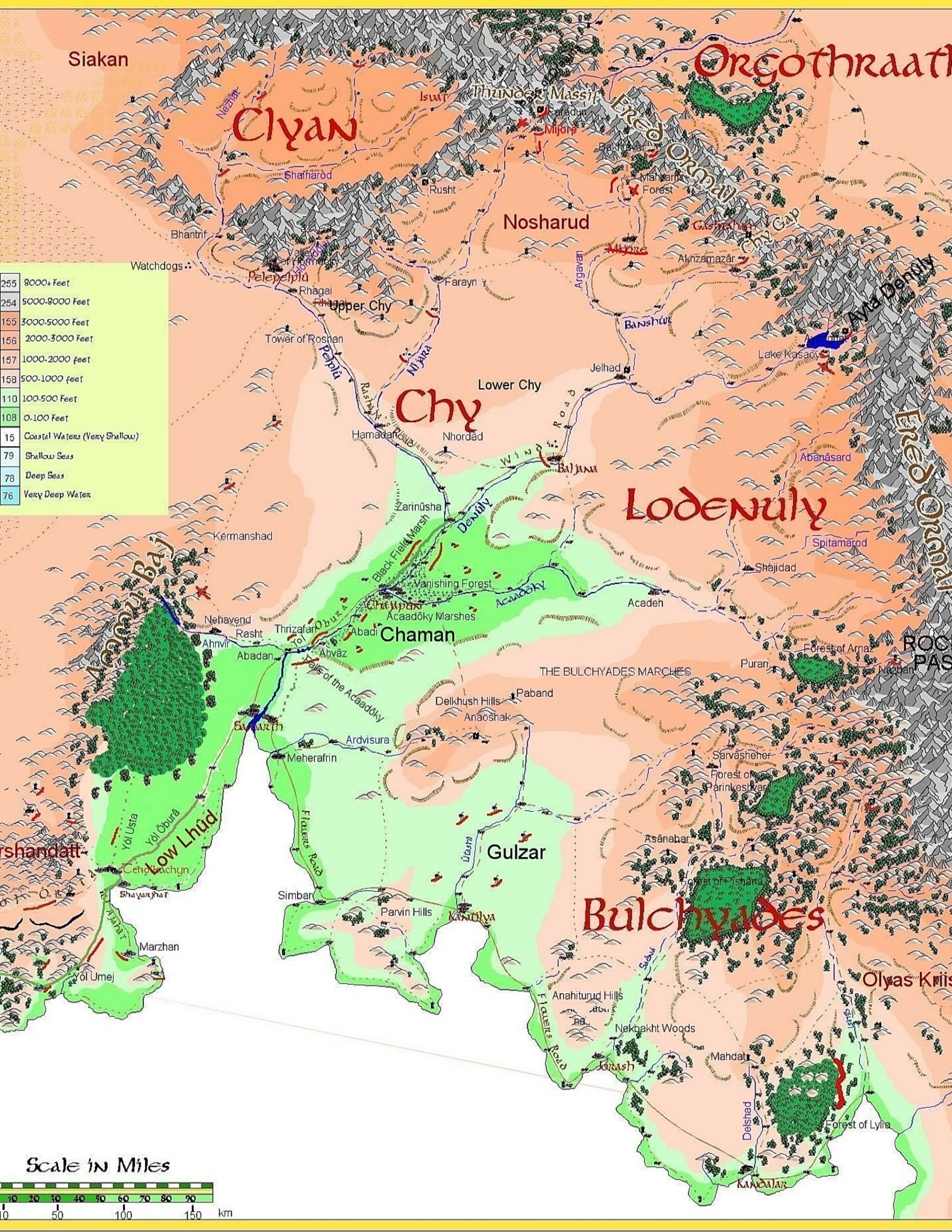
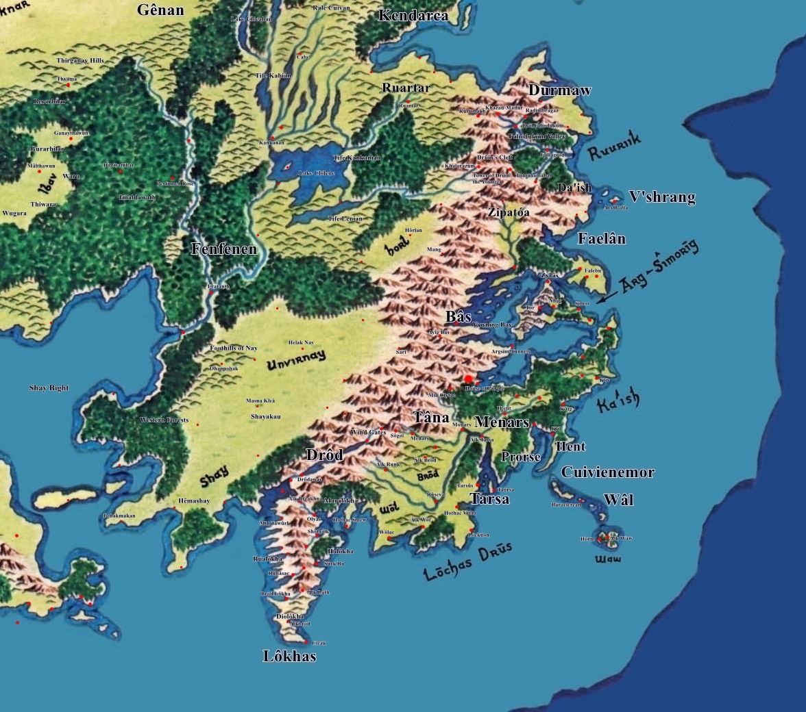
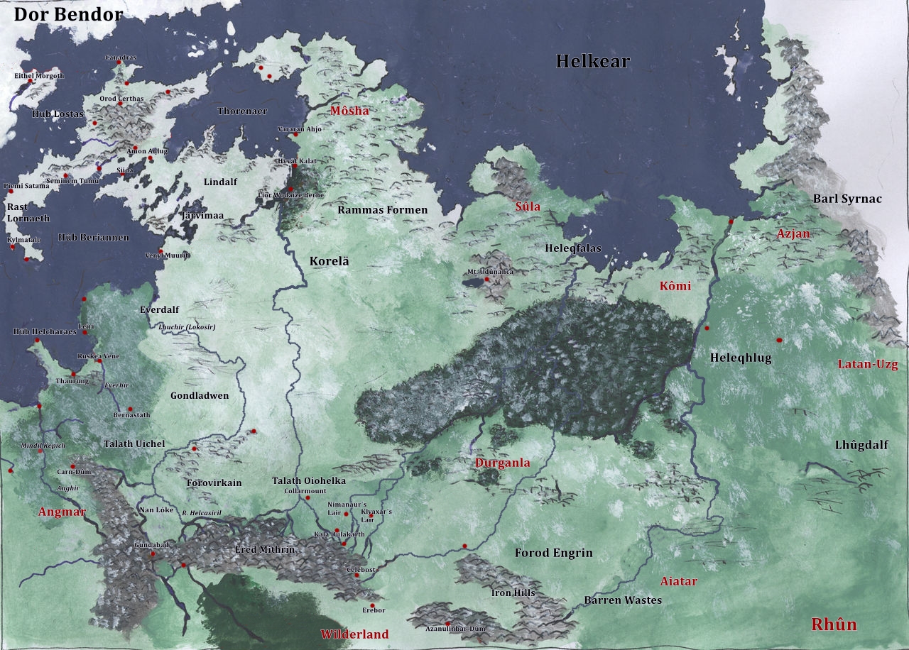
The continent Endorë, or Middle-earth, extends from 5°N to 59°N, and from 38°W to 33° E
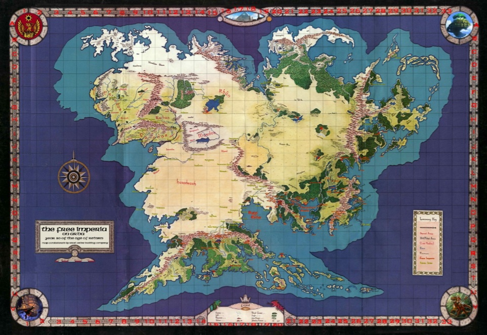
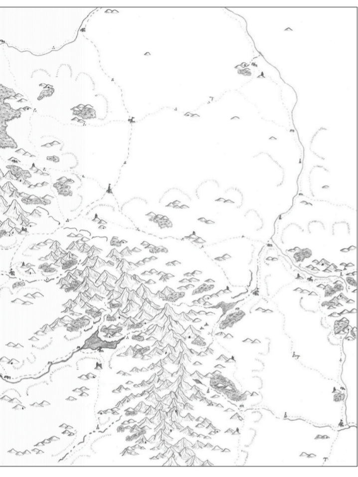
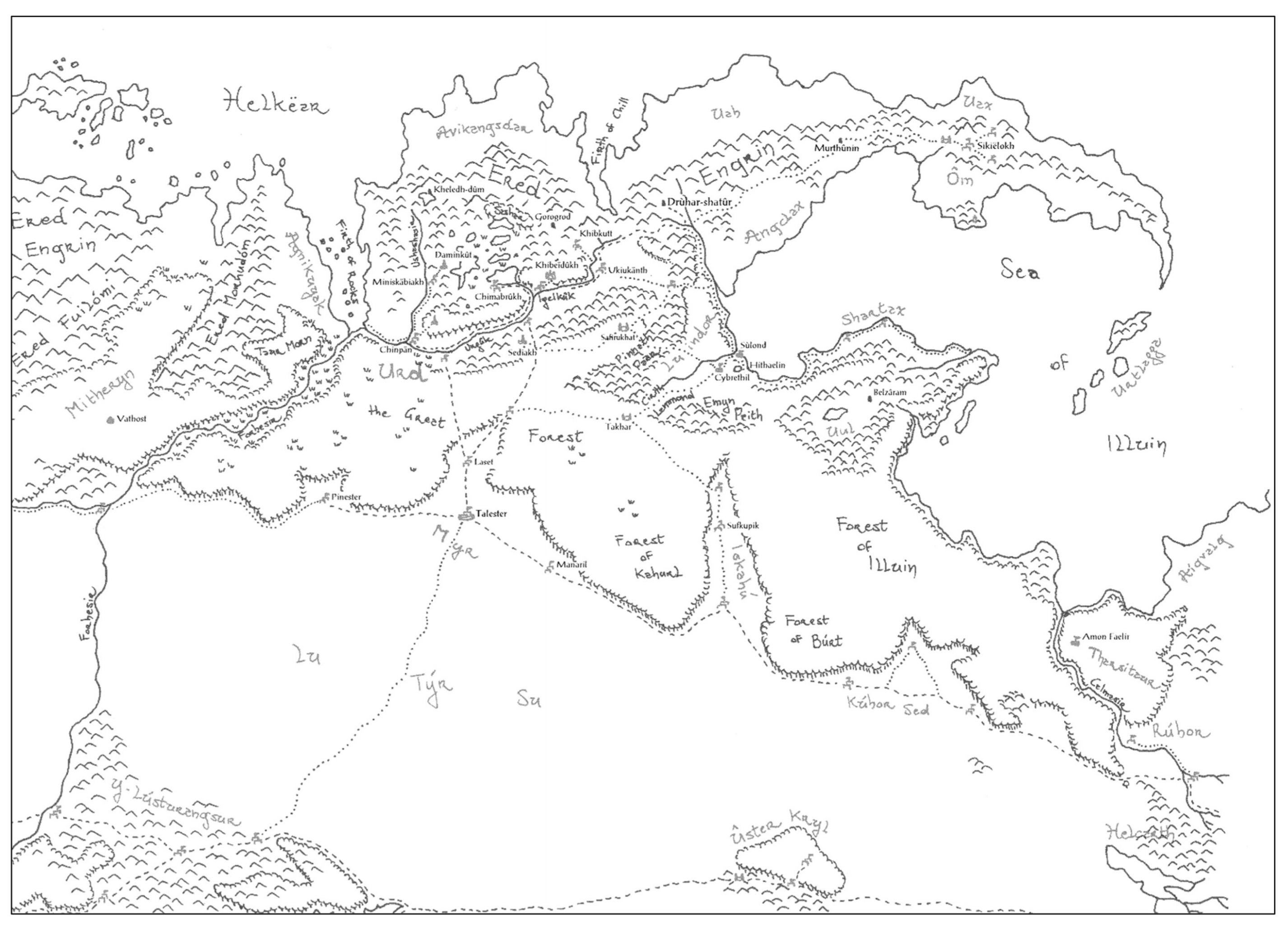
Full Sized Map of Endórë with cities, settlements, and outposts
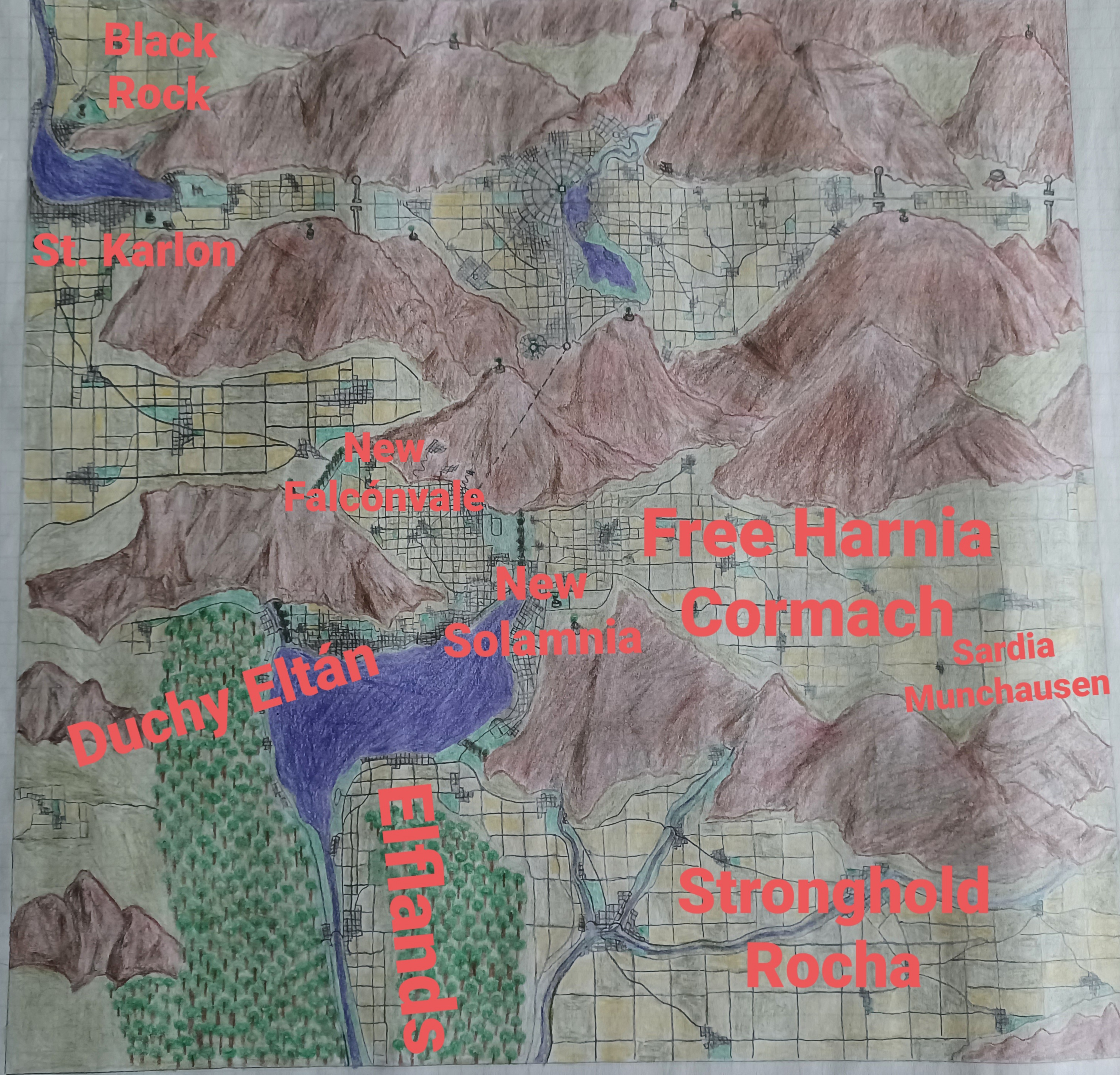
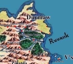
Free Imperia
Member Nations, Cities and Outposts
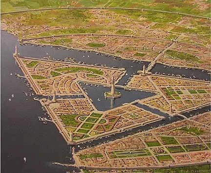
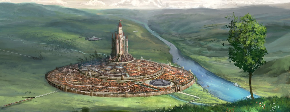
At the heart of the The Free Imperia are the Sister Cities that are its joint Capital, Nexus Prime and Micadonia. Site of the Great Pyramid, the Order Magika, the Colossal Statues of the Founders, and The Great Shipyard.
Both as districts of the Sister Cities, and as surrounding South Valley and Westmark settlements, the major nations of the Free Imperia have their Suburb Capitals. Many also have a National Capital far away from the Sister Cities.
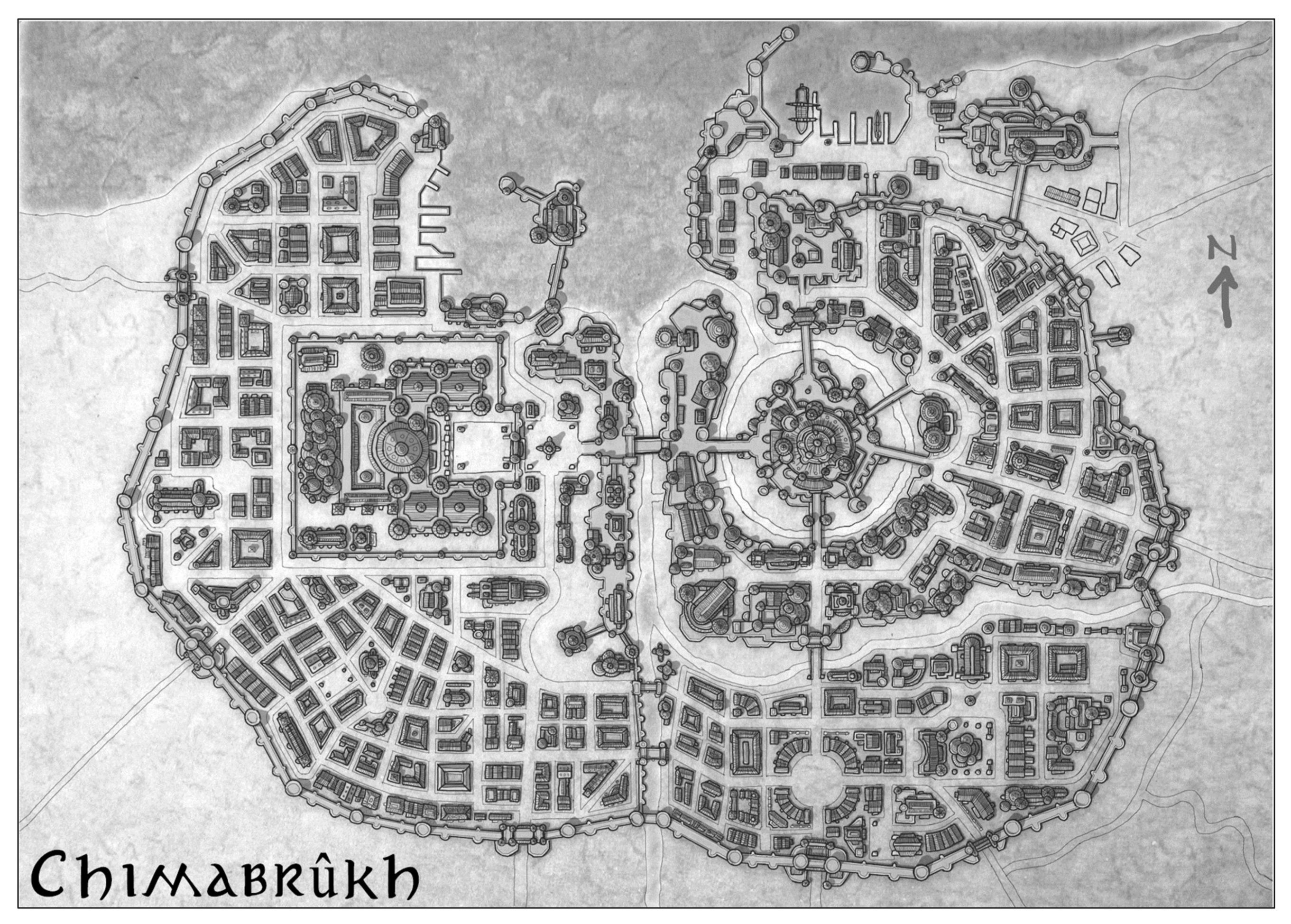
The Sister Cities
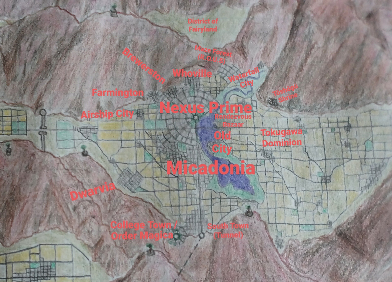
Nexus Prime
Nexus Prime, sister city to Micadonia
- Great Pyramid with Portals
- Colossal statue of Aragithalas Sercenornorow Kanan
- Imperial District
Micadonia
Micadonia, sister city to Nexus Prime
- Colossal statue of Mica "Wiley" of the Nine
- Great Order Magika Complex
The Out Cities
South Valley and the Westmark are the suburbs of the Capital Cities. Each is home to capitals of the Major Houses of the Free Imperium.
Map: N20-O20
South Valley
South Valley is attached to the Sister Cities by the Great South Tunnel. Its settlements are built around the headwaters of the Great Southern River.
-
- Arch Duke Wings' suburb capital in the South Valley.
- Built outside the South Tunnel from Micadonia
-
- Lord Gunthar uth Wistan's Suburb Capital of Solamnia
- Kingfisher Brewery and Bar
-
- Suburb Capital of the Free Kingdom of Harnia, ruled by King Cormach
- Horse Breeding
-
- Suburb Capital of Duchy Stronghold, under the leadership of Duke Rocha.
- Part of the Free Kingdom of Harnia.
-
- Suburb Capital of Barony Munchausen, under the good Baron
- Fealty to Free Kingdom of Harnia
-
- Suburb Capital of the Elflands, under King Gilthanas Kanan of House Eventine.
- Great pair of fey cherries, signifying Unity.
-
- Duchy Eltán's Suburb Capital, under Thalion Paurgiliath Arch Duke of Eltán
- Giant Waterfall powered Pipe Organ Emplacement
Westmark
Westmark outside the West Gates is built around Westlake, improved headwater of the East River.
-
- Suburb capital of Duchy St. Karlon, under Arch Duchess Damelia St. Karlon
- St Karlon Girl pilsner
-
- Capital of Prince Brendian Erendyl
Major Settlements
Large settlements of the member nations, not in or around the Sister Cities.
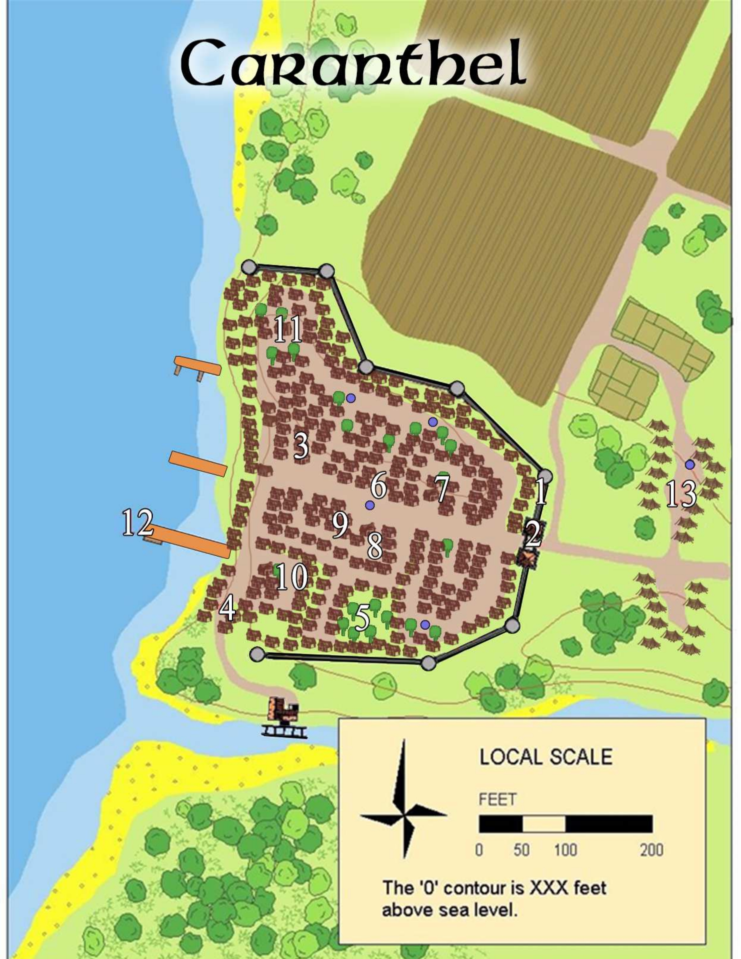
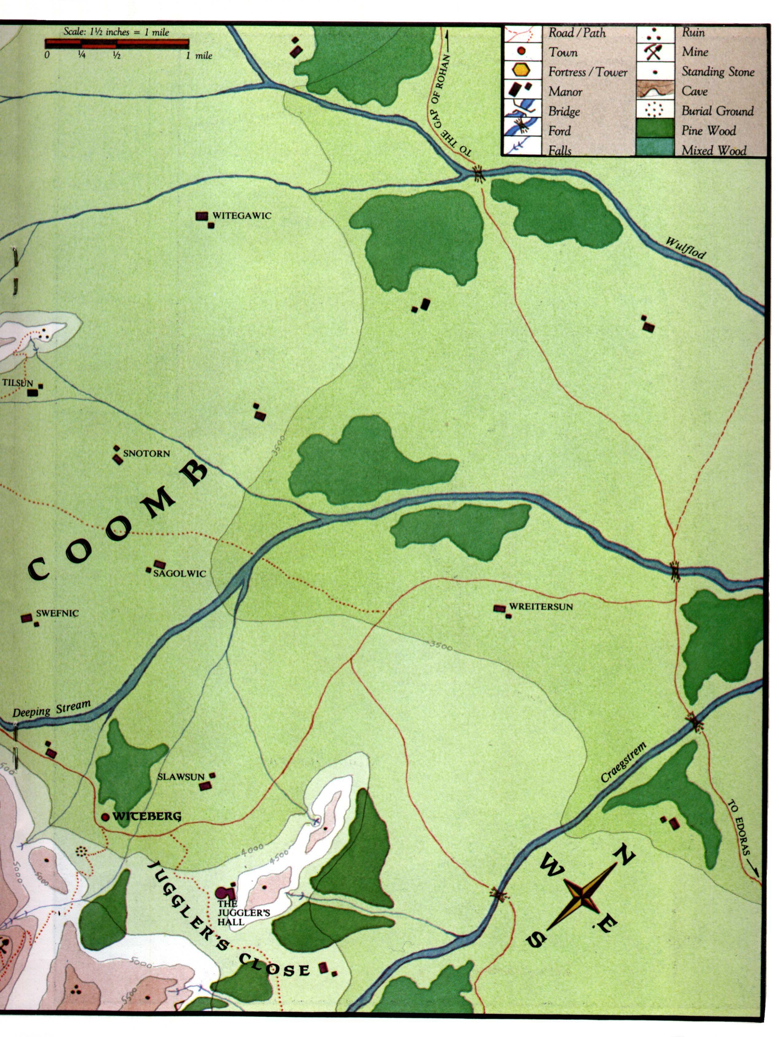
Barony Tranth
- Belfaux - Map: K17
- Capital town, 4500-5000 population
- A main pass through the Ered Ormal range from Khand at the Eastern edge of the Harad desert to the Chey Plateau in Southwestern Palisor.
- Sofular - Map: K16
- Village, 1500 area population
- 70 miles West of Belfaux on approx. site of historical Sturlurtsa Khand
- Orothiar - Map: K17
- Autonomous Hill Dwarven enclave,
- 40 miles North of Belfaux, on a fork off the old mine trail.
- Old Bloodstone Mine
- 60 miles North of Belfaux
Odin's Folk
- Vestrhelm - Map: G14-G15
- major fortified settlement of Odin worshipping Rohirrim and Alfheim Elves
- On the Southwestern tip of the Sea of Rhûn.
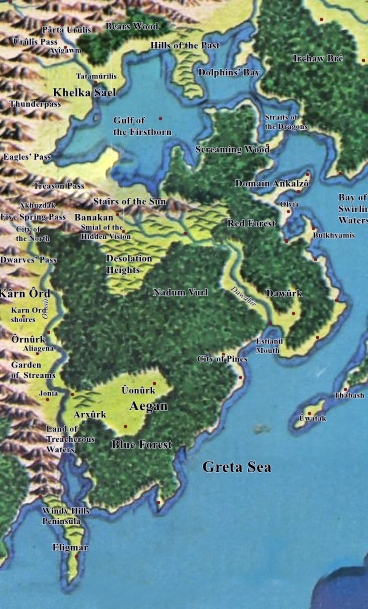
Duchy Eltán
- Beriad Ostaurelian - Map: R14-R15
- Towers of Rainbow Forest Fortress
- Wild capitol of the Rainbow Barbarians
- On Rainbow Cove
- Council Grove of Clan Chieftains
- Sîrnan - Map: Q12
- Rivendale
- Rhóvanost - Map: S16
- Fort Wilder
- Largest city on the Mûmakan Peninsula
- Beast training and breeding programs
- Cîwharnith - Map: U20
- New Harn Sister
- Capital of Duchy Eltán
- Ring of islands in the Southern Archipelago
- Dinosaur Training, Breeding, and Acquisition
Gilthanas' Kingdom of Elflands
- Krynn - Map: N22
- On the North shore of the Dargonesti Sound
- Includes underwater district, which is the Dargonesti Elves' capital.
- New Silvan - Map: K25
- Isolationist Silvanesti Capital
- Magical livesculpting growth of ship hulls
- Quilinestia - Map: N23
- Qualinesti Elven Capital
- Silk, brandies and tinctures, gems
- Wild Mountains - Map: K26
- White Eagle Kagonesti Tribe nominal Capital
- East bank of Kagonesti Basin
- Trade Fortress - Map: N21-N22
- North shore of East Harbor
- Ship building
Dwarf Kings
- Tri-King Fortress - Map: O25
- 3 copper ore veins, 3 lead ore veins, 1 tin ore vein, 3 iron ore veins
- Capital of the Three Kings of the Dwarves
- Built in the Tri-King Mountains on the Tri-King Peninsula
- Citadel City - Map: Q14-Q15
- 3 lead ore veins
- The Nazgûl's Citadel - history, ethnography, etc
- Harnic Dwarfhold, interfaith center, major fortress
- Great Inland Waterway Initiative Skylock in Yellow Mountains
- Iron Fist - Map: Q16
- tin ore vein, iron ore vein
- Harnic Dwarfhold, Armory
- Skylock in Yellow Mountains
- Middle Town - Map: O22
- Copper ore vein, tin ore vein, iron ore vein, pure silver vein (2000sp/week/miner, no smelting needed)
- Krynnic Dwarfhold
- Largest ropeworks in Free Imperia, supplying the Free Imperia Navy and WATC Fleet
- Argentum Capita - Map: I26
- Silver ore vein, chance of Mithril every decade, Iron ore vein
- Founded by Thane Smash
- Faerunic Dwarfhold
- Northern end of the Great Inland Waterway Initiative
King Cormach
- Harnia - Map: N23
- National Capital of Free Kingdom of Harnia
- Built on the mouth of the Stronghold River, at the Dargonesti Sound
- Haven - Map: M25
- Headwaters of Safehelm River
- Skylock to Monaco River
- Kesh - Map: P24
- Port city on Shay Head
- Outside of taxed harbors
Baron Munchausen
- Monaco - Map: N26
- Barony Munchausen's Capital
- Resort Island in Grand Monaco Bay on East coast of Endorë
Duke Rocha
- Safehelm - Map: M24
- Fortress Capital of Duchy Stronghold
- Safehelm Isthmus between Great Stronghold Lake and Lake Safehelm
- Castille - Map: M24
- Fourth and Fifth Mist-Rib Lakes
- Fur markets and fishing
- Semboch - Map: L25
- Built on Great Sylvanesti Bay
- An Eastern terminus of the Great Inland Waterway Initiative
Lord Gunthar Uth Wistan
- Castle Sancrest - Map: Q15
- Yellow Mountains Skylock
- Smiths, Rose Market
- Dragon Manor - Map: Q15
- Monestary on island in Kingfisher Lake
- Portions built for comfort of dragons, to scale
- Finest rose gardens on Arda
- Fort Wistan - Map: Q18
- Mumak, Buffalo, Boar
- Draco Village - Map: S21
- Significant minority population of reformed Draconians
Outposts
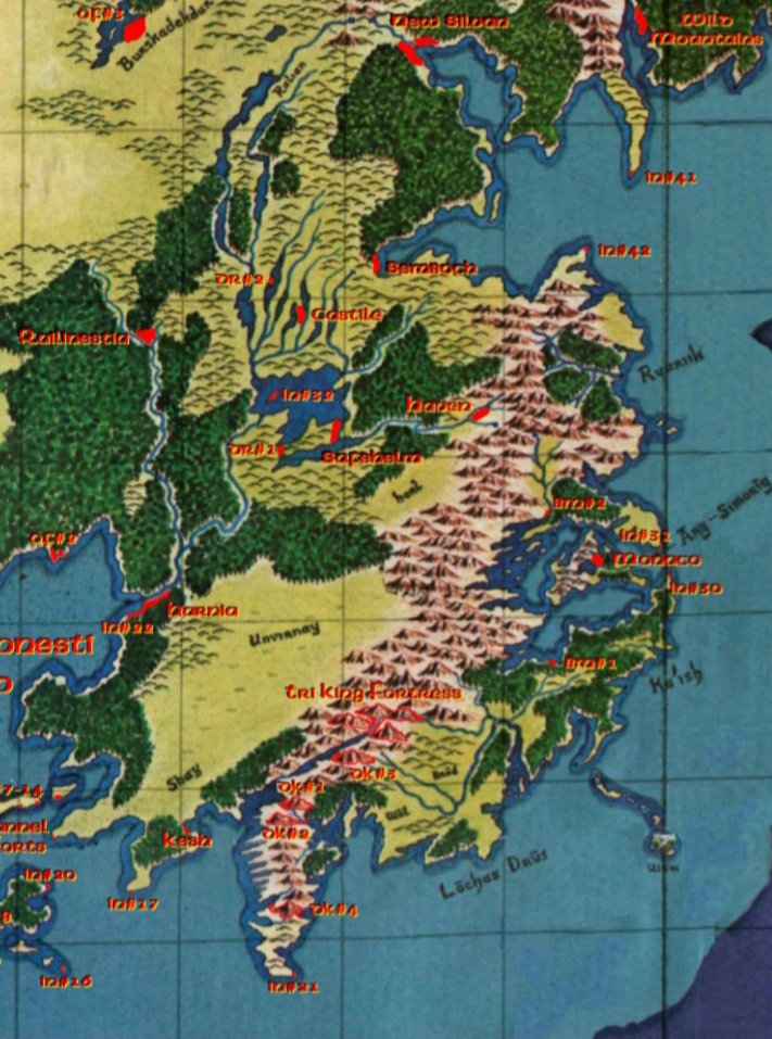
Outposts are forts, lighthouses with artillery emplacements, villages, etc., built to anchor trade and future settlements. All are being upgraded to include Signal Company equipment and WATC facilities, and were built with Imperial Dispatch facilities, including pigeons and remounts. All have surrounding rural population or small villages.
Imperial Military Bases
Imperial Military - IM#x
- IM#1 - Map: N21
- Very large fort and frontier boomtown
- 120 miles NNE of the Sister Cities, on the East River.
- IM#2 - Map: N20
- Large fort
- 60 miles NNW of the Sister Cities on the North Fork of the East River.
- IM#3 - Map: N20
- Fortified base camp at the Northern overlook mountain outside West Gate
- 85 miles NW from the Sister Cities at source of Nort Fork of East River
- IM#4 Map: N19
- The Northern Watchtower
- IM#5 - Map: N19
- The Western Watchtower
- IM#6 Map: N20
- The Southwest Watchtower
Imperial Navy
Imperial Naval - IN#X
- IN#1 - Map: N21
- Original East Harbor Fort
- Double Island Fortress in mouth of East River
- IN#2 - Olyas Yard - Map: O20
- Fortified yard on Great Southern River mouth into Firth of Olyas
- Wet Navy and Spelljammer repairs and provisioning
-
- Forts on mouth of East Harbor from Dargonesti Sound
- IN#5 - Map: P20
- Fortified lighthouse on SW Point of the Firth of Olyas
- IN#6 - Map: P21
- Fortified lighthouse on Imperial Point
- IN#7-14 - Channel Forts - Map: P22-P23
- Built across the Dargonesti Narrows in entrance to the Dargonesti Sound
- Always changing channel, needs pilot
- IN#15 - Map: P21
- Fortified lighthouse on tip of Codya Point
- IN#16 - Map: Q23
- Fortified lighthouse on the most Southerly of the Jojojopo Rocks
- IN#17 - Map: P23
- Fortified lighthouse on Shay Head
- IN#18 - The Narrows Yard - Map: P22
- Natural harbor in Dargonesti Narrows
- Major shipyard, duty free market
- IN#19 - Map: P22-Q22
- Fortified lighthouse on Southernmost tip of Jojojopo Peninsula
- IN#20 - Smuggler's Cove - Map: P23
- Fortified lighthouse on Easternmost point of Jojojopo Peninsula
- IN#21 - Map: Q24
- Fortified lighthouse on the southernmost tip of the Tri-King Mountains.
- IN#22 - Map: N23
- Original construction in downtown Harnia
- Stronghold River mouth on Dargonesti Sound
- IN#23 - East Harbor Naval Yard - Map: N21
- Major shipyard between mouths of East River and Jojojopo River
- Diverse wet hull construction, Jammer repair, large ropeworks
- IN#24 - Map: P20
- Fortified lighthouse on the Southernmost tip of Olyas Point
- IN#25 - Map: L20
- Small fortified port on mouth of Lōdenūlý River, into Bight of Exile
- IN#26 - Map: M22-M23
- Fortified lighthouse on Pyramid Peak Point on Ivory Peninsula
- IN#27 - Map: O21
- Prosperous inland port on Lake Jojojopo in central Jojojopo Peninsula
- IN#28 - The Archipelago Yard - Map: R20
- Built on Horseshoe Rock, in the Southern Archipelago
- Builds frigates and smaller, repairs anything
- IN#29 - Map: P17
- Strong harbor fort at mouth of Chennacatt River
- IN#30 - Map: N27
- Fortified lighthouse on Southern point of the Arg-Simorig gap into Grand Monaco Bay
- Astronomer monastery
- IN#31 - Map: N26
- Fortified lighthouse on Northern point of the Arg-Simorig gap into Grand Monaco Bay
- IN#32 - Map: M24
- Strong island fortress in Great Stronghold Lake
- IN#33 - Map: O14
- Island fortress between Dûshera Bight and Bay of Ûsakan
- IN#34 - Map: R13
- River fort on Bay of Ûsakan
- Eastern end of the Thanihazad bypass
- IN#35 - Map: N15-O15
- Large Fort at mouth of Dûshera Bight
- 'Borneo in the Earlies'
- IN#36 - Map: S18
- Strong if small Naval Fort on mouth of Bay of Gan
- IN#37 - Map: K28
- Fortified lighthouse at Southern entrance to Gulf of the Firstborn
- IN#38 - Map: I28
- Fort at narrows of Gulf of the Firstborn
- IN#39 - Map: I28
- Great Northern Imperial Timber operation
- IN#40 - Map: Q12
- Fortified port on mouth of Norpûl Estuary
- Westernmost outpost of the Empire
- IN#41 - Map: L26
- Fort on the tip of Longclaw Point
- Entrance to the Great Silvanesti Bay
- IN#42 - Map: L26
- Fortified lighthouse on Breakshell Bank
- Entrance to Great Silvanesti Bay
Paurgiliath Peacekeepers
Paurgiliath Peacekeepers - PK#x
- PK#1 Map: N19
- NW screening fort for Sister Cities
- Moated by headwaters of Lōdenūlý River
- PK#2 Map: N20
- Near NW screening fort for Sister Cities
- Moated by East River
- PK#3 Map: O19-O20
- SW screening coastal fort for Sister Cities
- Built on Exiles' Craw, on Northern shore of Bight of Exile
- PK#4 Map: T20
- Fortified lighthouse screening harbor for Cîwharnith
- PK#5 Map: T20
- North Island fort at Cîwharnith
- PK#6 Map: R13
- Southern screening fort for Sîrnan
- Inland Waterway Skylock through Listening Mountains
- PK#7 Map: Q12
- Northwestern screening fort for Sîrnan
- Built at fork of Norpûl River and Aron Dùin River, historical mystery
- Very large school and orphanage
Solamnic Orders
Odin's Folk
Odin's Folk - OF#x
- OF#1 - Map:N20
- Northern screening fort for Sister Cities
- Built on East River 100 miles from Black Rock
- OF#2 - Map: N23
- Fortified saltwater port on Dargonesti Sound
- Ship building
- OF#3 - Map: K23
- Southernmost outpost across Palisor at Bûrskadekdar
- OF#4 - Map: I23
- Second outpost across Palisor at Lygar Krâw
- OF#5 - Map: H22
- Third outpost across Palisor at Daldúnair.
- OF#6 - Map: G20
- Outpost on the Talathrant River in Palisor
Imperial Dispatch
Signal Company
West Arda Trading Company
West Arda Trading Company - TC#x
- TC#1 - Map: R12
- Westernmost Sky Lock of the Great Inland Waterway
- Headwaters of the Norpûl River
-
- Haunted Caravanserai at the Great Oasis in Eastern Harad
Gilthanas
Dwarf Kings
Three Kings of the Dwarves - DK#x
- DK#1 - Map: P24
- Silver ore, quality 4 (200 sp/miner/week)
- Krynnic Dwarfhold
- Mouth of Firth of Durin on Tri-King Peninsula
- DK#2 - Map: PP24
- Copper Ore
- Krynnic Dwarfhold
- DK#3 - Map: O24-O25
- Iron Ore, Tin Ore
- Harnic Dwarfhold
- DK#4 - Map: P24
- Gold Ore, quality 7 (400gp/miner/week)
- Interorigin Dwarfhold
- The lookout mountain, furthest down the Tri-King Peninsula
- DK#5 - Map: Q15
- Copper Ore
- FaerunicDwarfhold
- DK#6 - Map: Q16
- Lead Ore, Lead Ore
- Krynnic Dwarfhold
King Cormach
Duke Rocha
Duke Rocha - DR#x
- DR#1 - Map: M24
- Fortress on the Western neck of Safehelm Isthmus, between Great Stronghold Lake and Lake Safehelm
- DR#2 - Map: L24
- Fortified jut into Second Mist-Rib lake
Baron Munchausen
Baron Munchausen - BM#x
- BM#1 - Map: O26
- Southern fort connecting Grand Monaco Bay and headwaters of the Northern fork of the Lōchas Drūs River
- BM#2 - Map: N26
- Northern fort on Grand Monaco Bay
Rainbow Barbarians
Rainbow Barbarians - RB#x
- RB#1 - Map: R14
- Island fortress in Rainbow Cove
- Whale riders
Church of Eru
Church of Eru Ilùvatar - CE#x
- CE#1 - Map: H26
- Arda Heritage Historical Preservation
- Lake Khelkeneni, last remnant of Cuiviénen, Western flank of Red Mountains
Foreign Lands, Historical
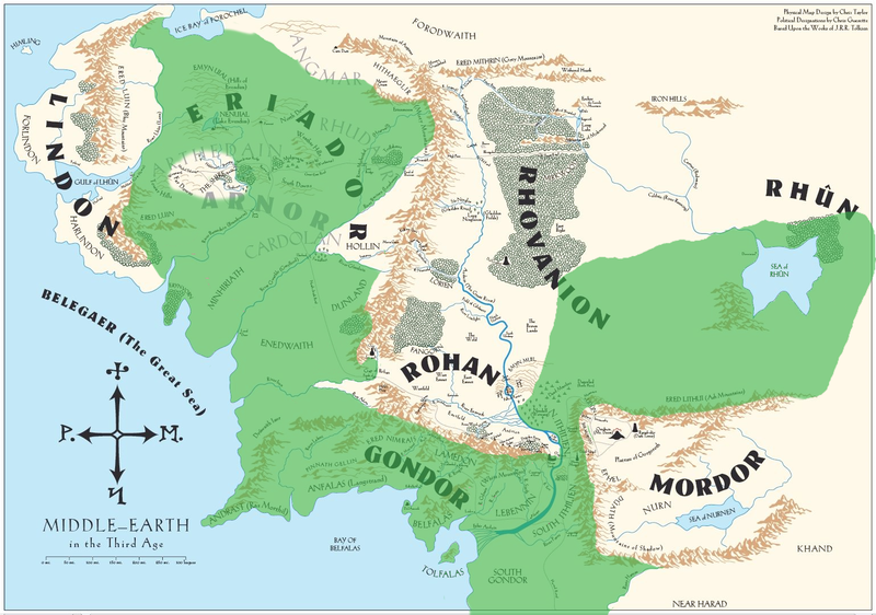
Maps of political entities and cities are from Third Age, now extremely unreliable (10,500 years)
The West
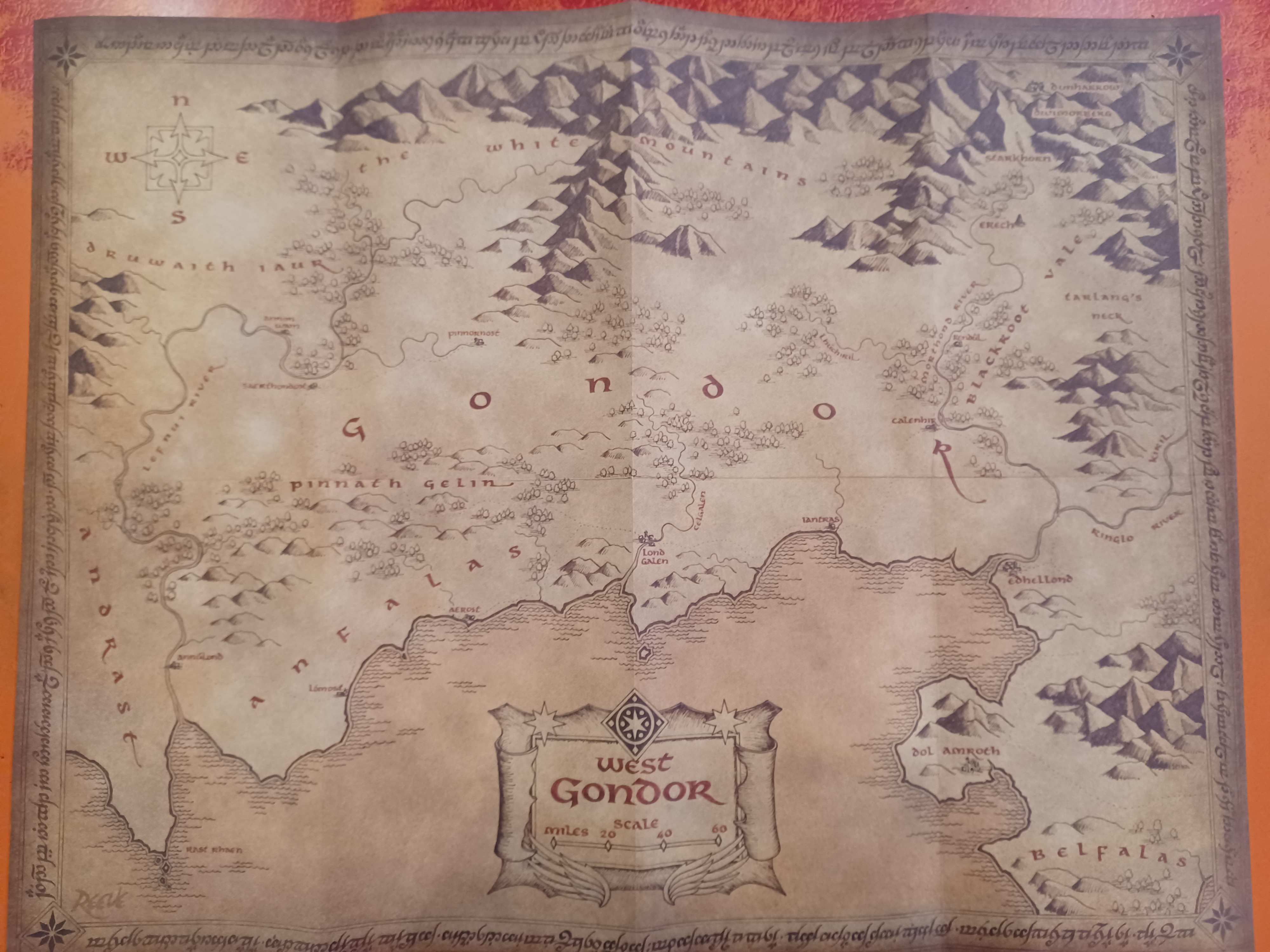
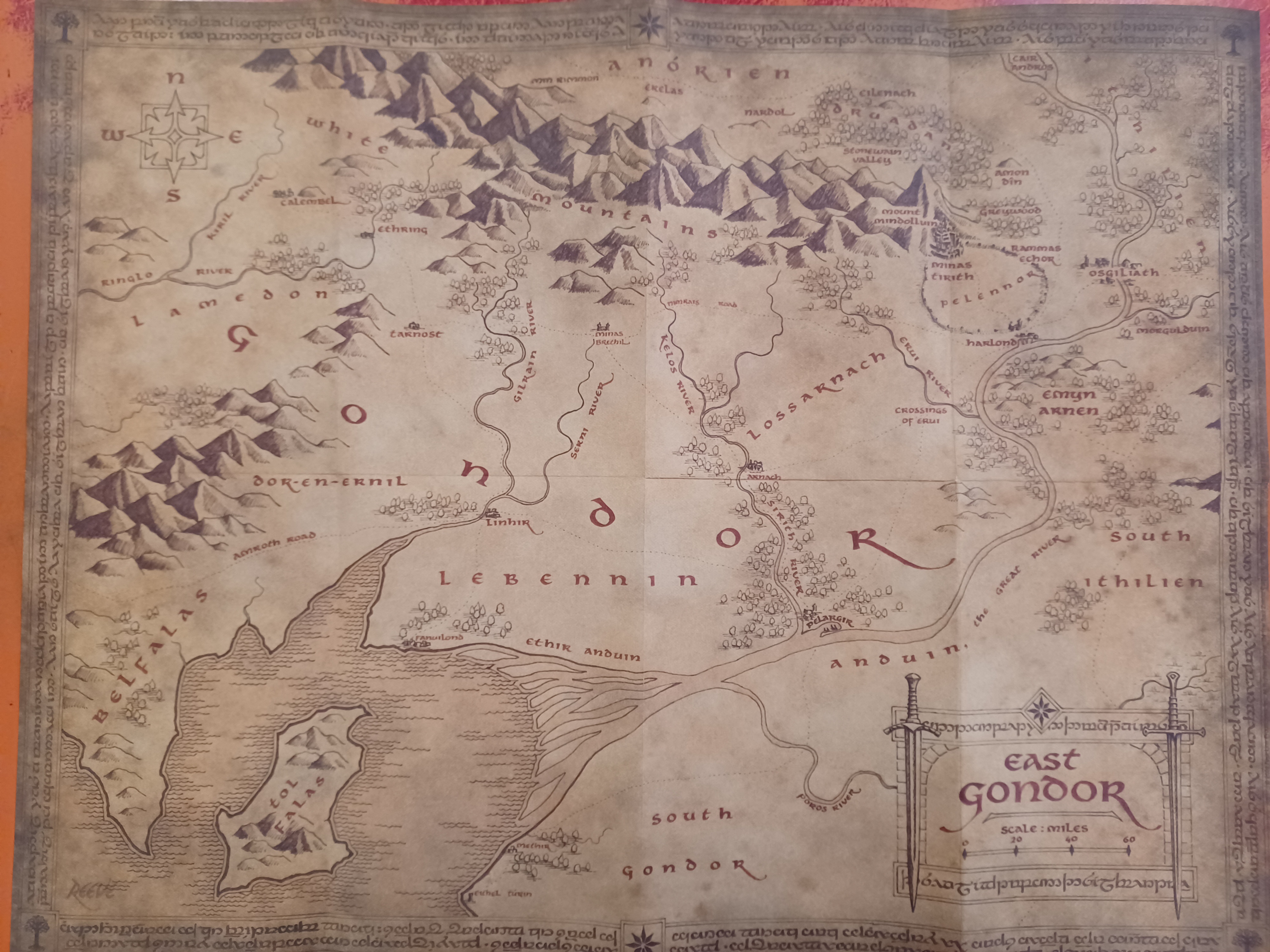
GONDOR, REUNITED KINGDOM

Old Gondor


- Ithilien

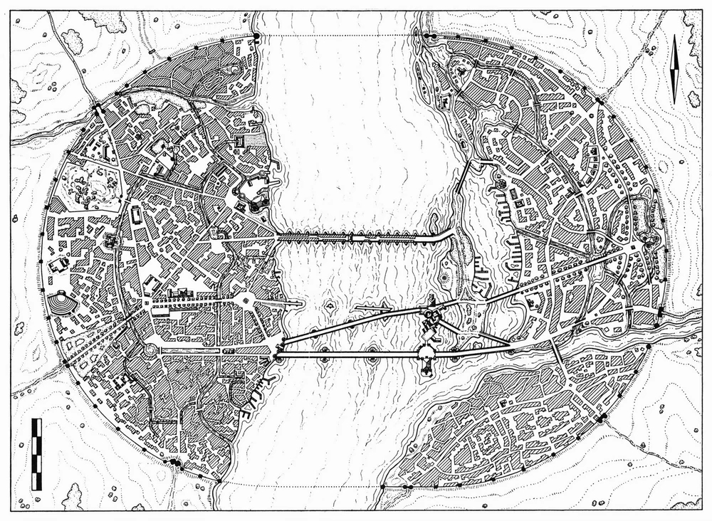
- osgiliath Map: I12
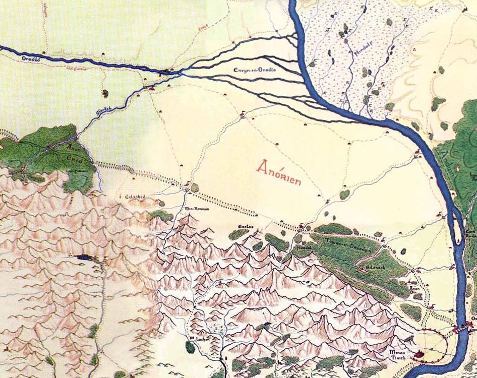
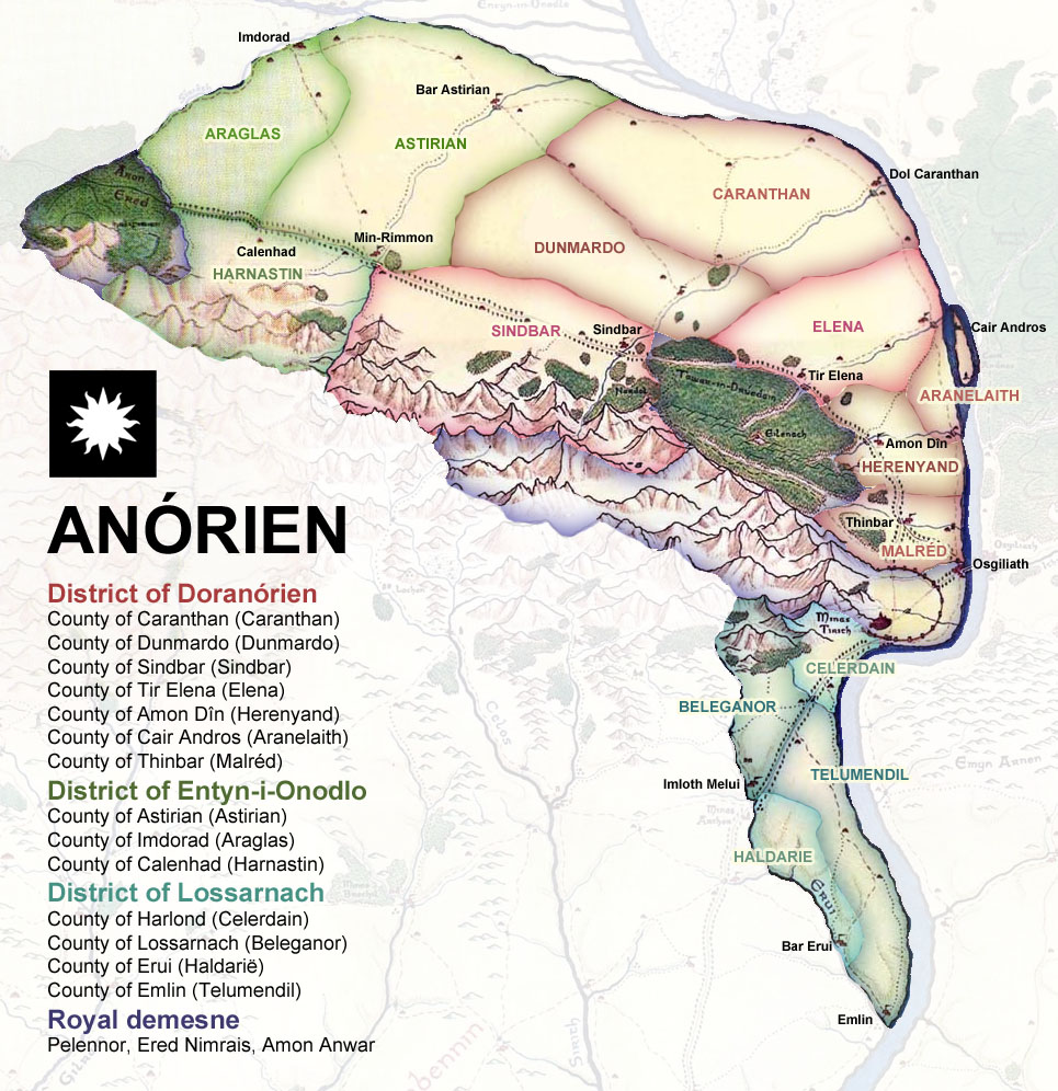
- Anorien


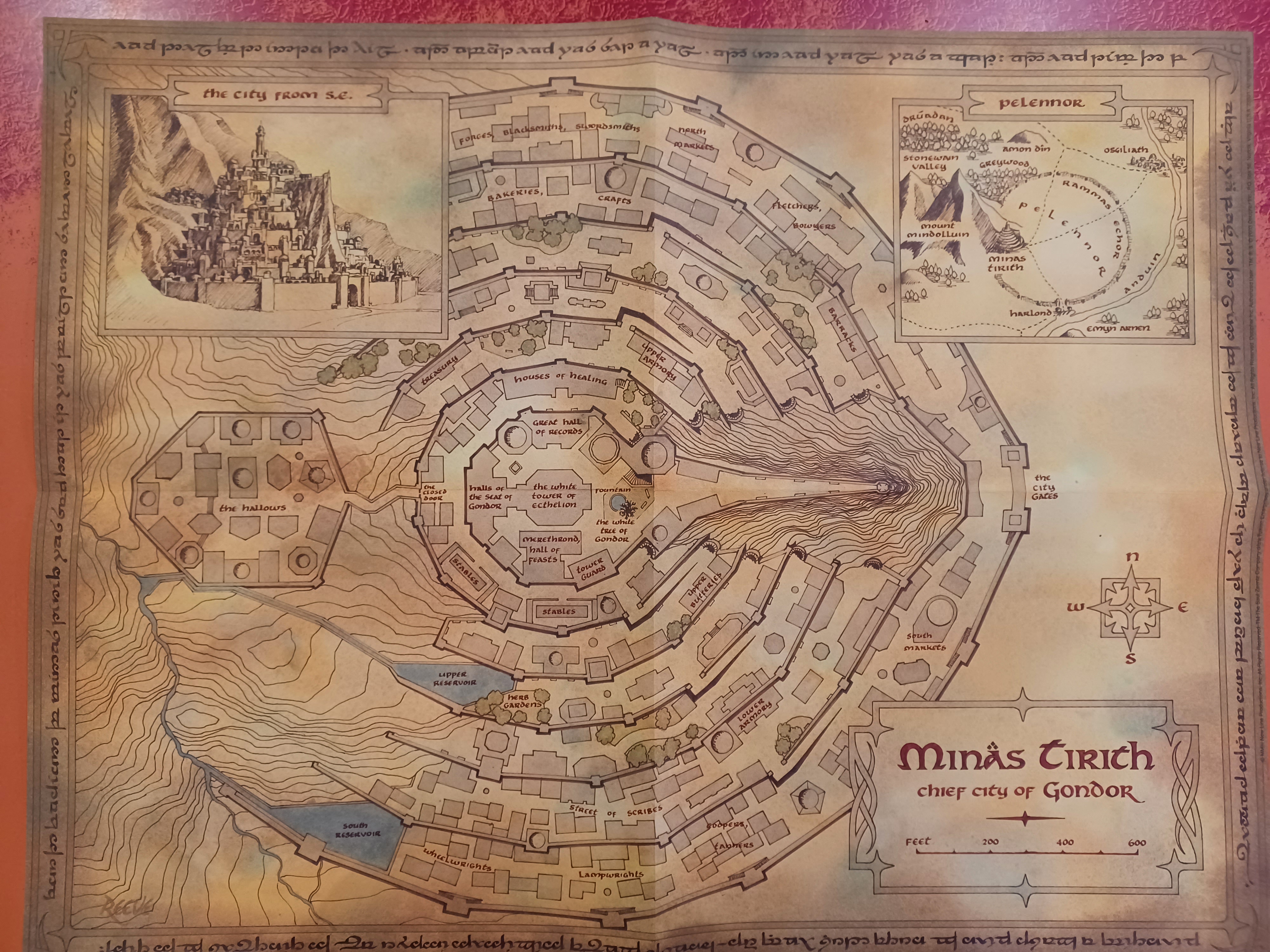
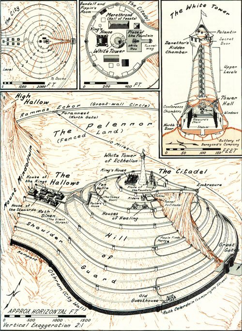
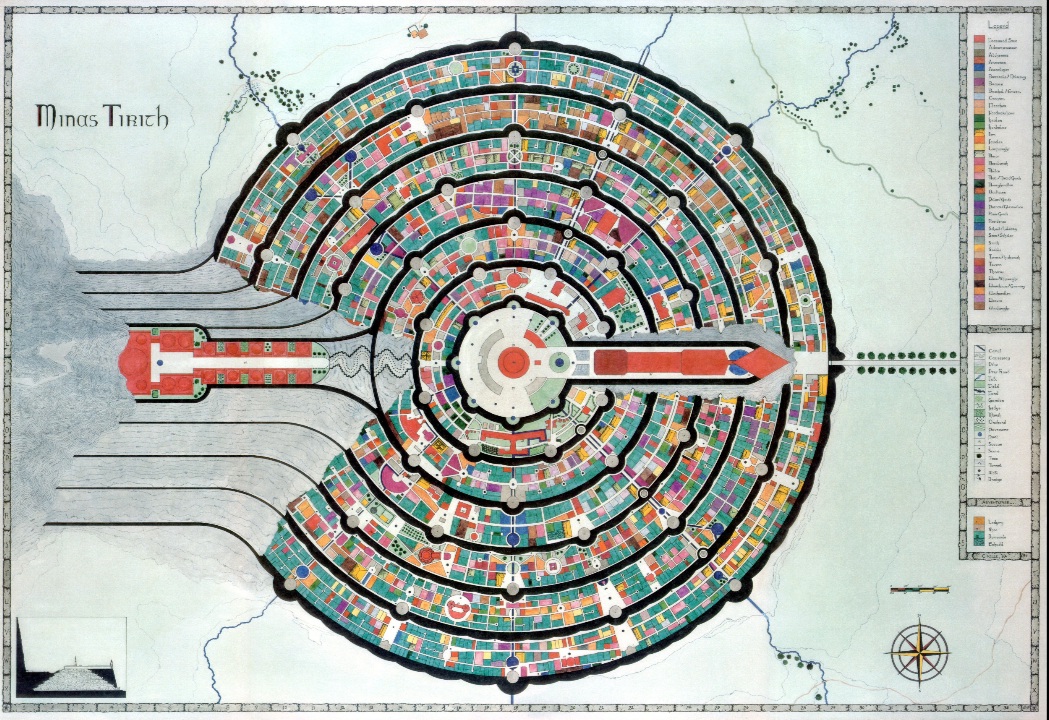
- minas anor (minas tirith) Map: I12
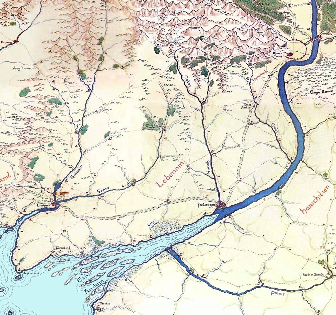
- Lebennin

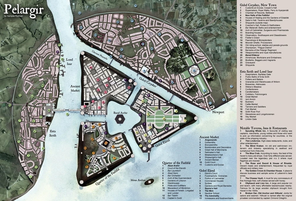
- pelargir Map: I12
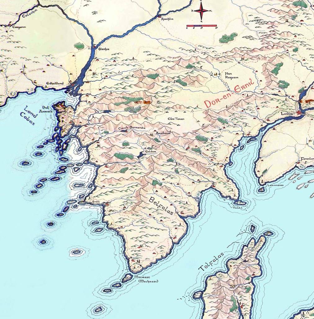
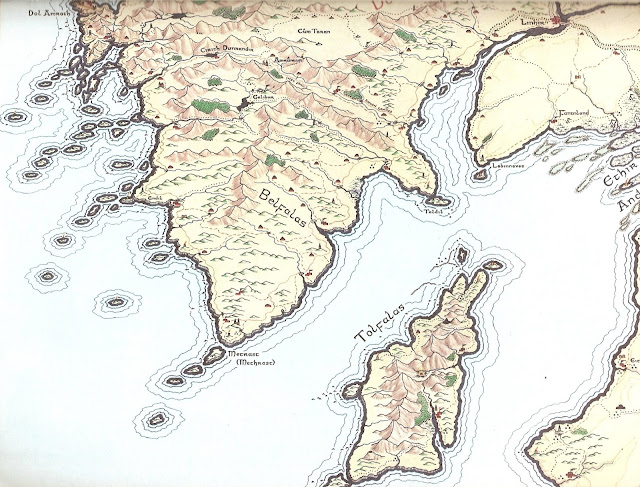
- Belfalas


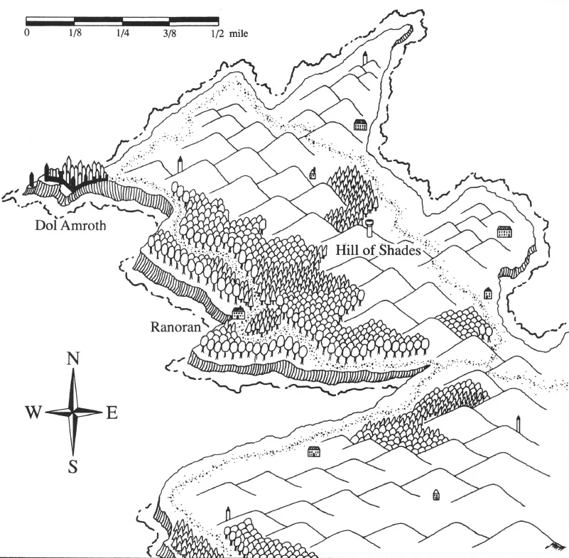
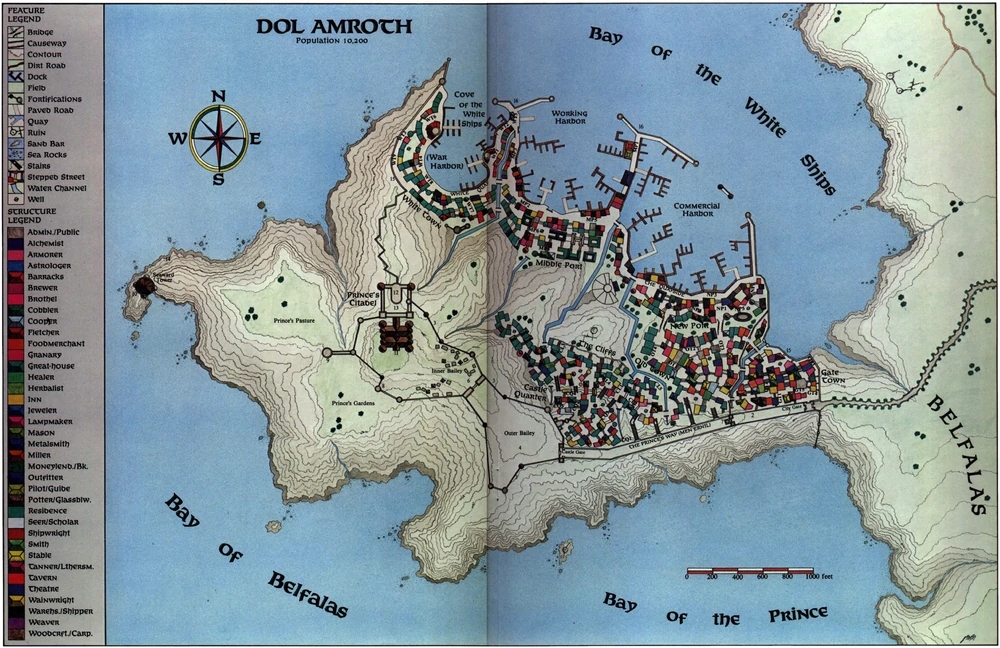
- lond ernil (dol amroth) Map: J9
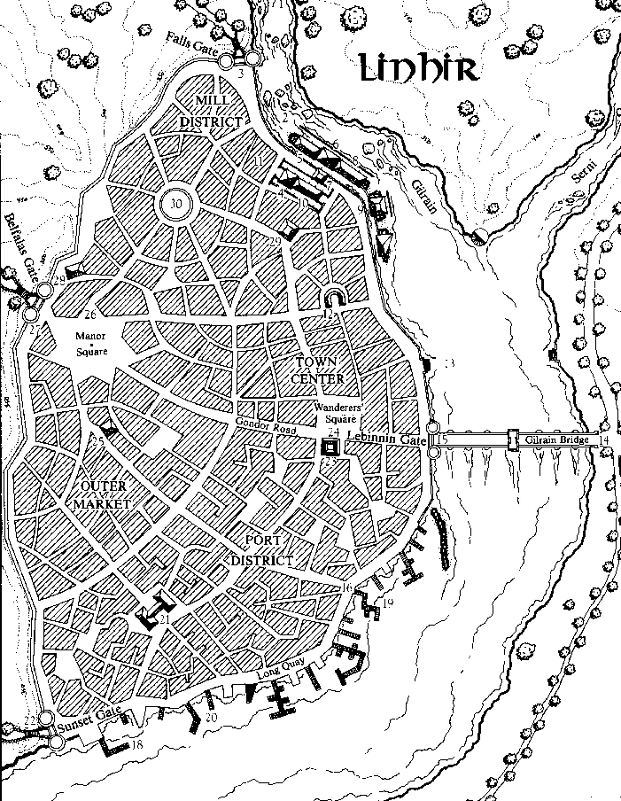
- linhir Map: I10
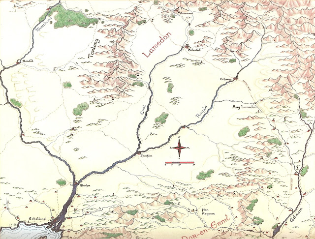
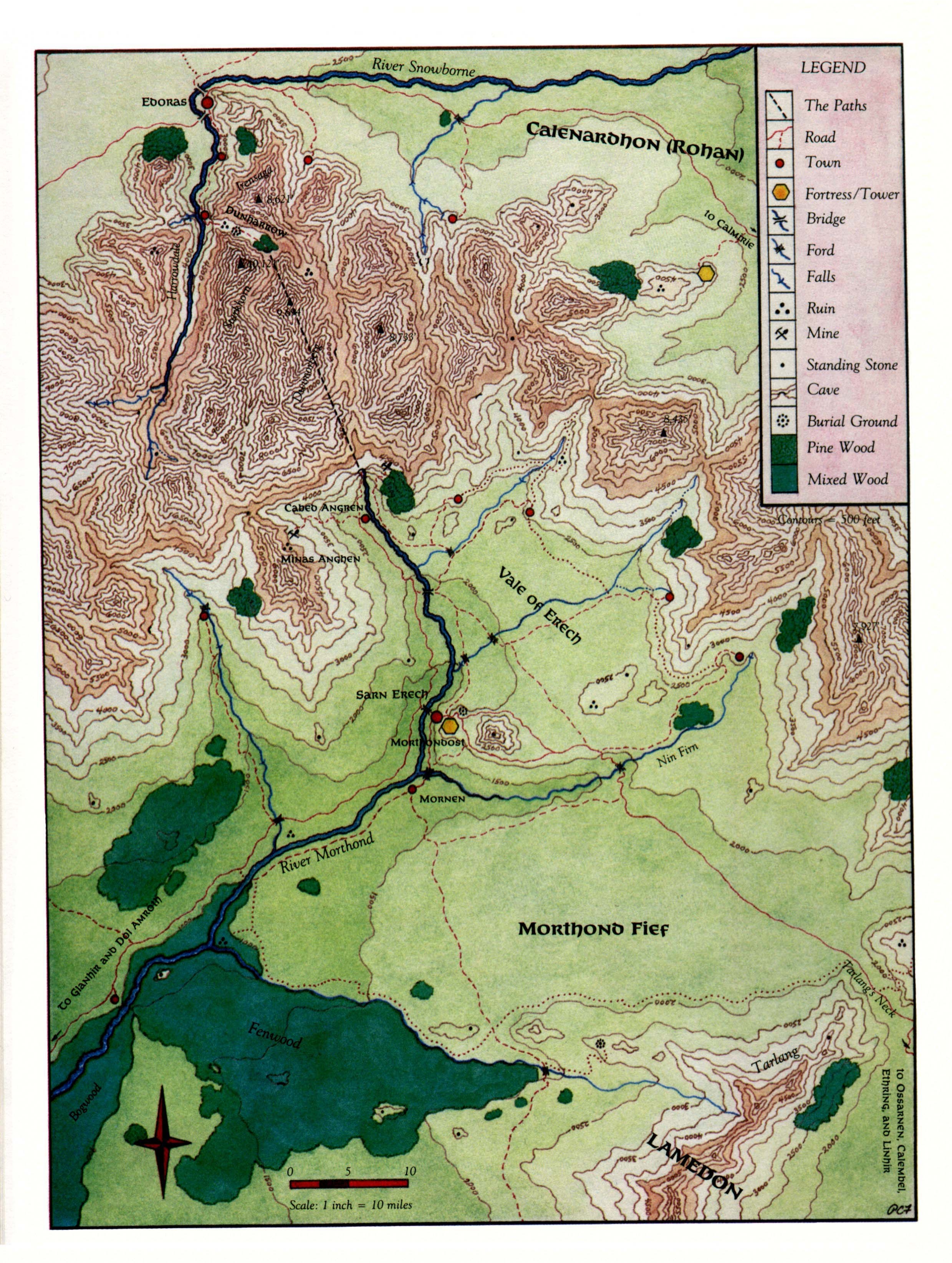
- Lamedon

- calembel Map: I10
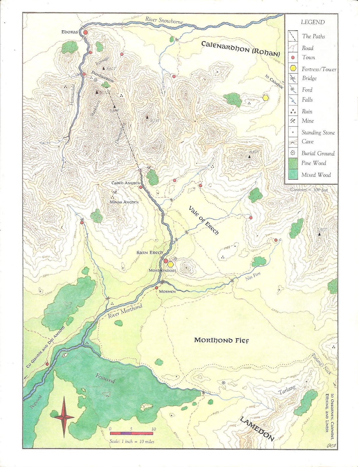
- Mornan (Morthond)

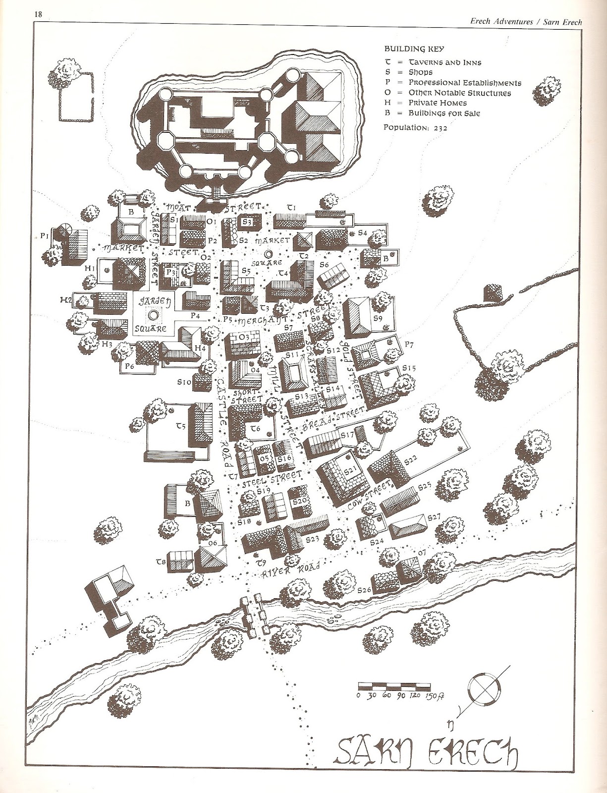
- sarn erech Map: I10
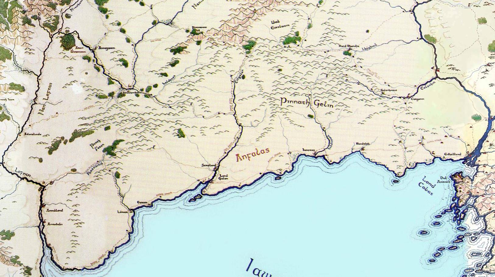
- Anfalas

- lond galen Map: I9
- annúlond Map: J8
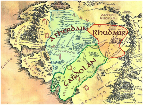
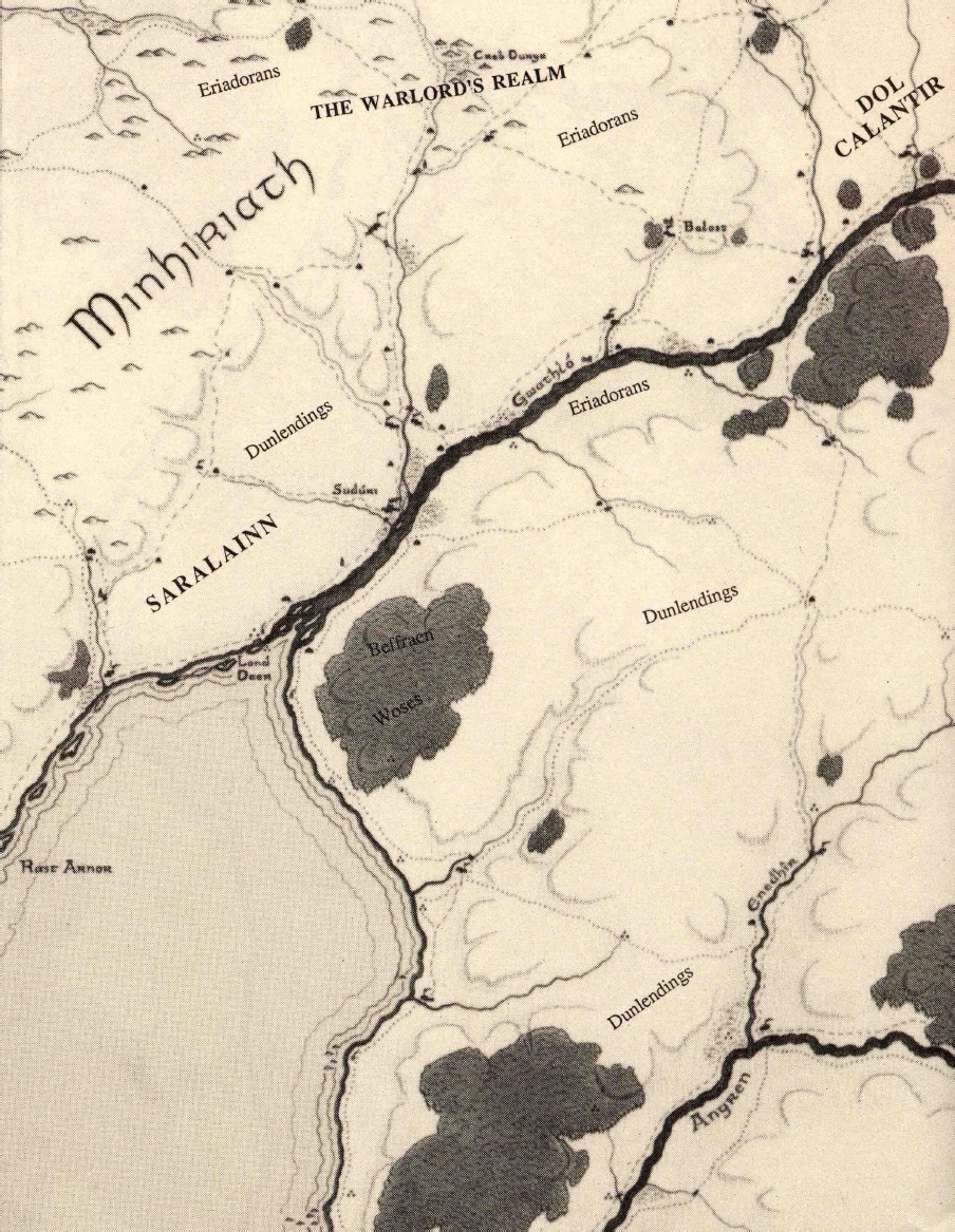
Eriador

- Enedwaith
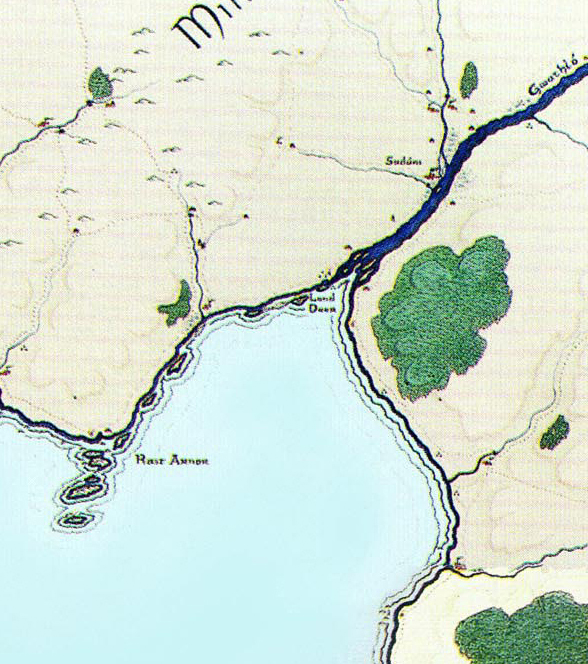
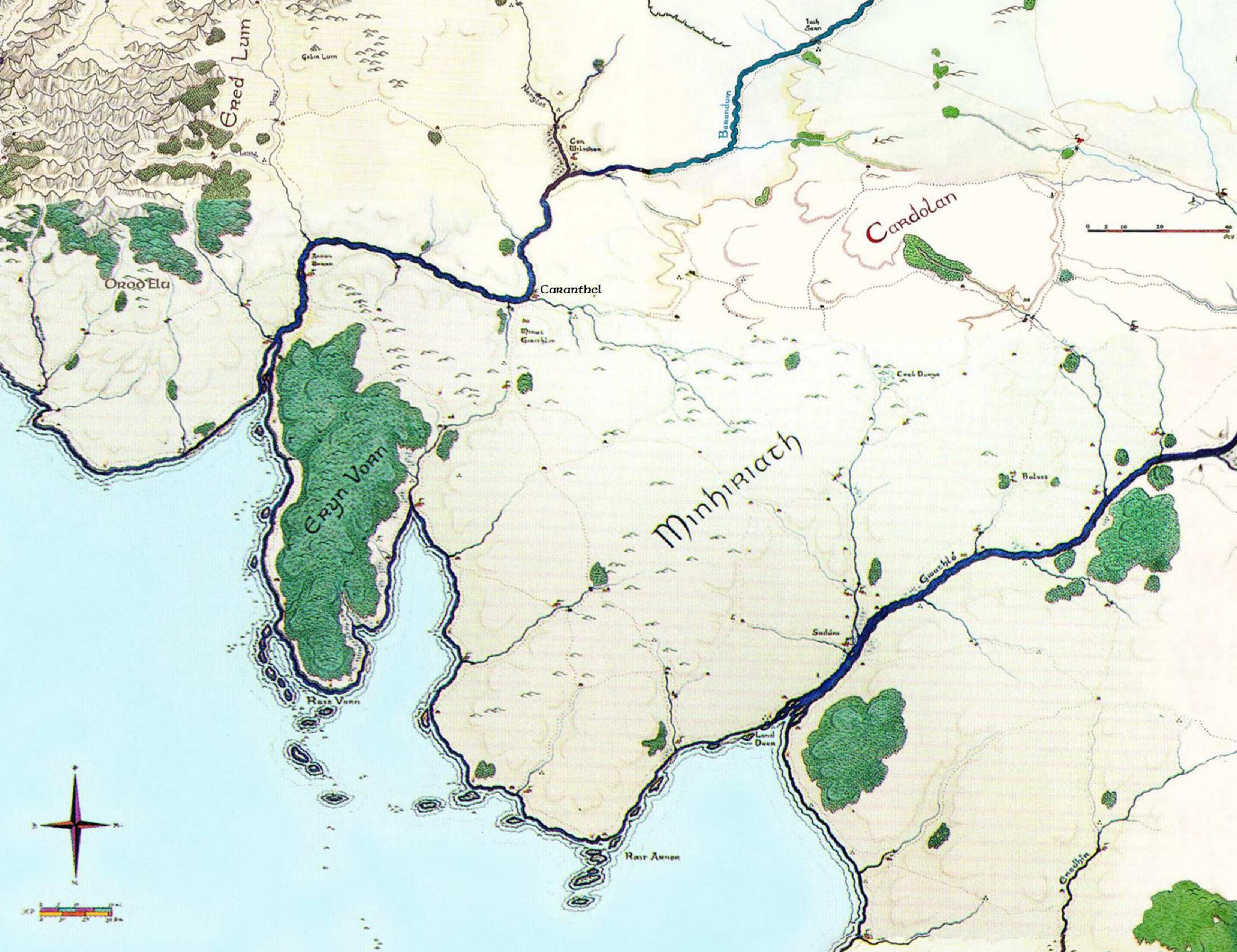
- Lond Daer
- Numenorean ruins


- Cardolan
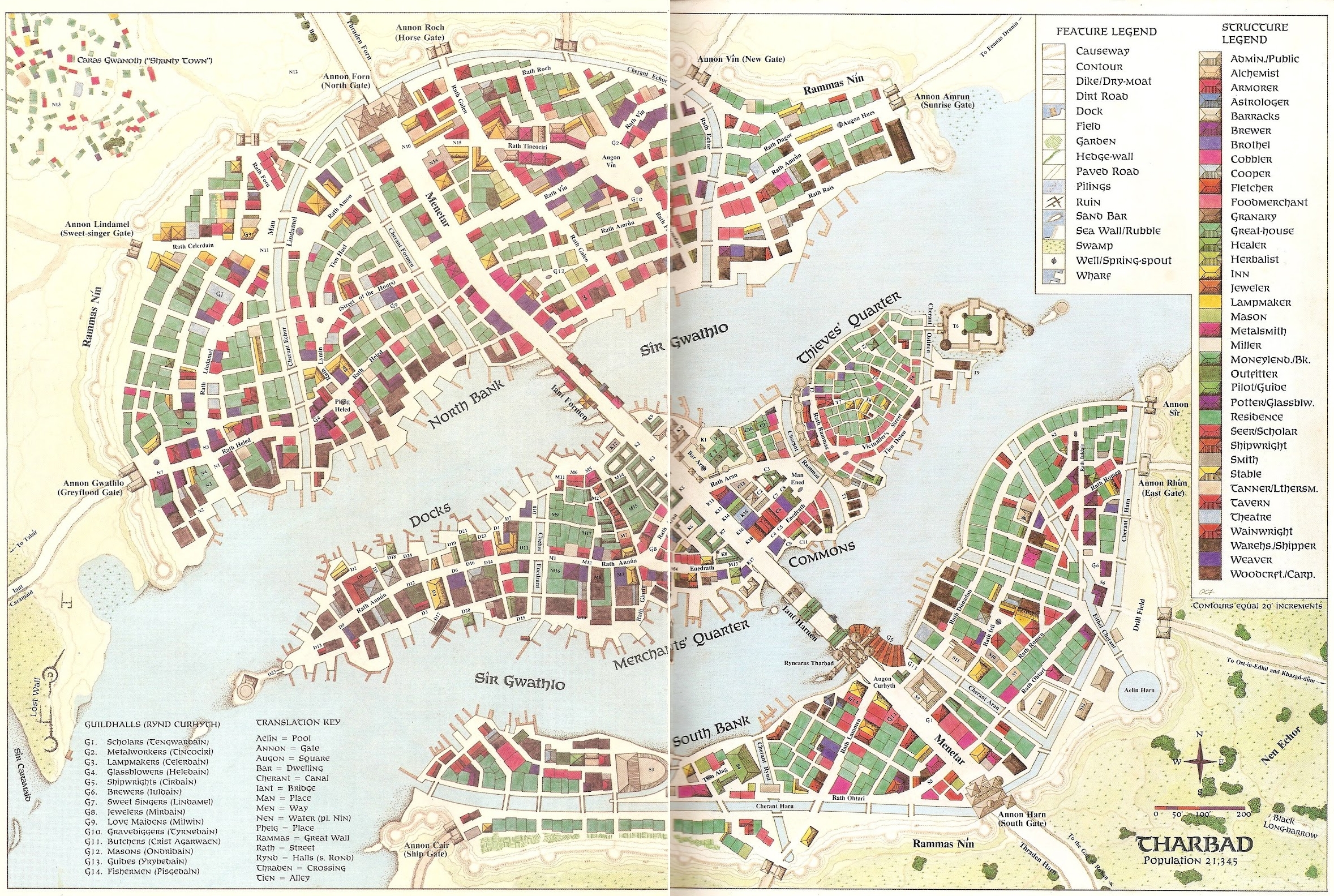
- Tharbad Map: G8
- Minhiriath
- Saralainn

- Suduri Map: H8
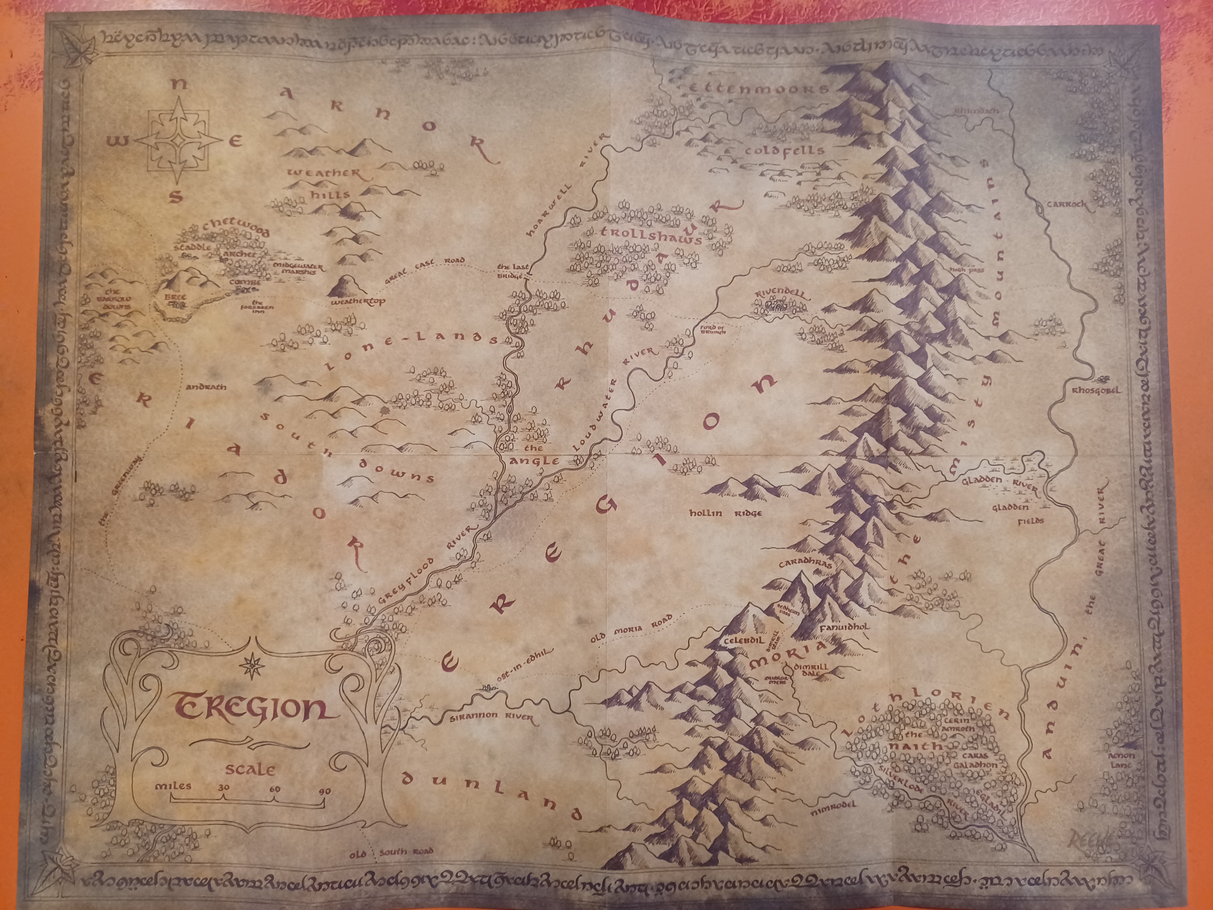
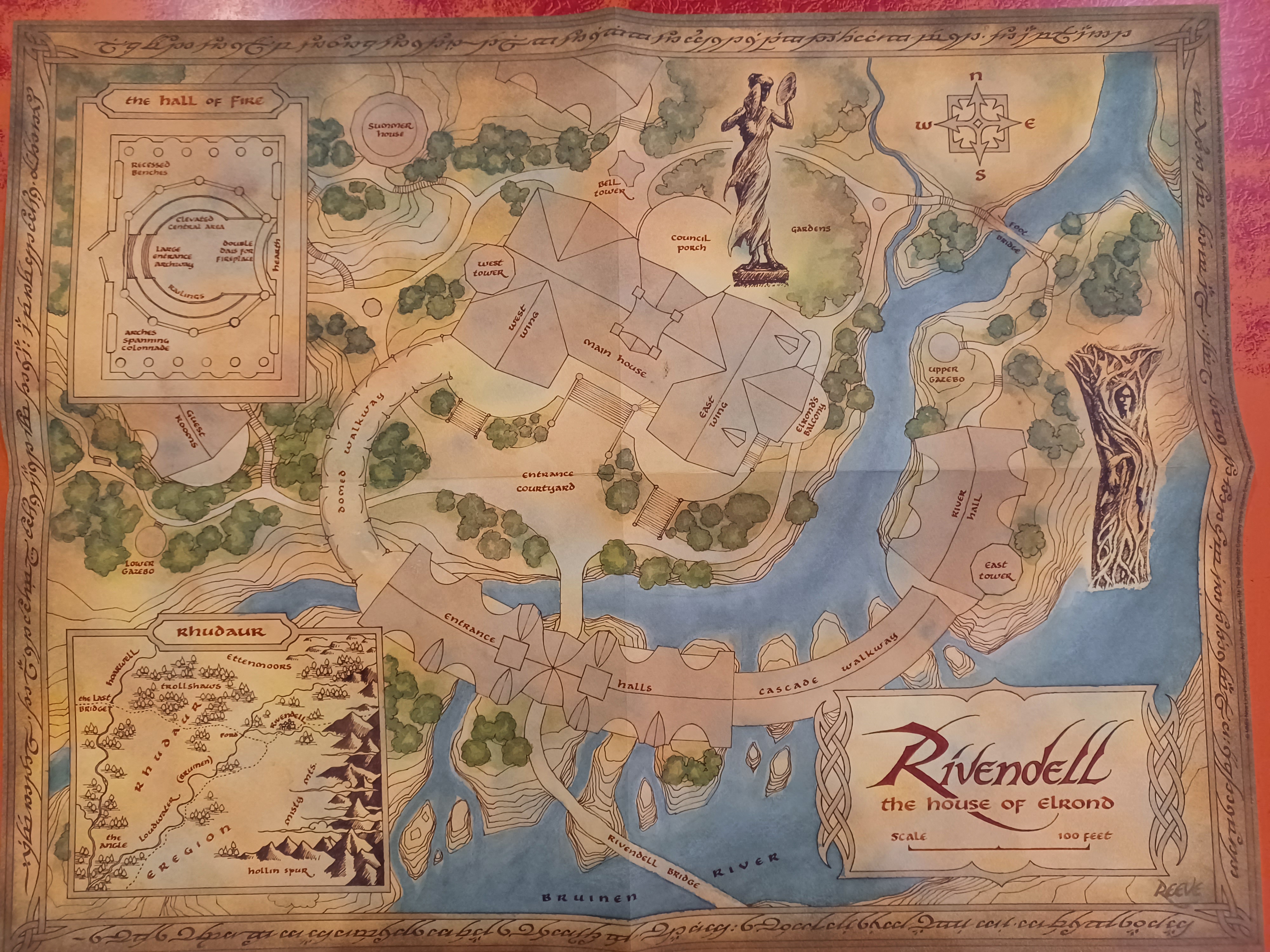
- Eregion

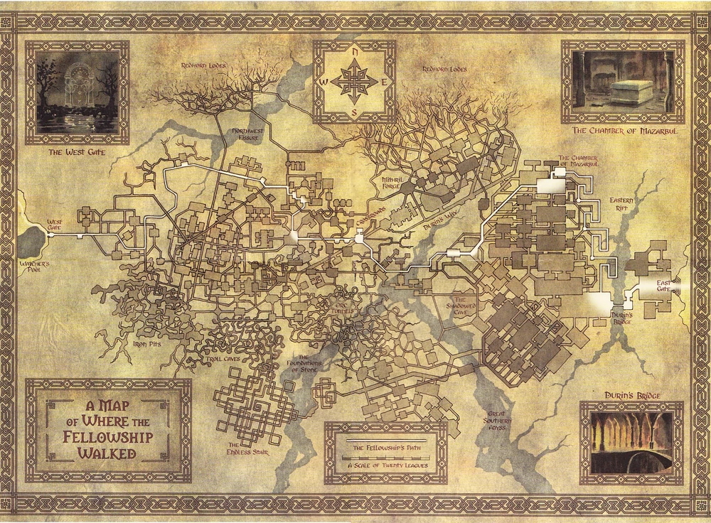
- (rivendell) Map: F10
- (moria w. gate) Map: F10-G10
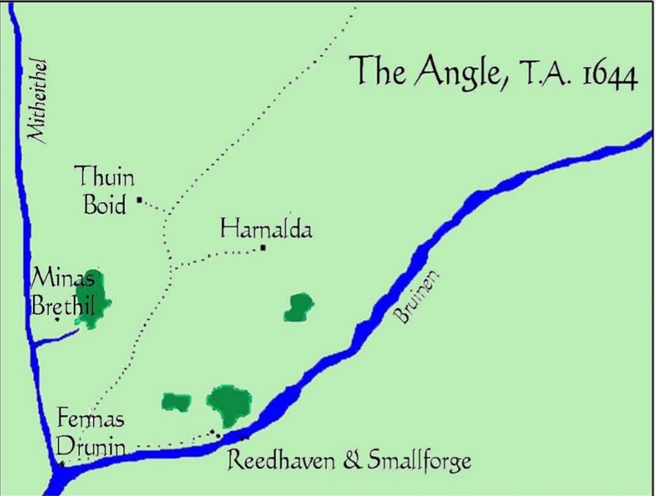
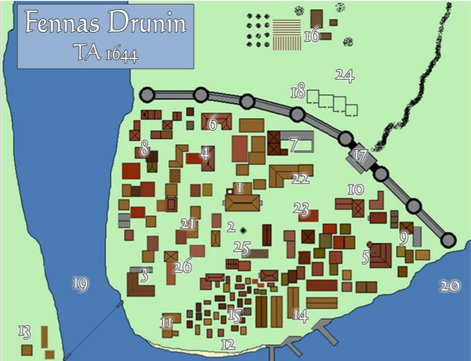
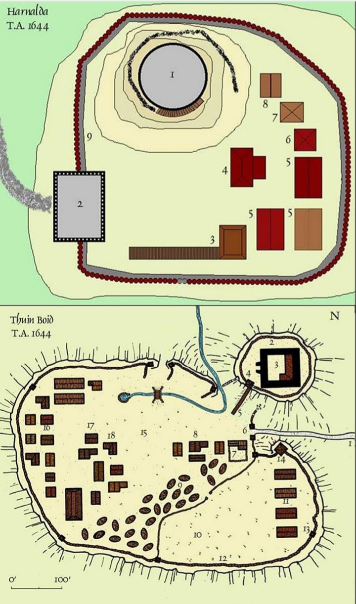
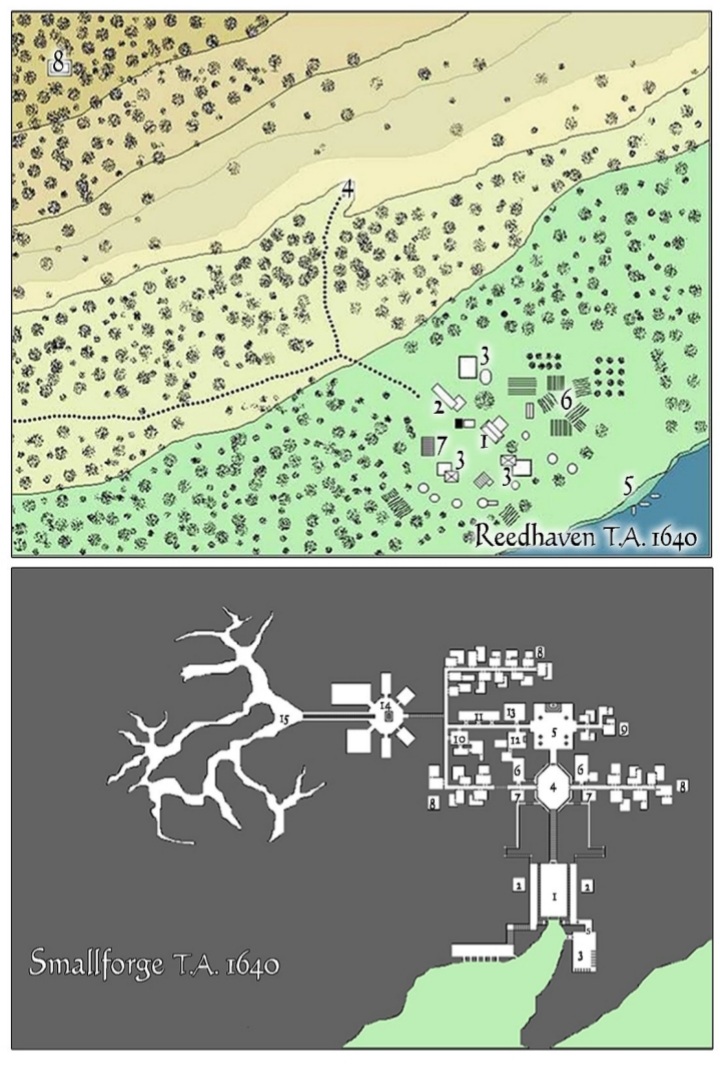
- The Angle
- Arnor / Arthedain
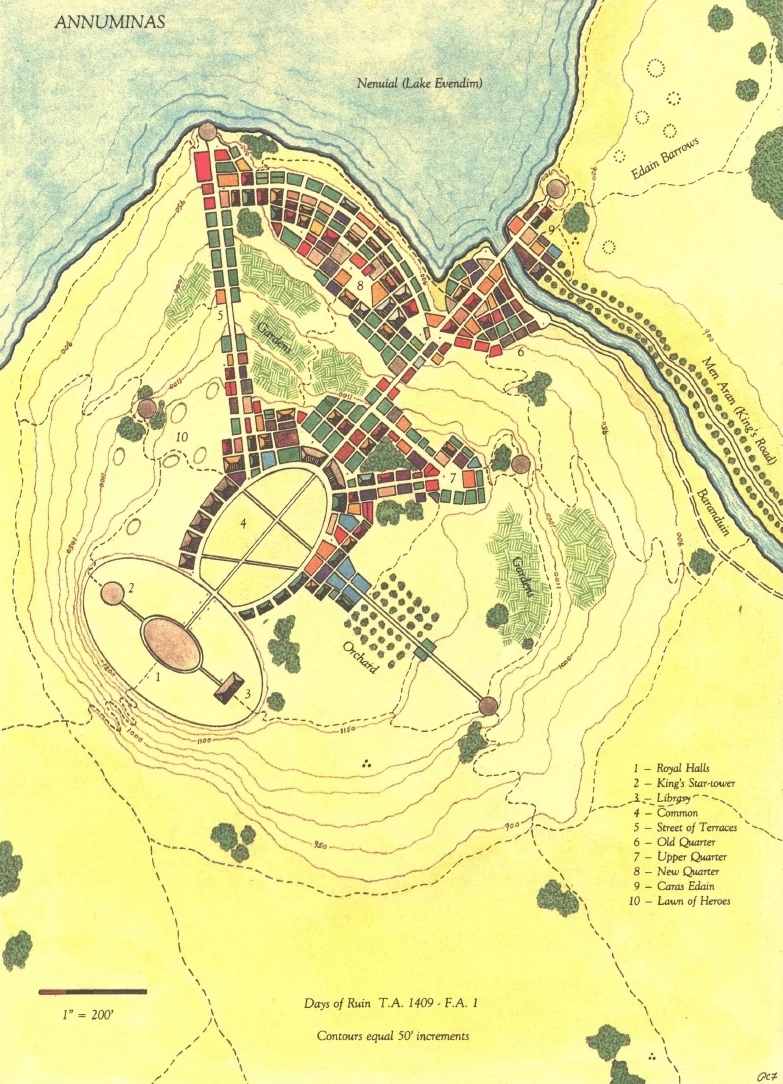
- Annuminas Map: F7 Annuminas was made into Elessar's summer capital
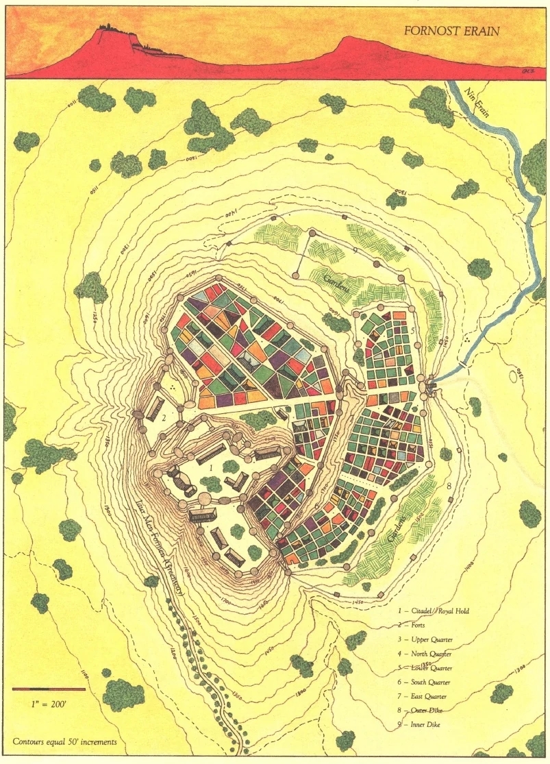
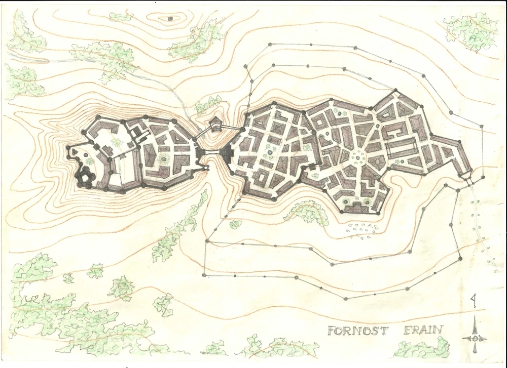
- Fornost Erain (Kingsbury) Map: F8
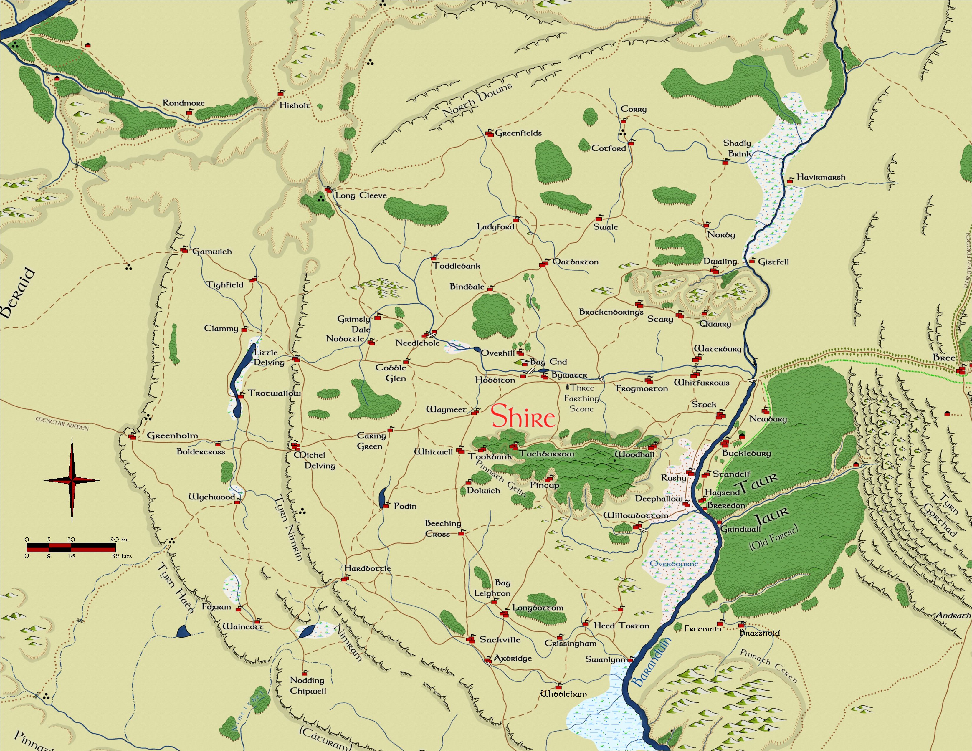
- Shire


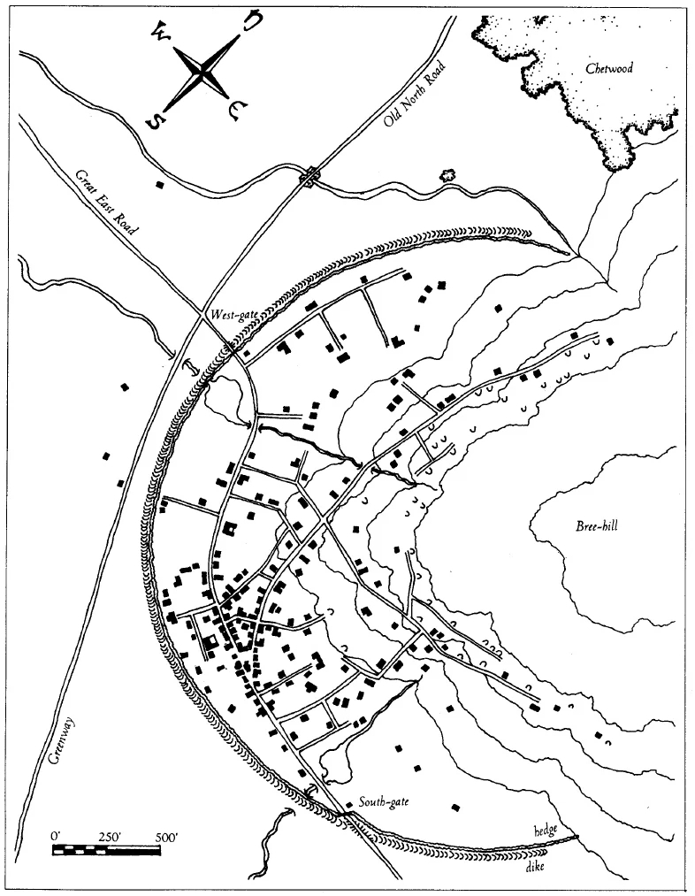
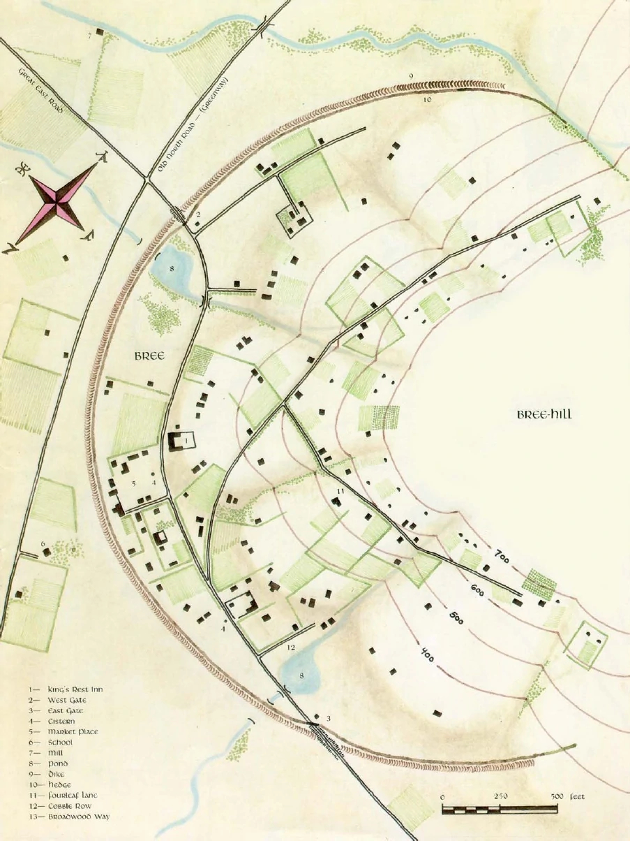
- Bree Map: F8
- Waste of Angmar
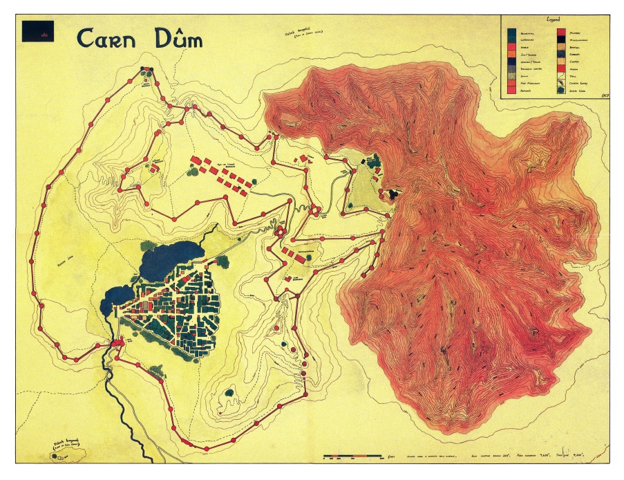
- ruins of carn dum Map: E9

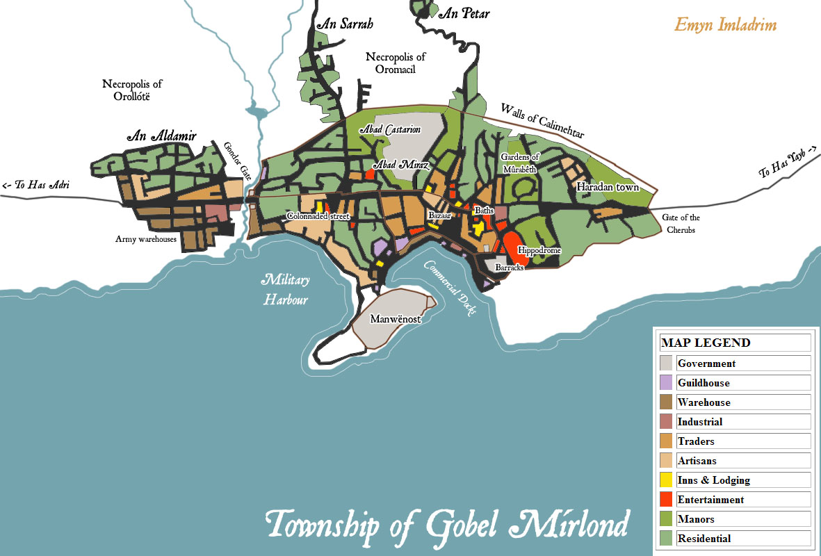
Harondor
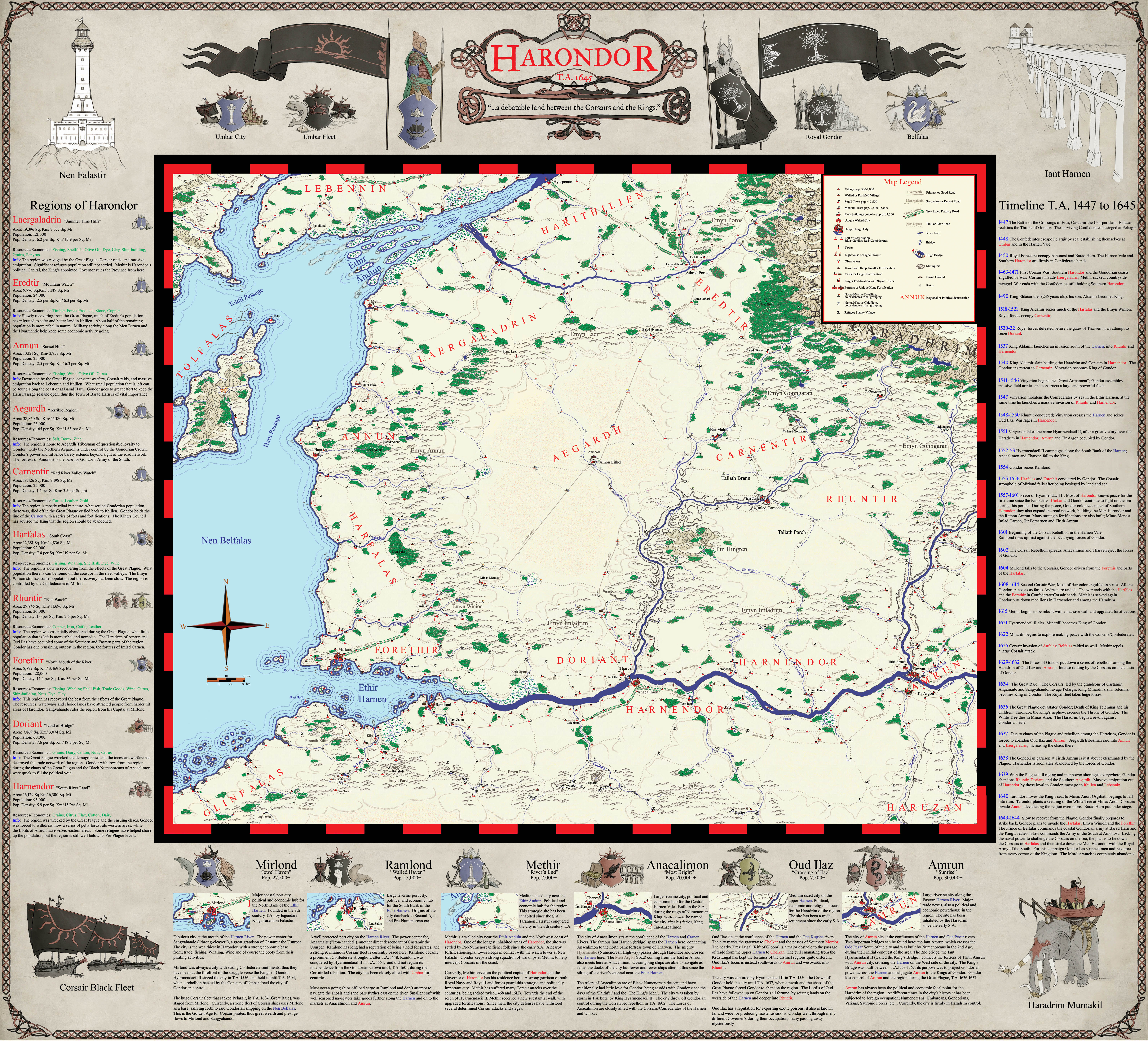
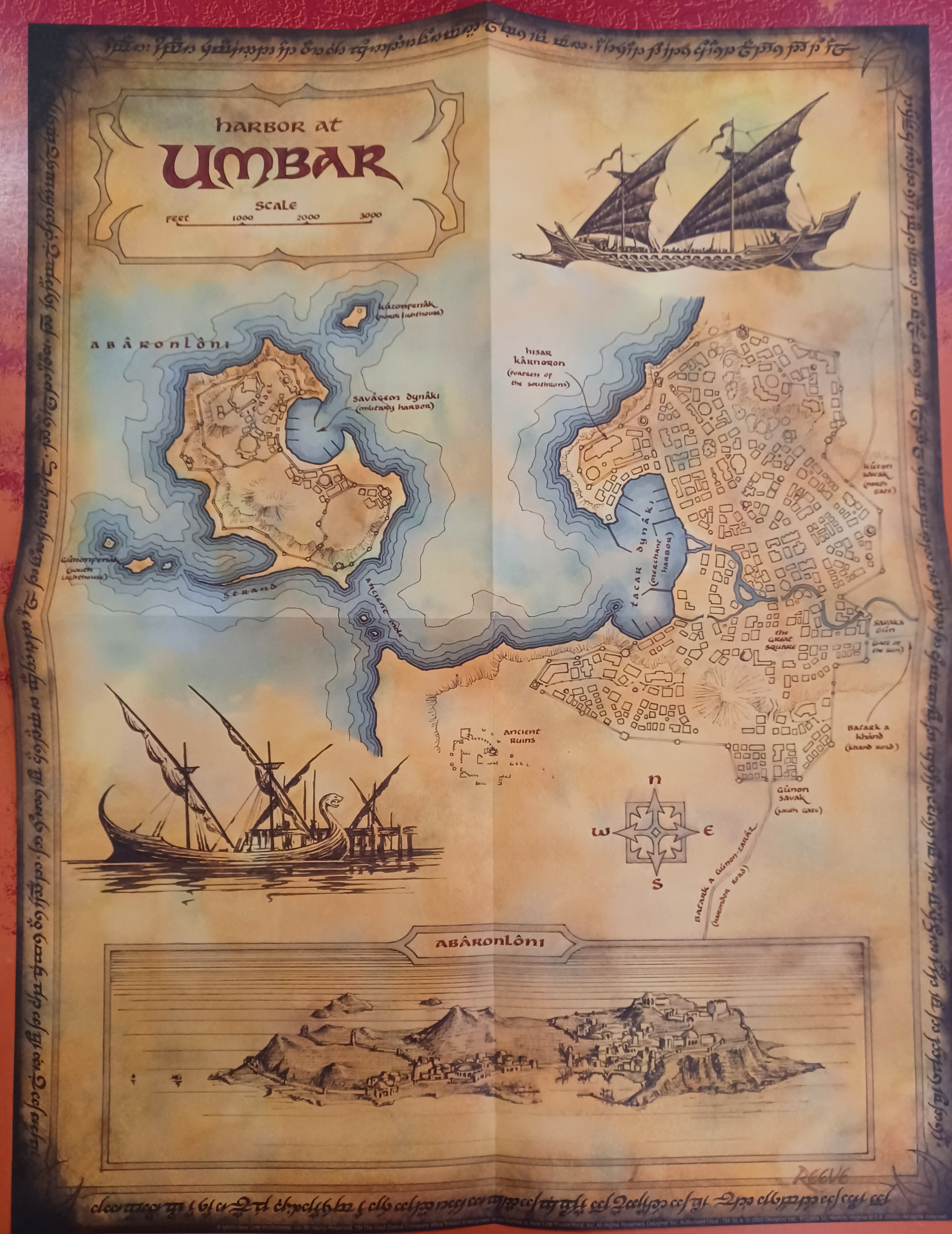
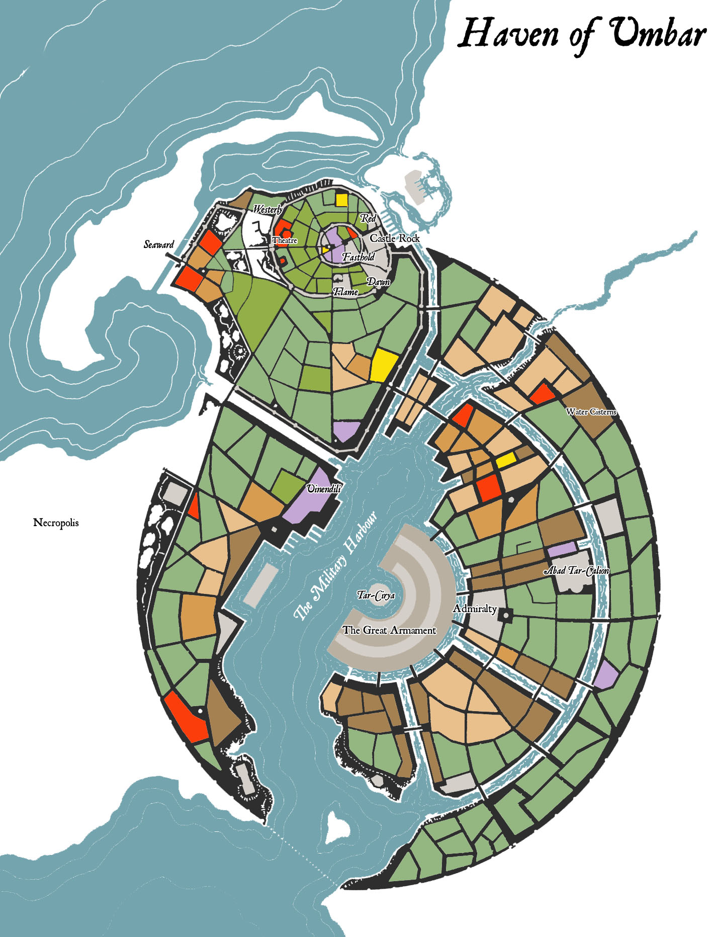
Umbar
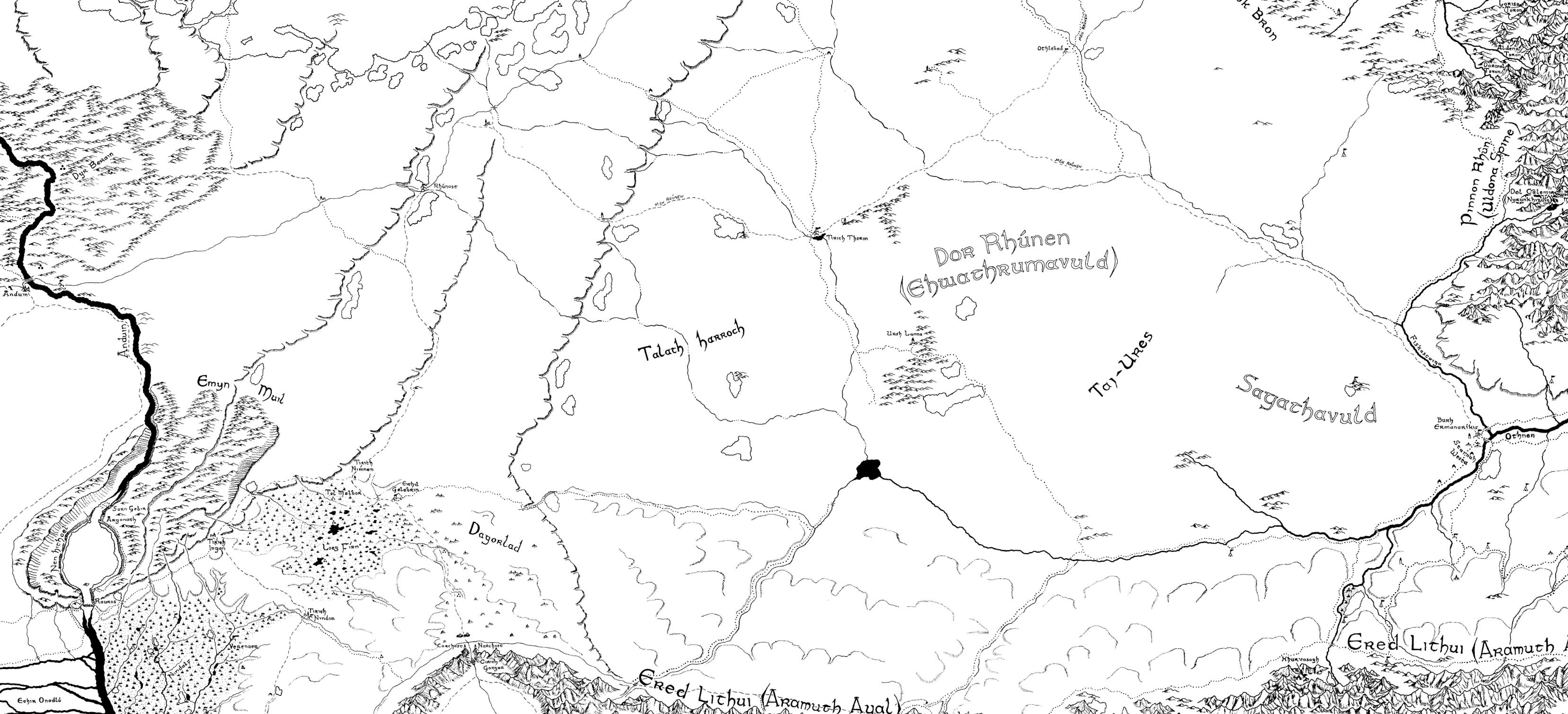
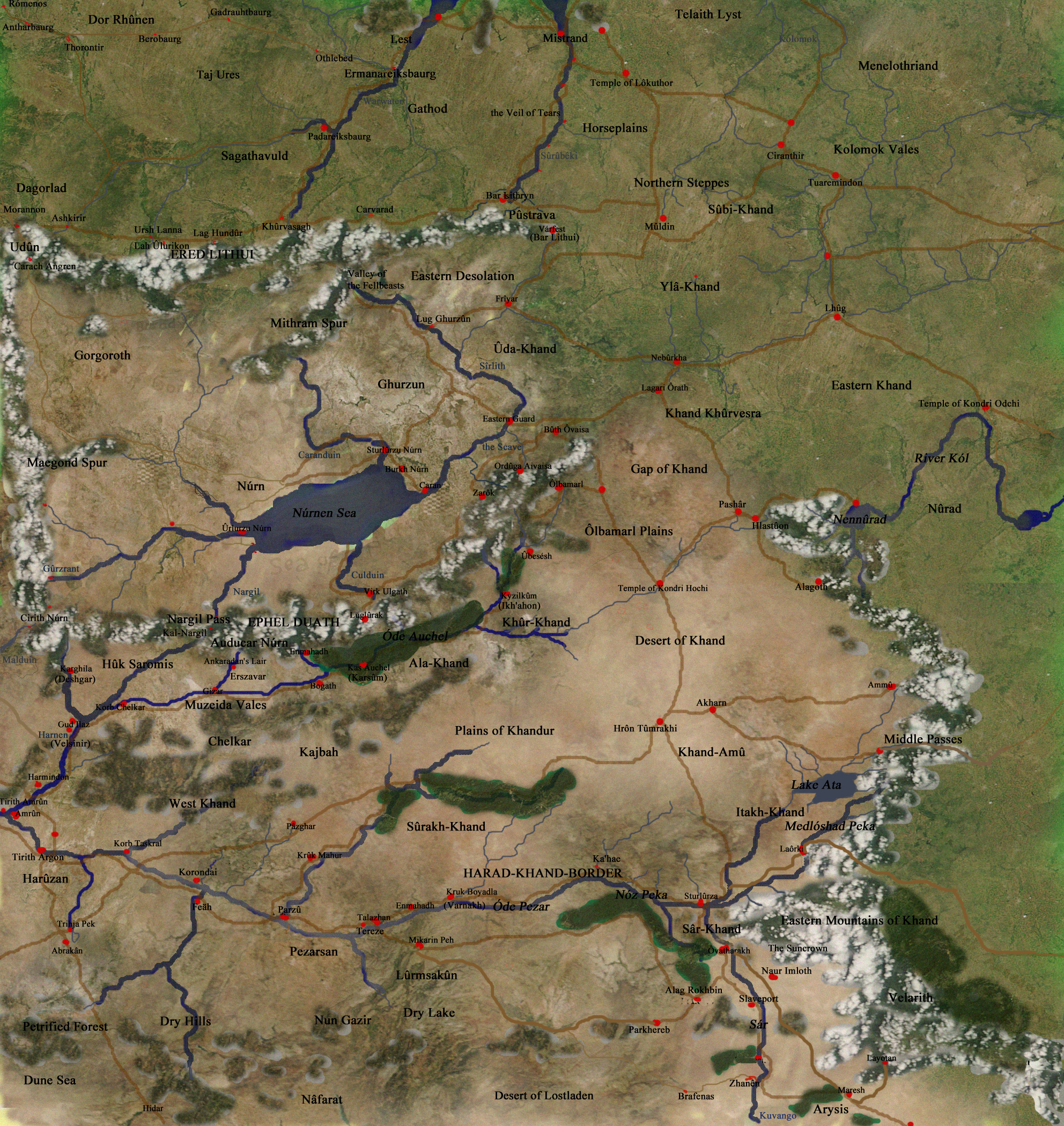
Rhûn
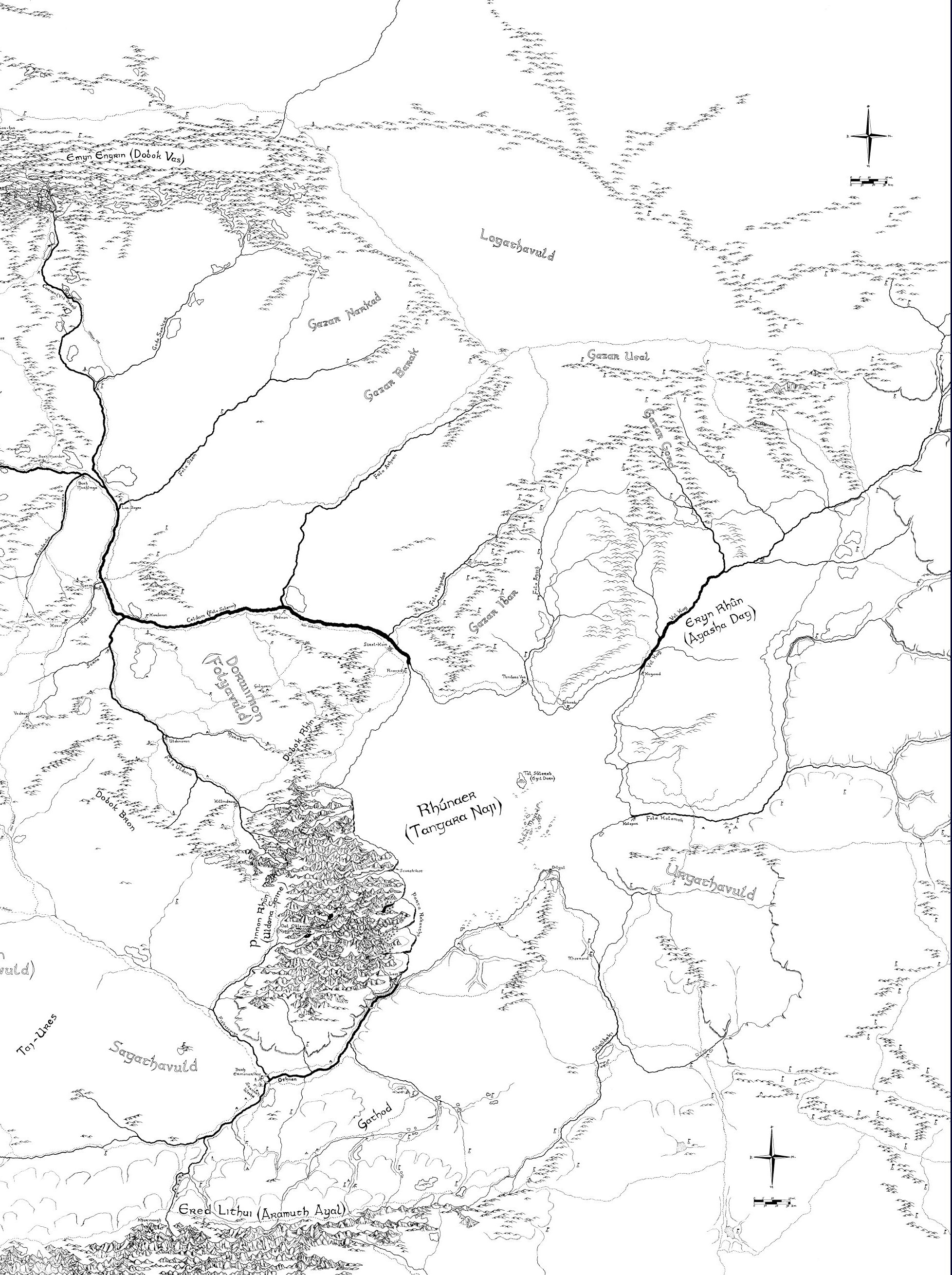
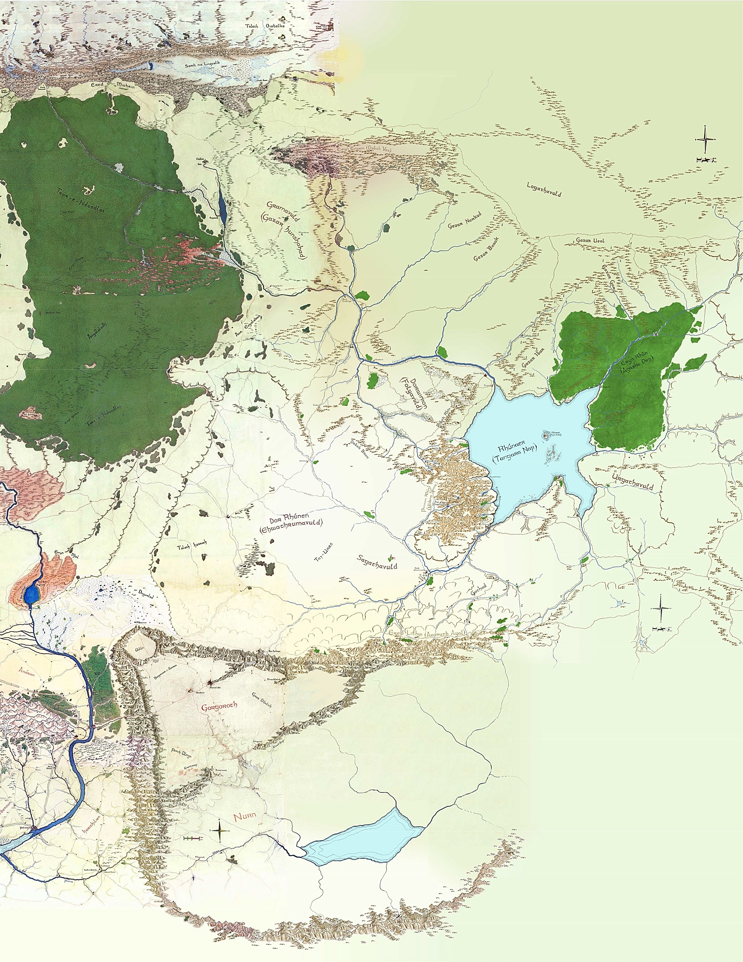
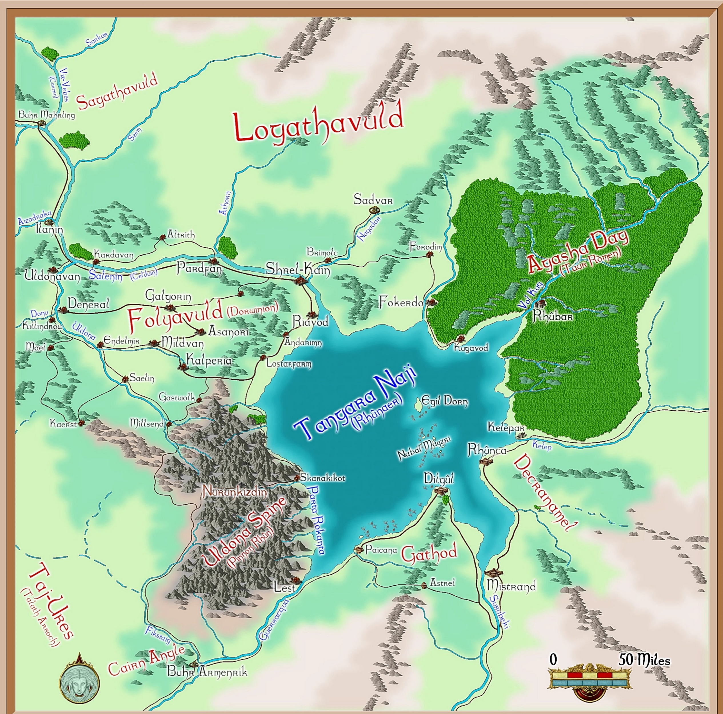
- Dorwinion
- szrel-kain Map: F15
- Gathod
- mistrand Map: G15
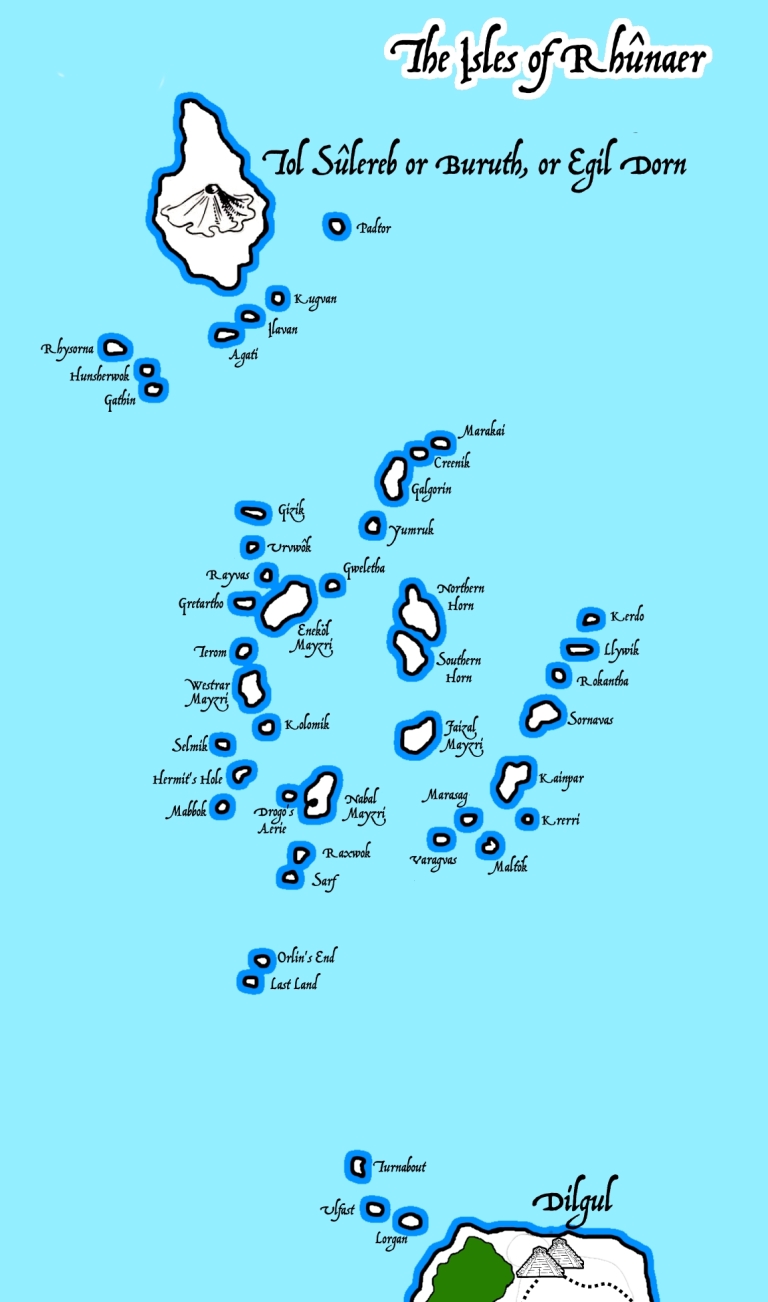
- Islands
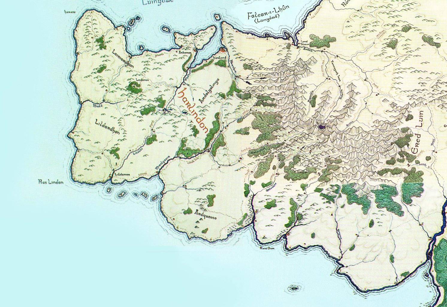
LINDON
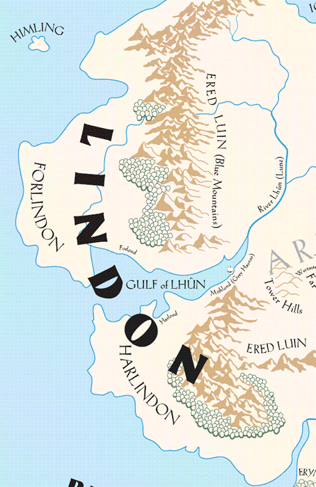
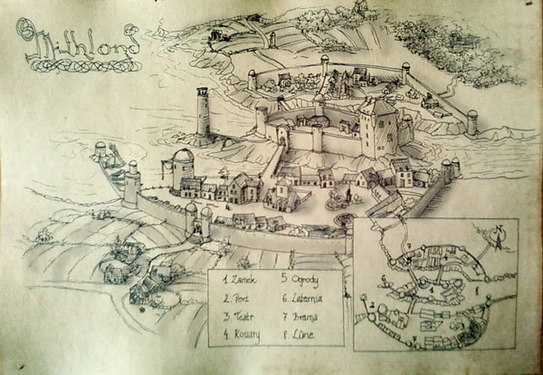
- Grey Havens (Mithlond) Map: F7
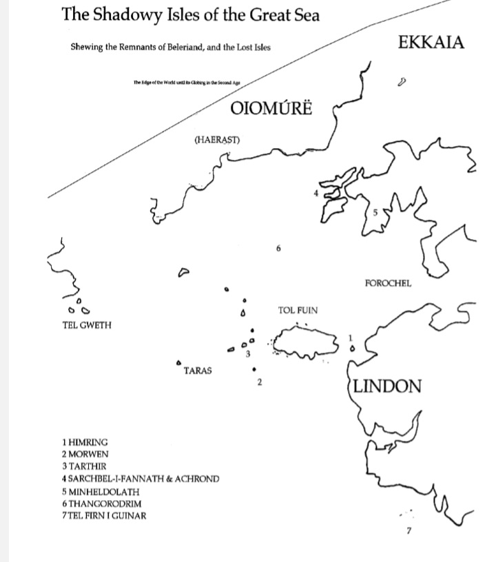
- Shadowy Isles
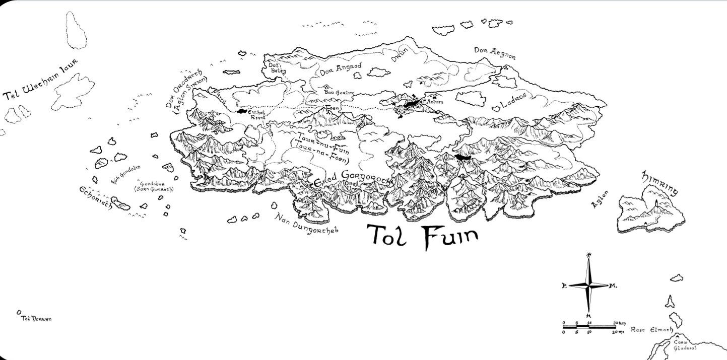
- Tol Fuin
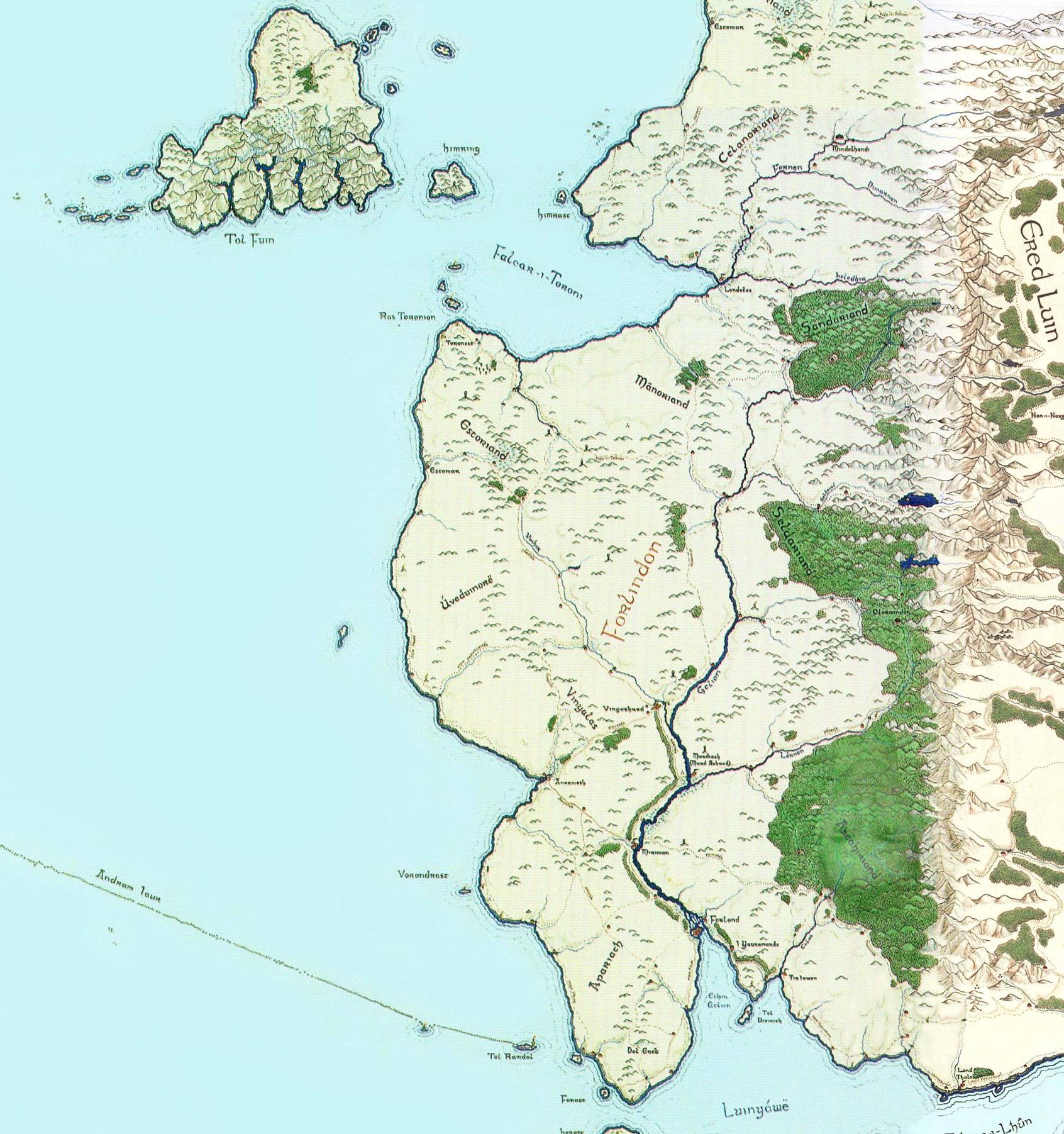
- Forlindon
- Harlindon
RHOVANION
- Dor Rhûnen
- rhûnost Map: G13
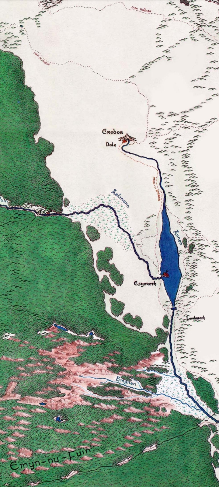
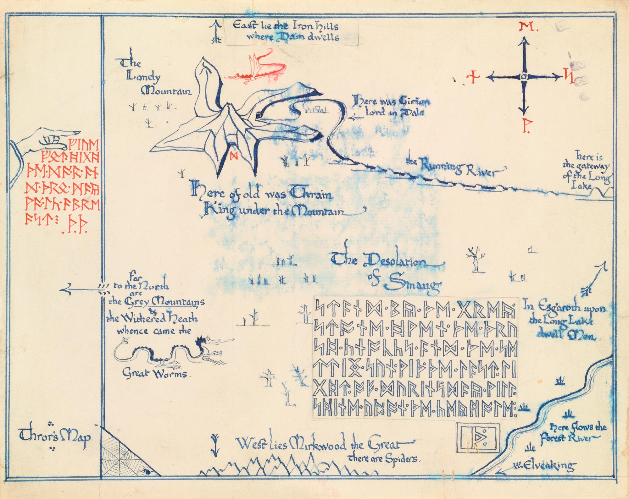
- Erebor

- Dale / Lonely Mountain Map: E13
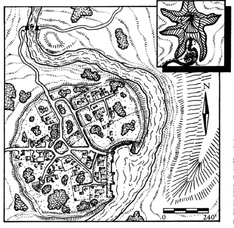
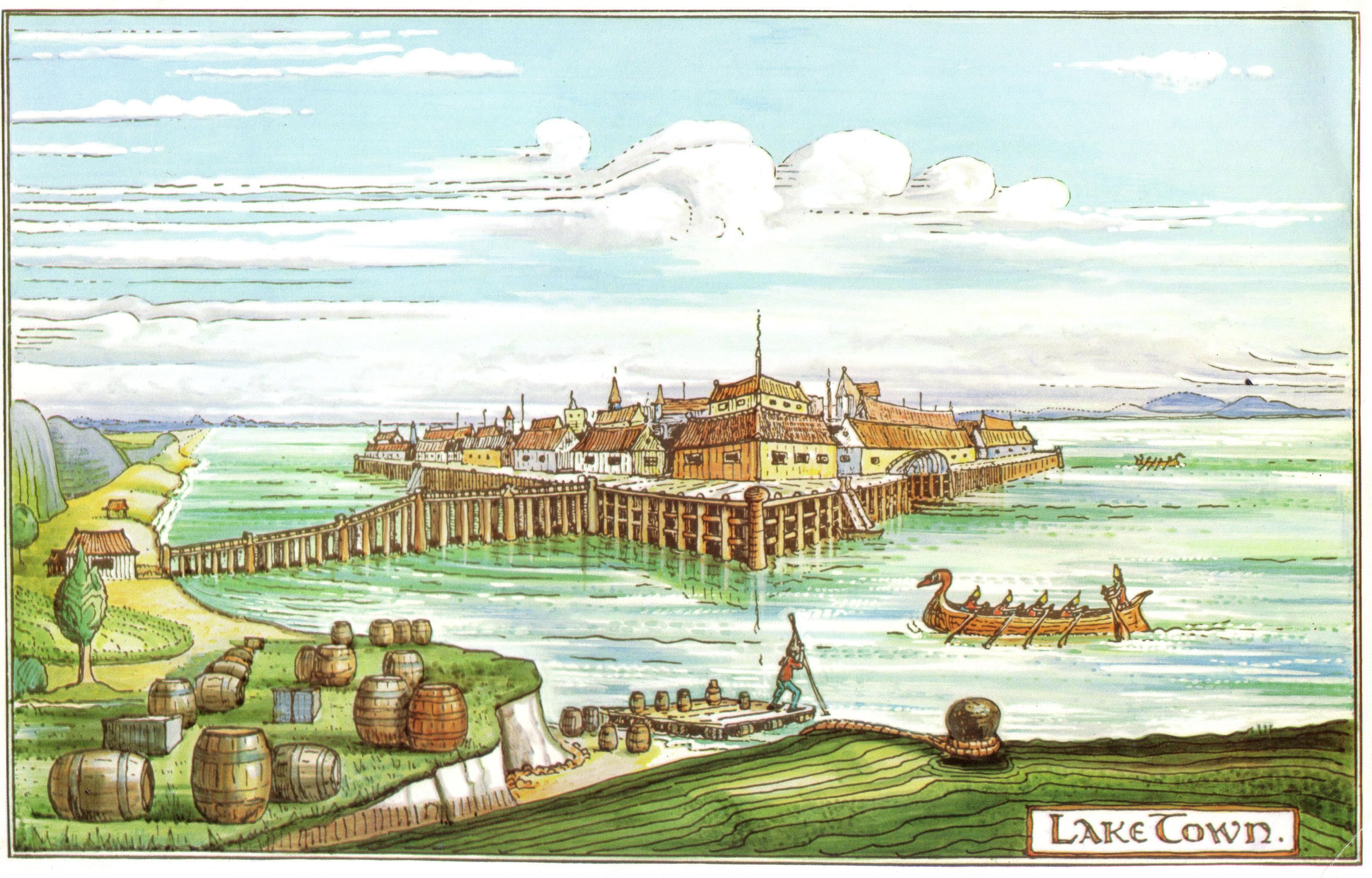
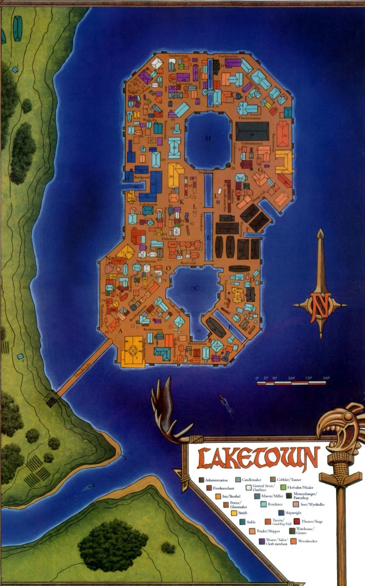
- Esgaroth (Long Lake) Map: F13
- Anduin Vale
- Mirkwood
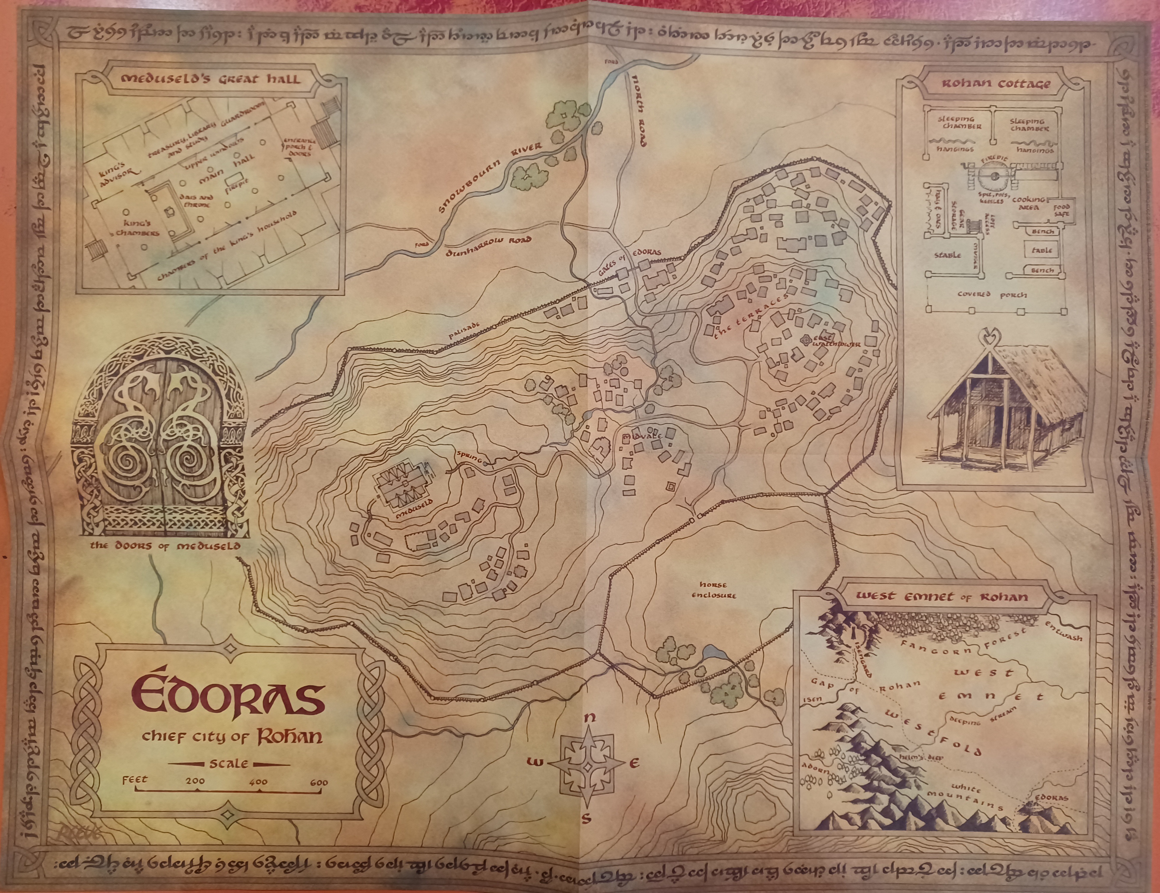
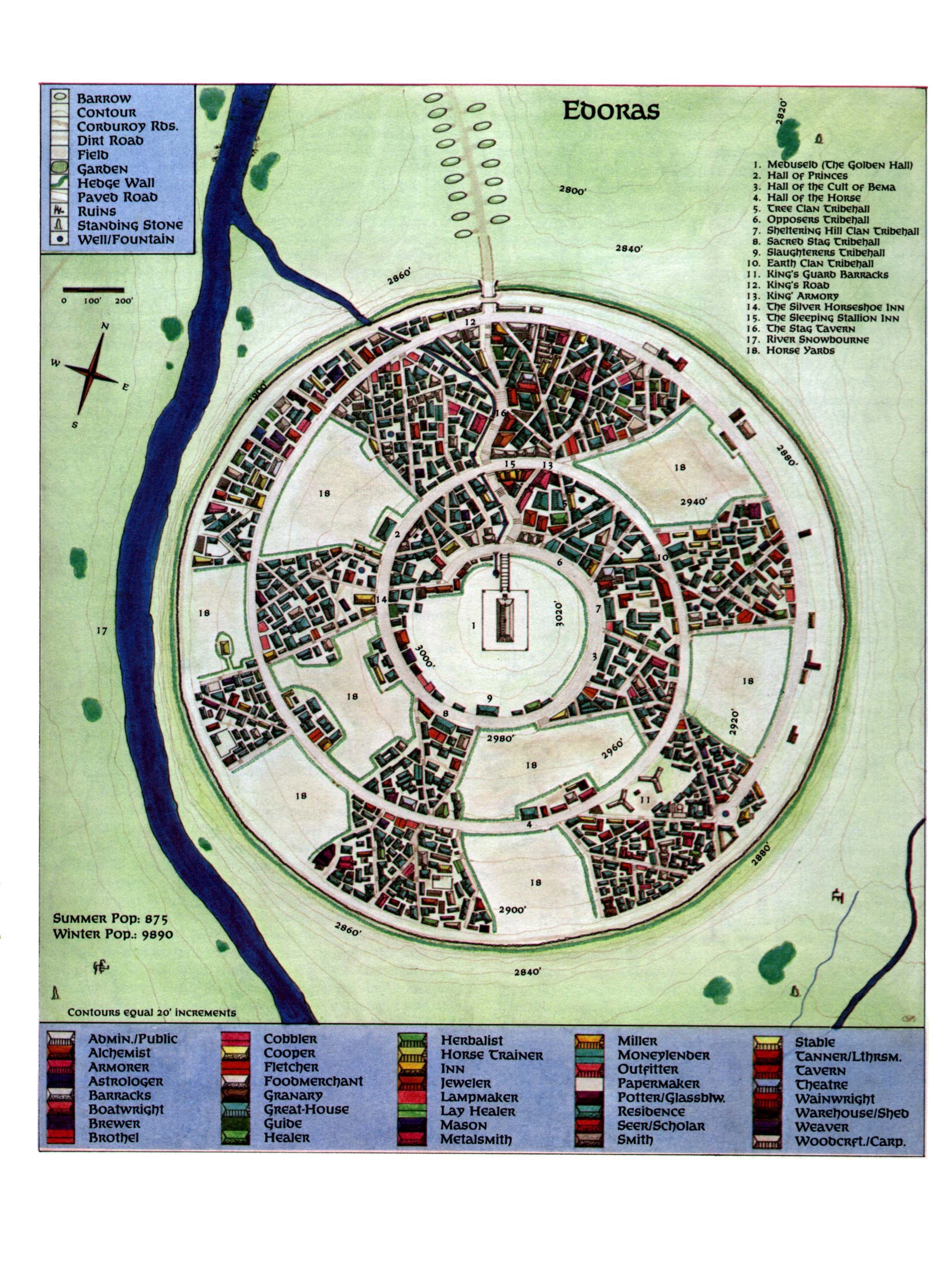
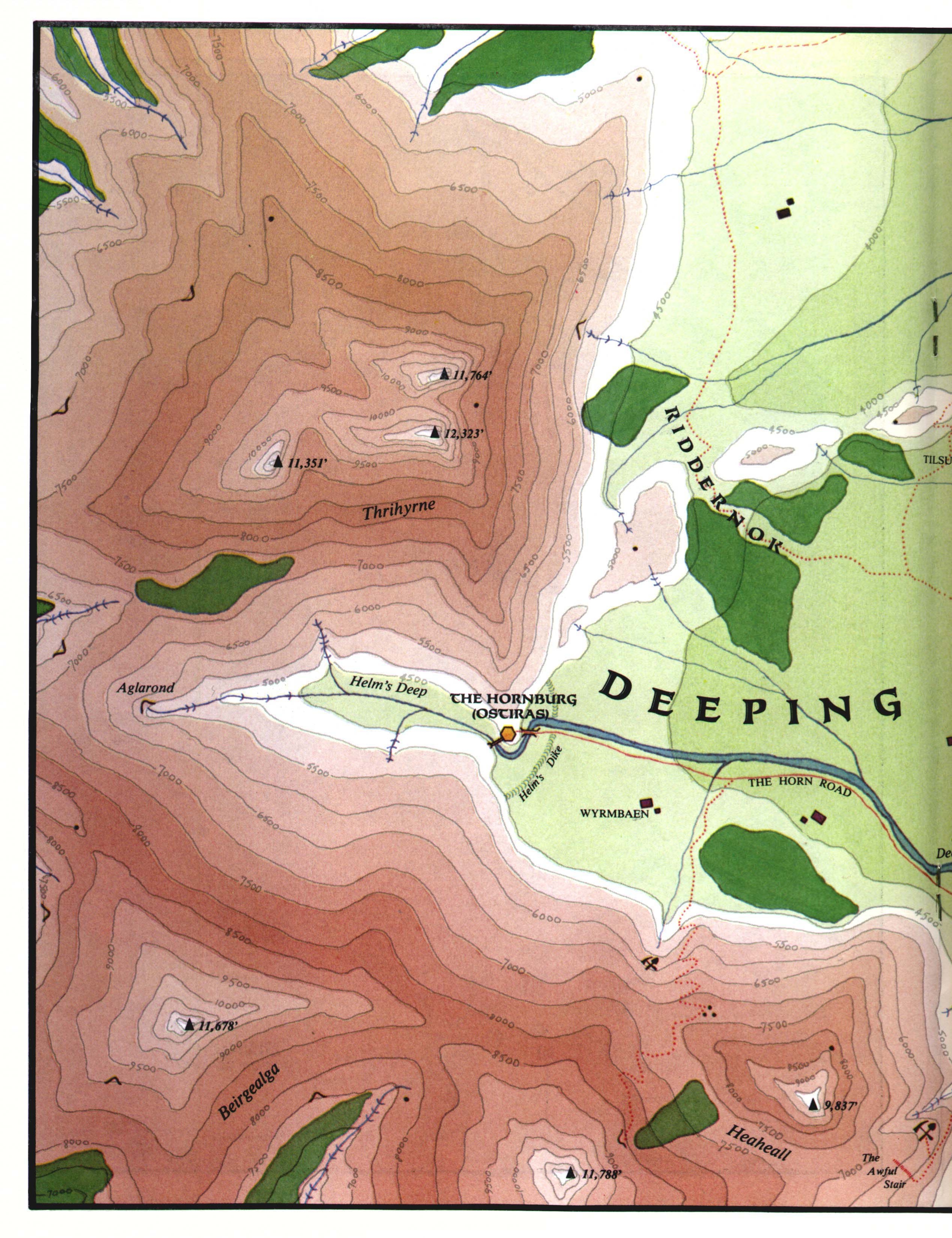
ROHAN
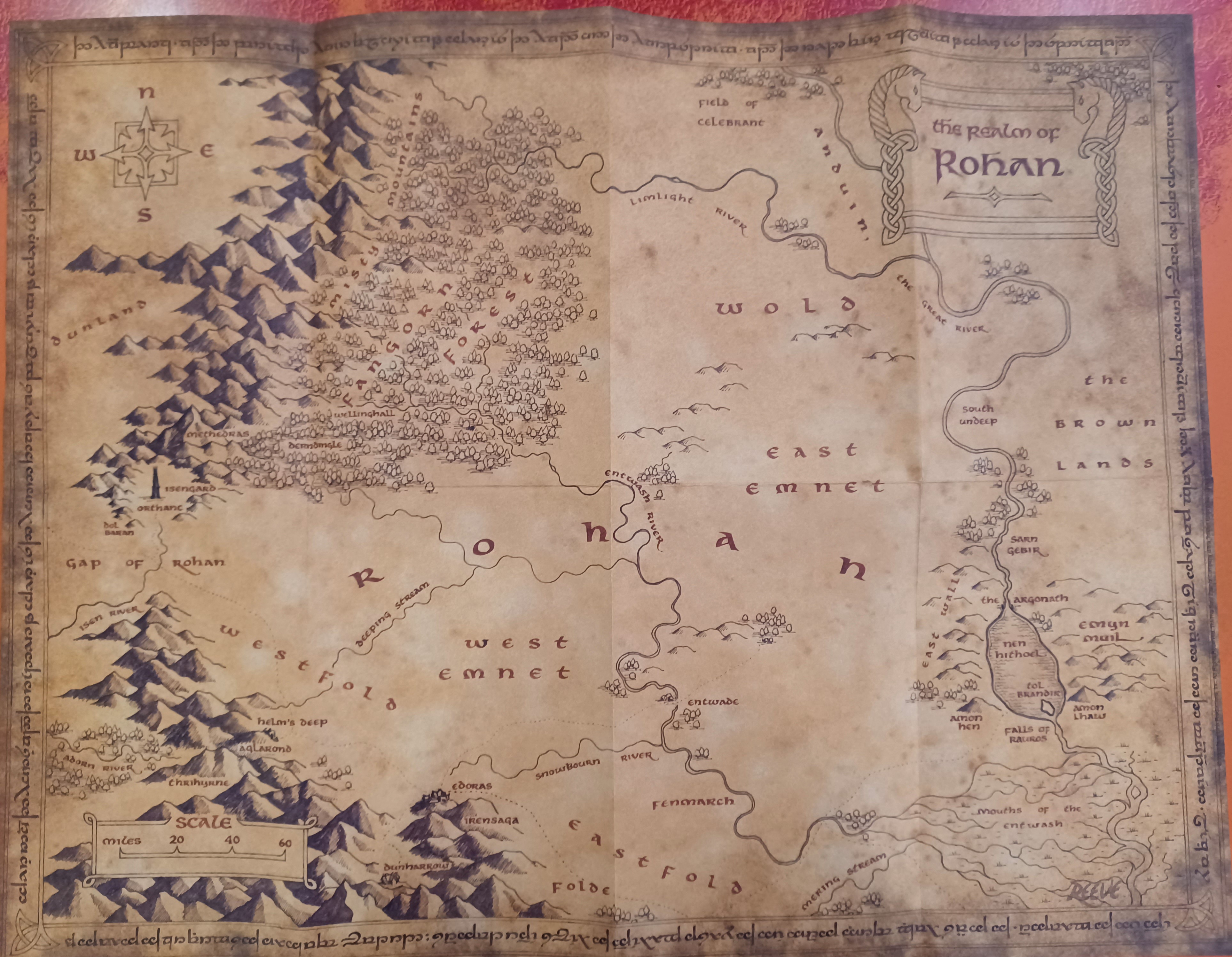
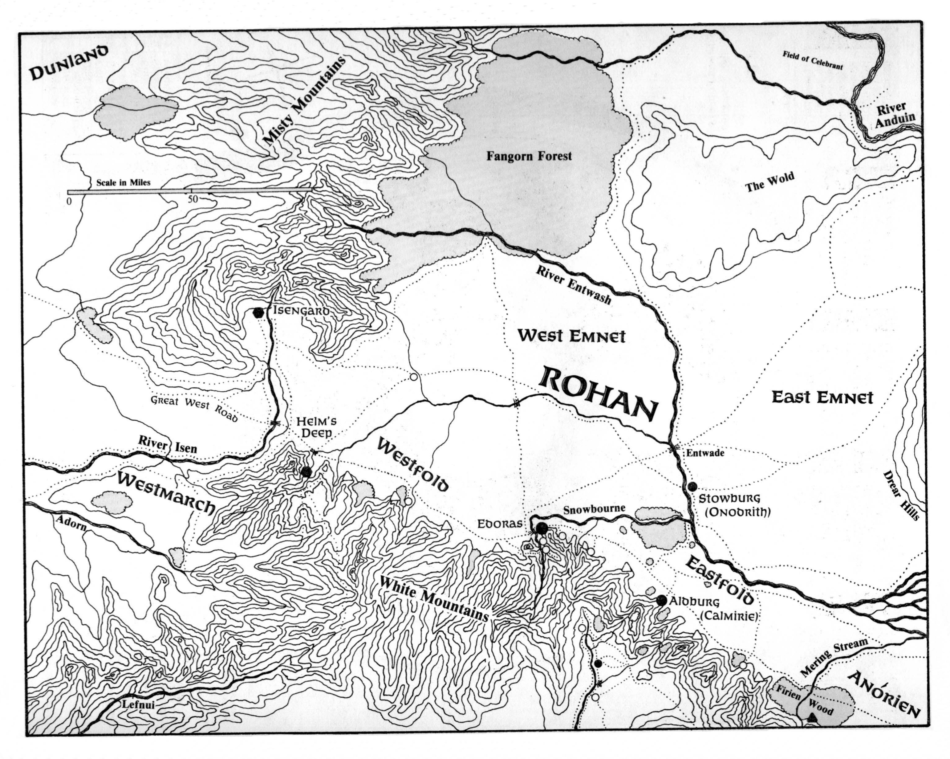
- calimirie (edoras) Map: H11
- Hornburg (Helm's Deep) Map: H11
- Aldburg Map: H11
MORDOR

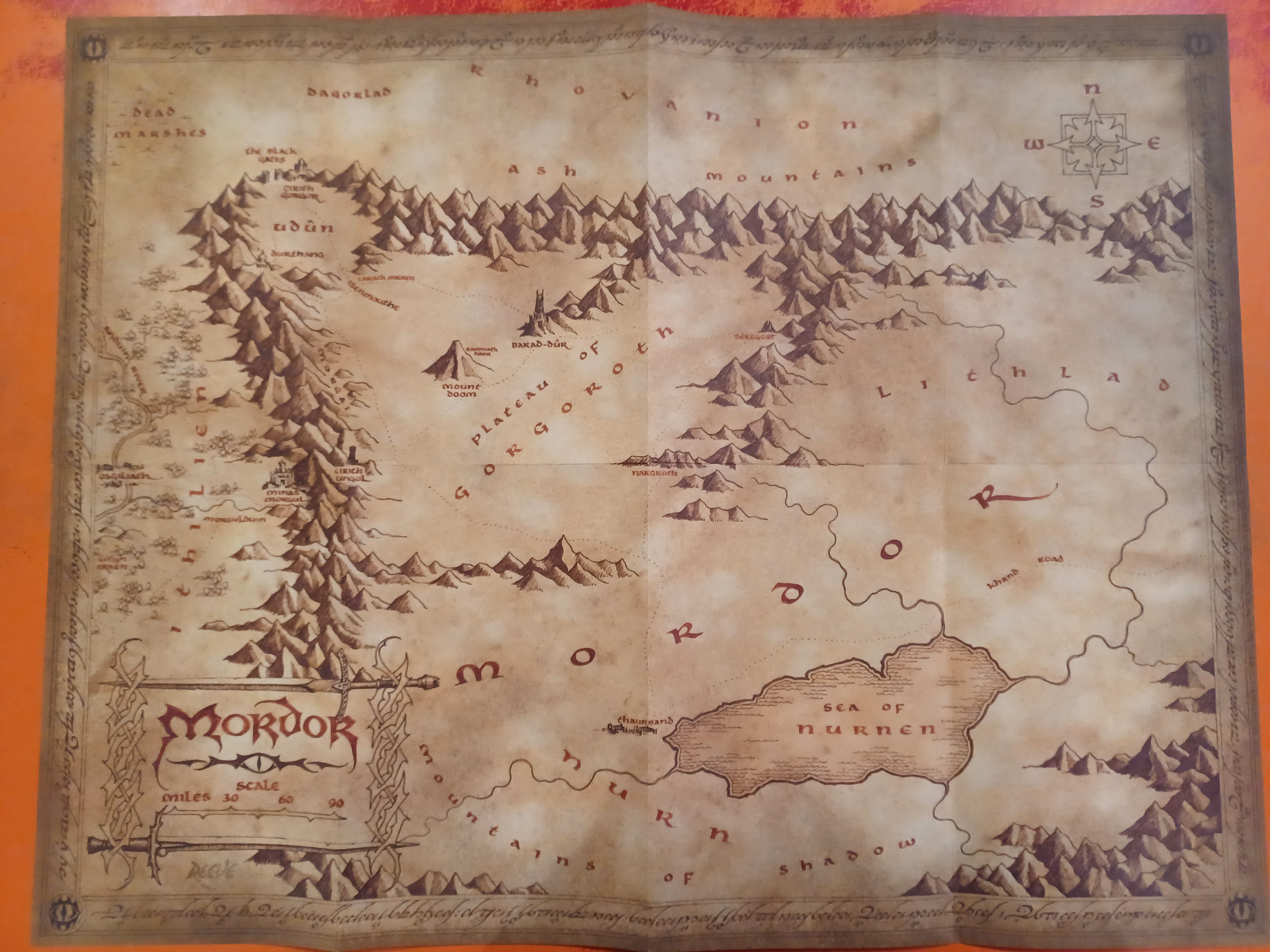
HARAD
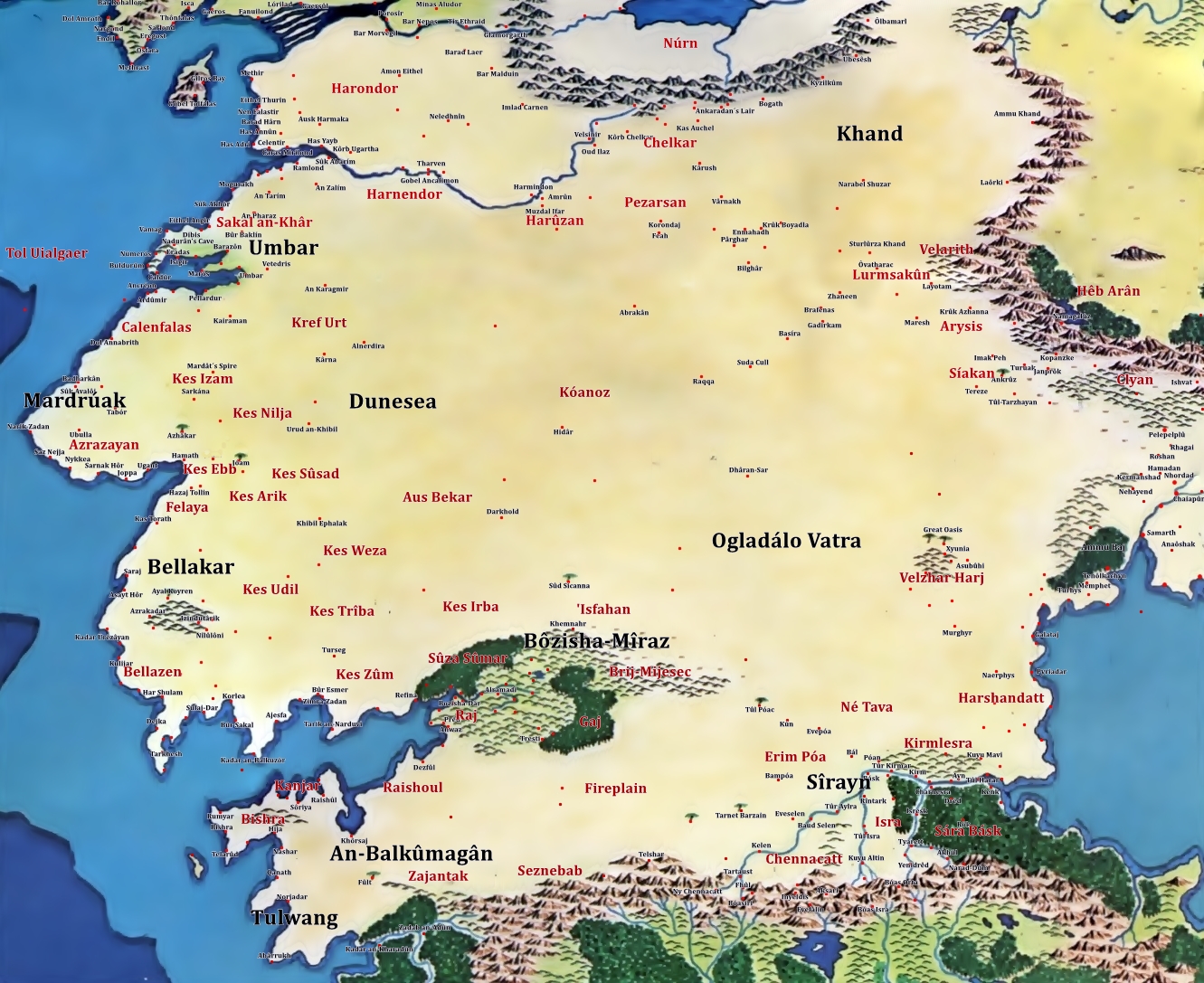
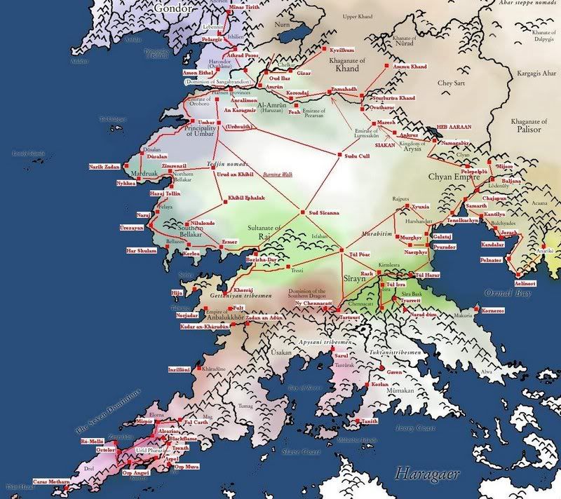
Sirayn
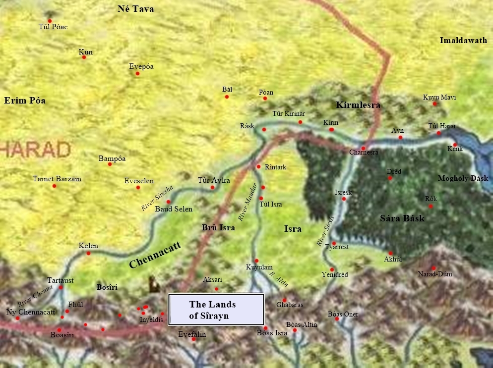
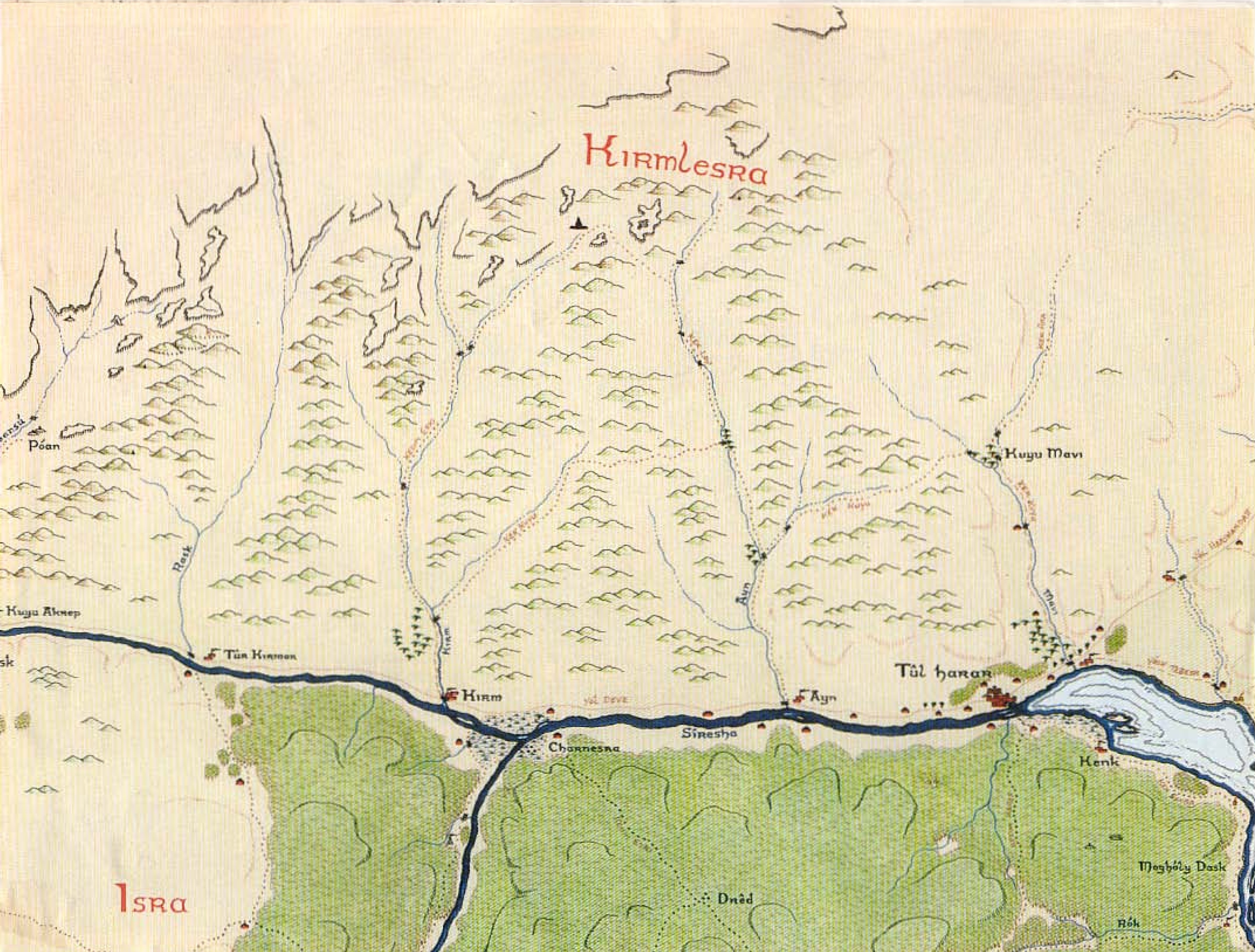
- Kirmlesra

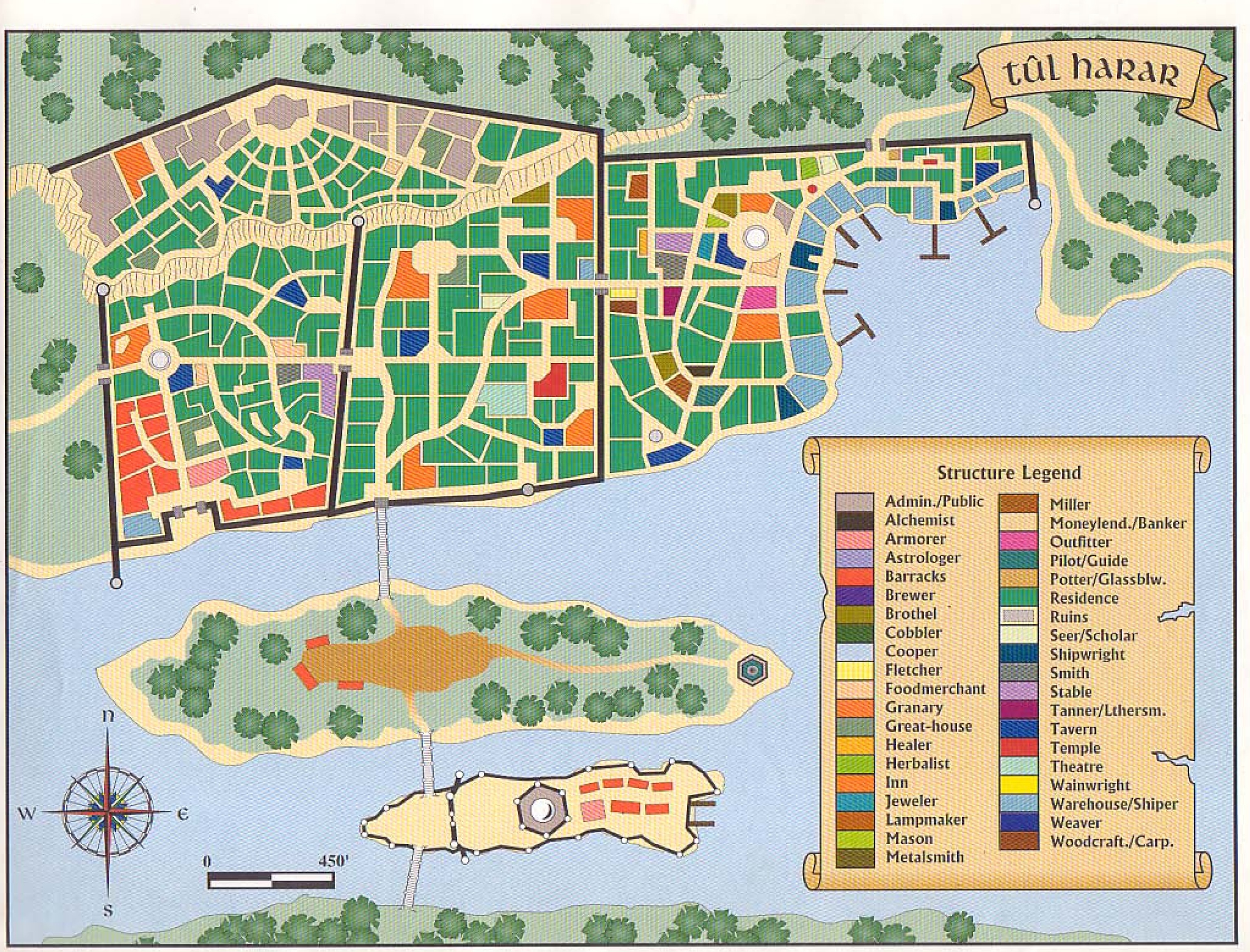
- Tul Harar
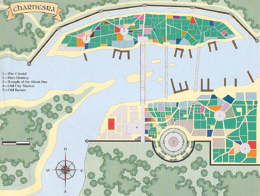
- Charnesra
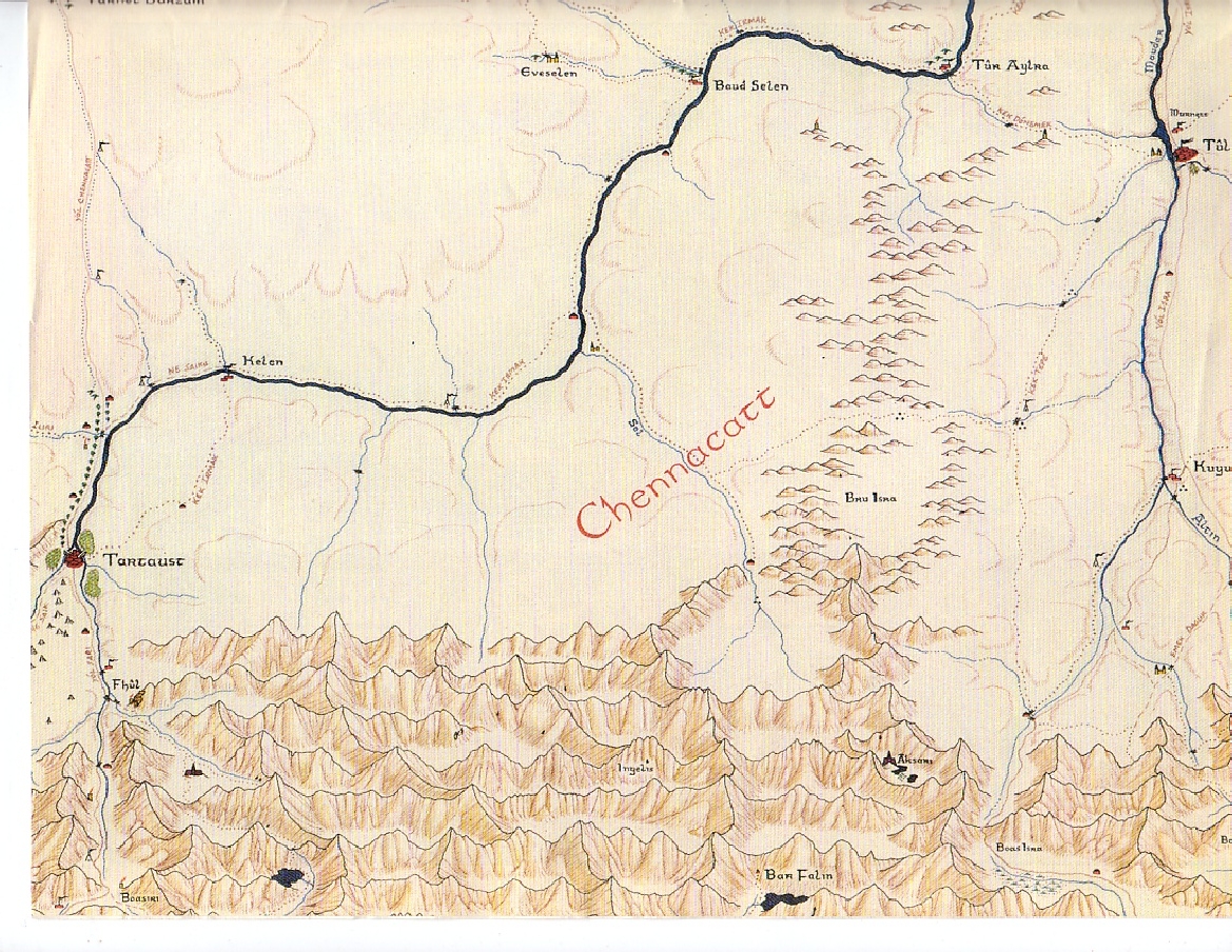
- Chennacatt

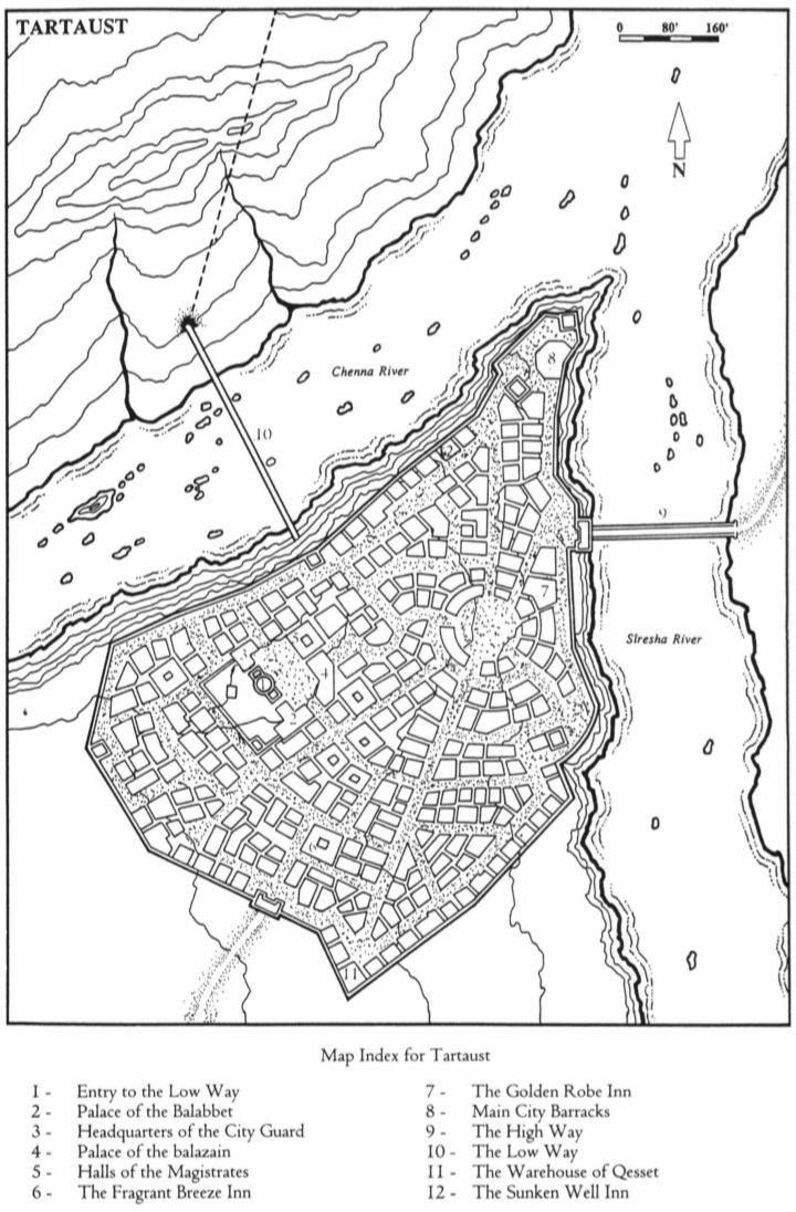
- tartaust

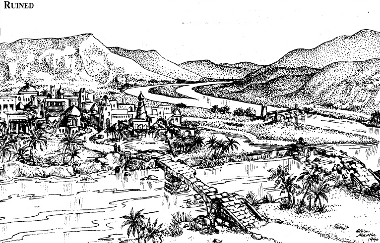
- When the Dwarves of Citadel City arrived, Tartaust was a crumbling ghost town at the feet of the Dragon-headed Mountain. The water was toxic with runoff of old lead mines, and scavenger orcs from the caves beneath sheltered in the ruins. It has been cleaned up and rebuilt considerably to new design, though here and there an old pillar or carved portico was worth saving. Now large Sky Locks extend above the city, awaiting boat traffic that has sailed around the imposing modern fortifications. The water is clean, and food grown on the other side where the soil is also clean is widely traded. A visitors' hostel serves local wine and ale.
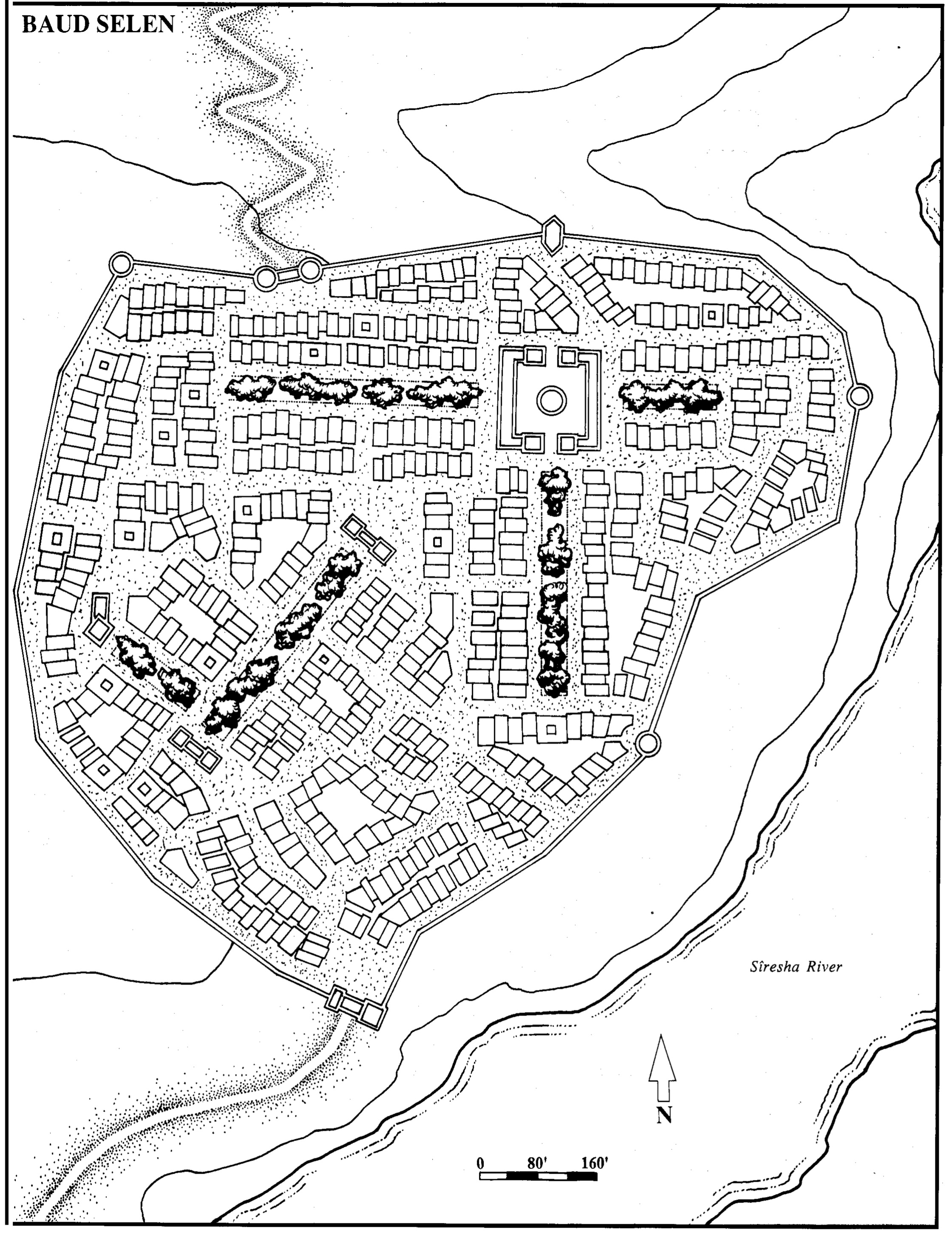
- Baud Selen
- Erim Poa

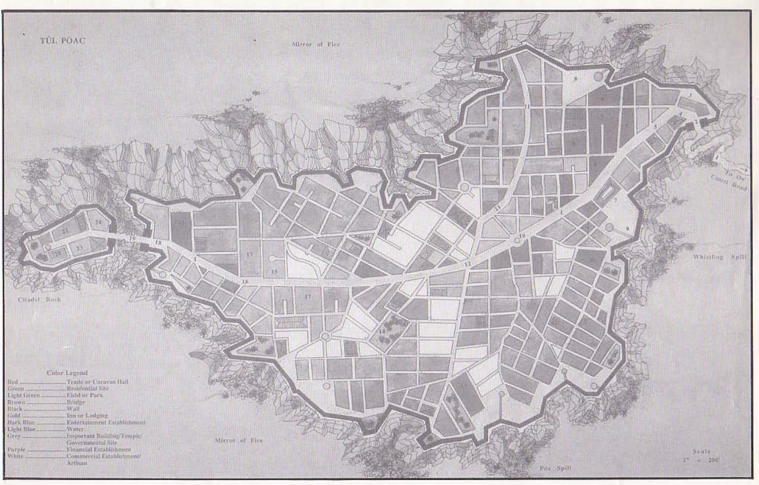
- tul poac
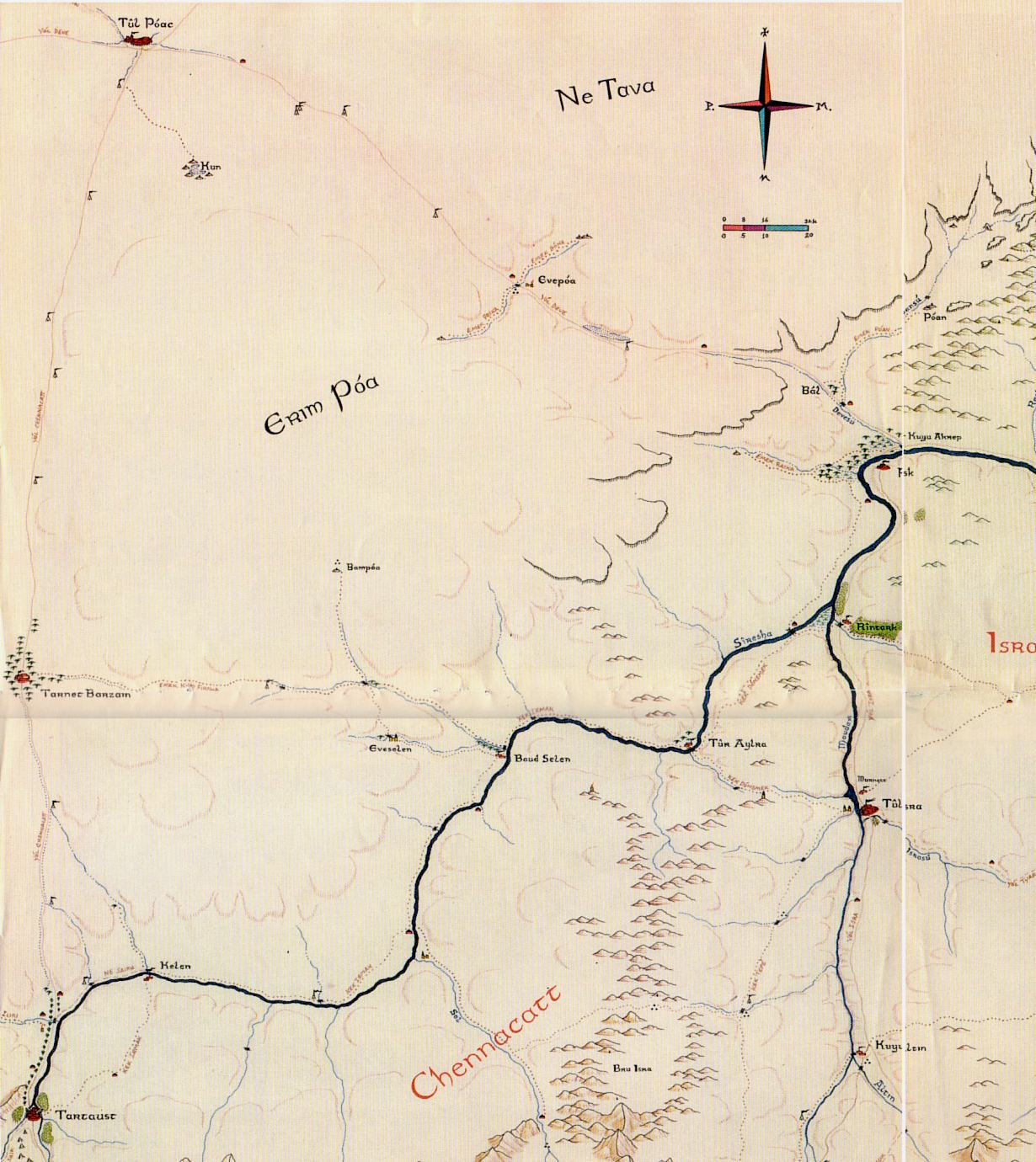
- Ne Tava
- Sará Rask

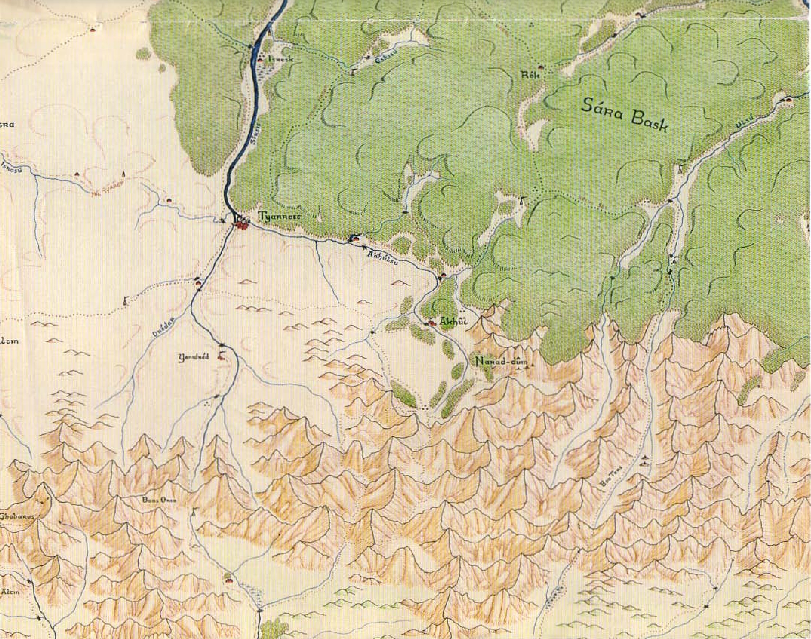
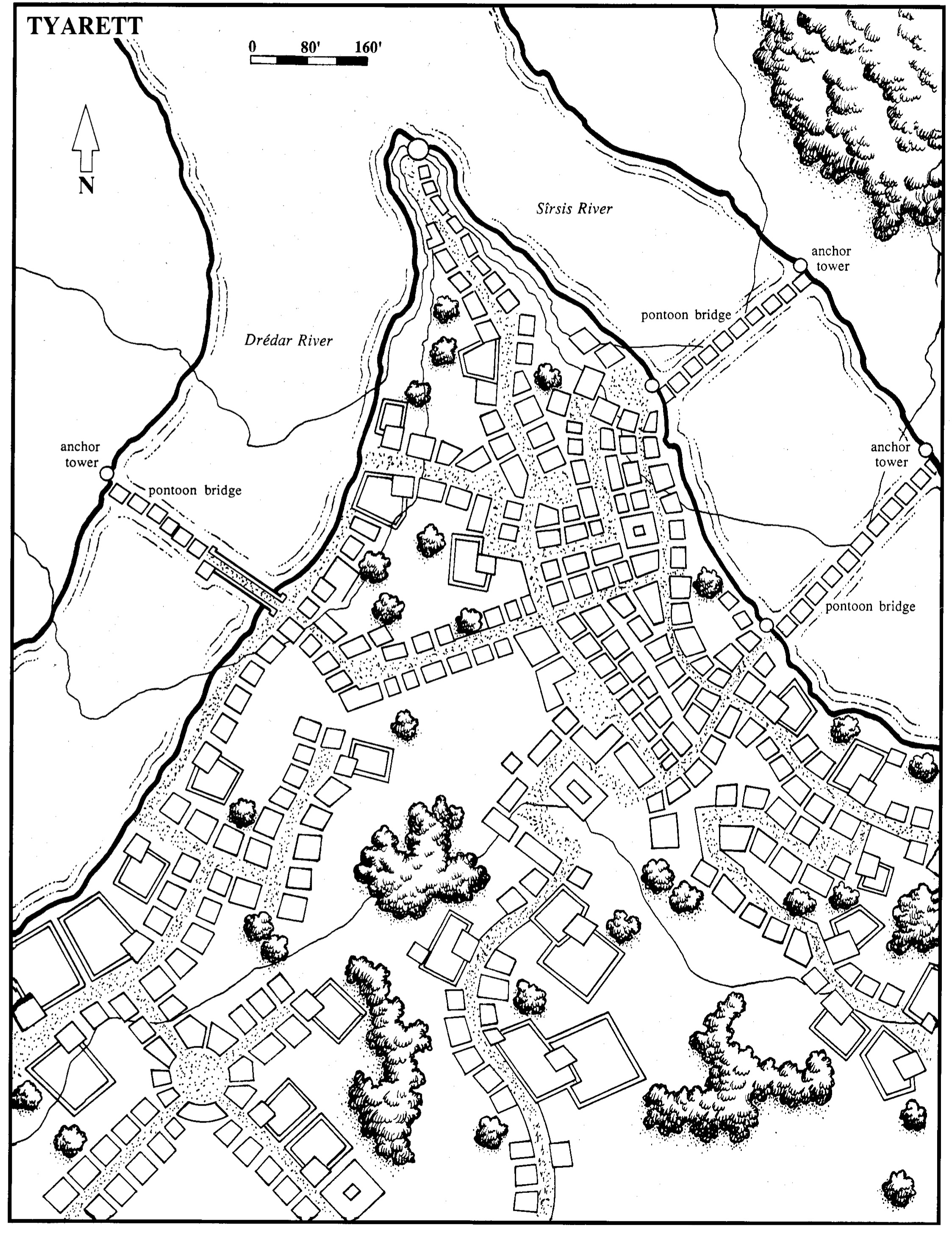
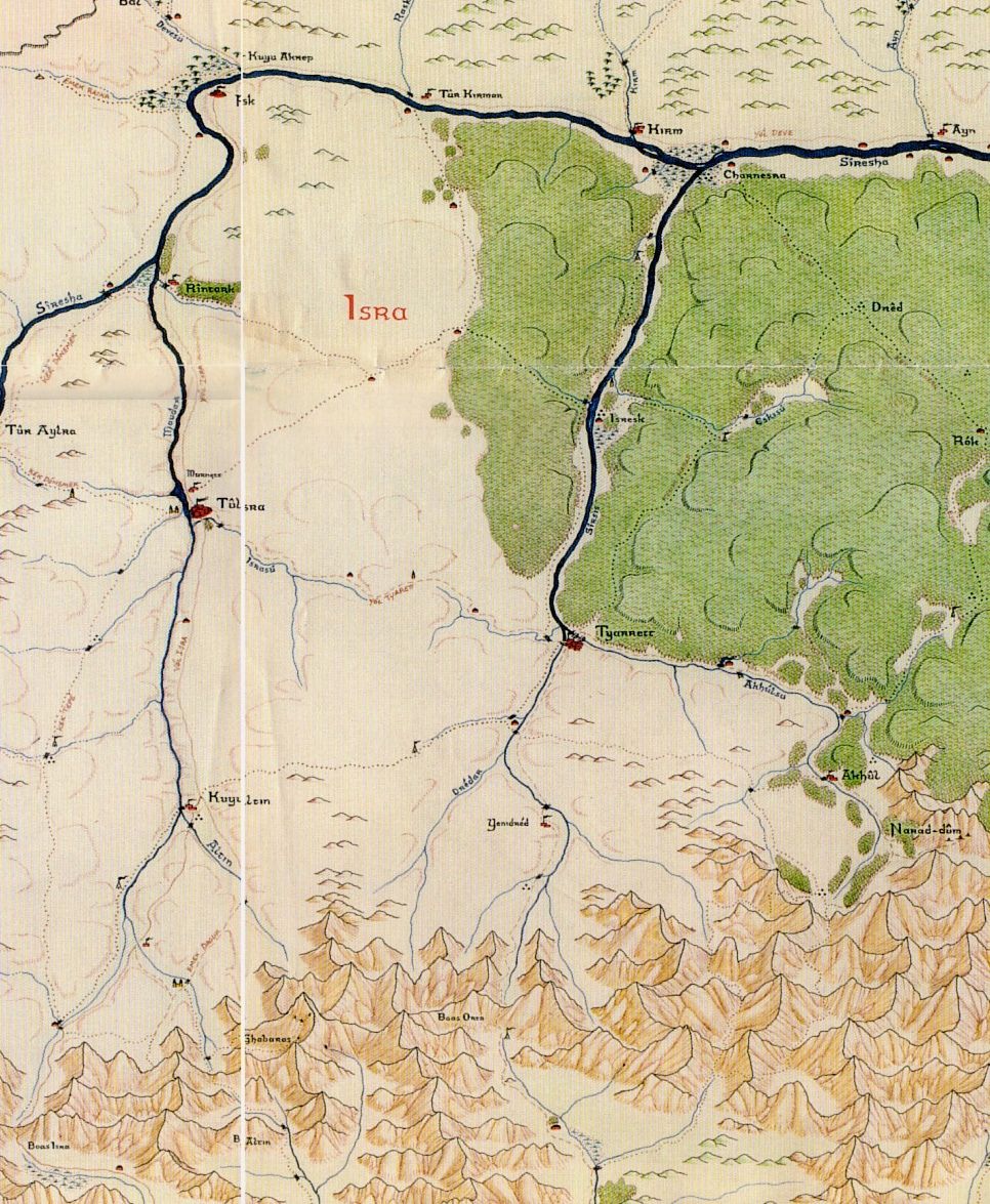
- Tyarett
- Isra

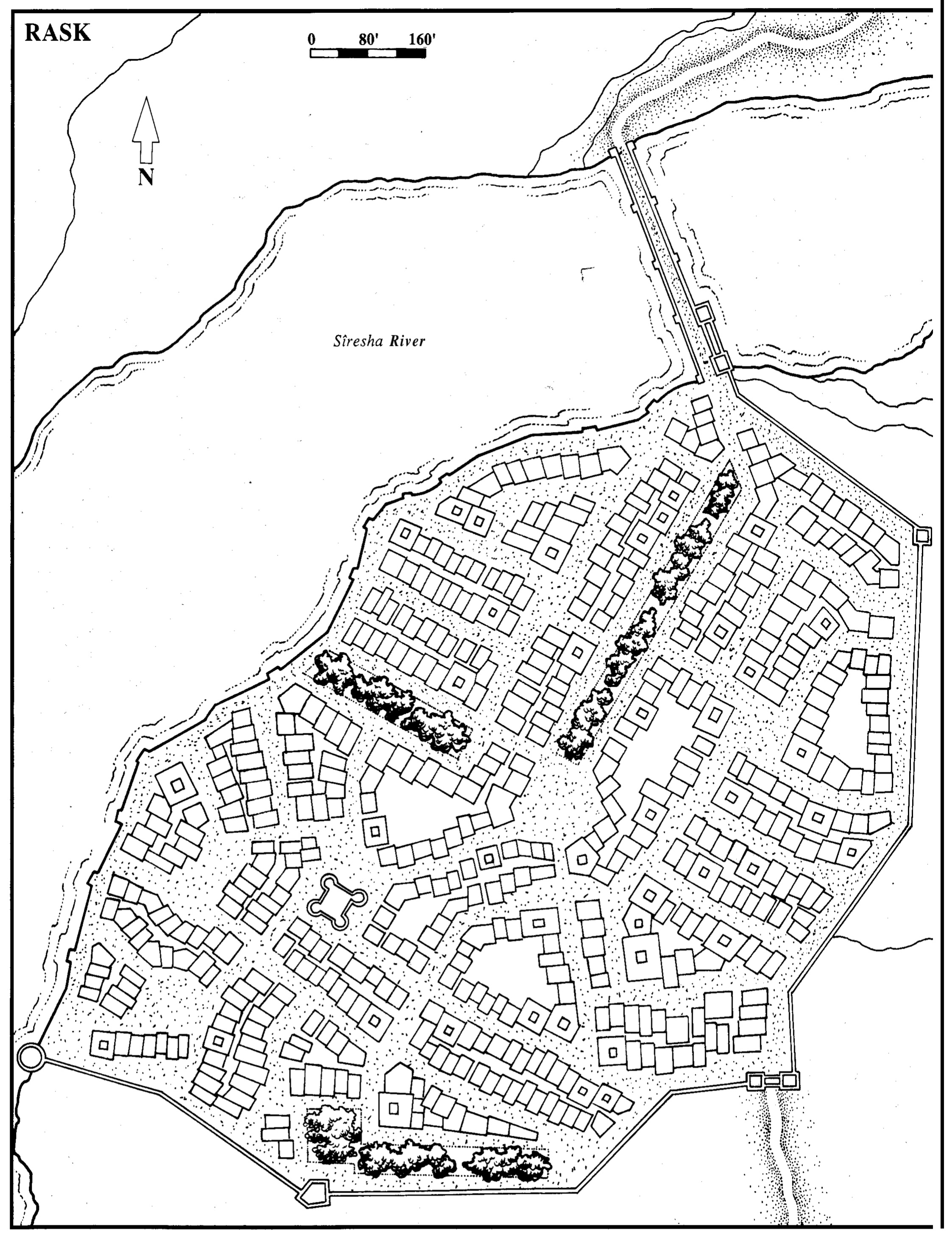
- Rask
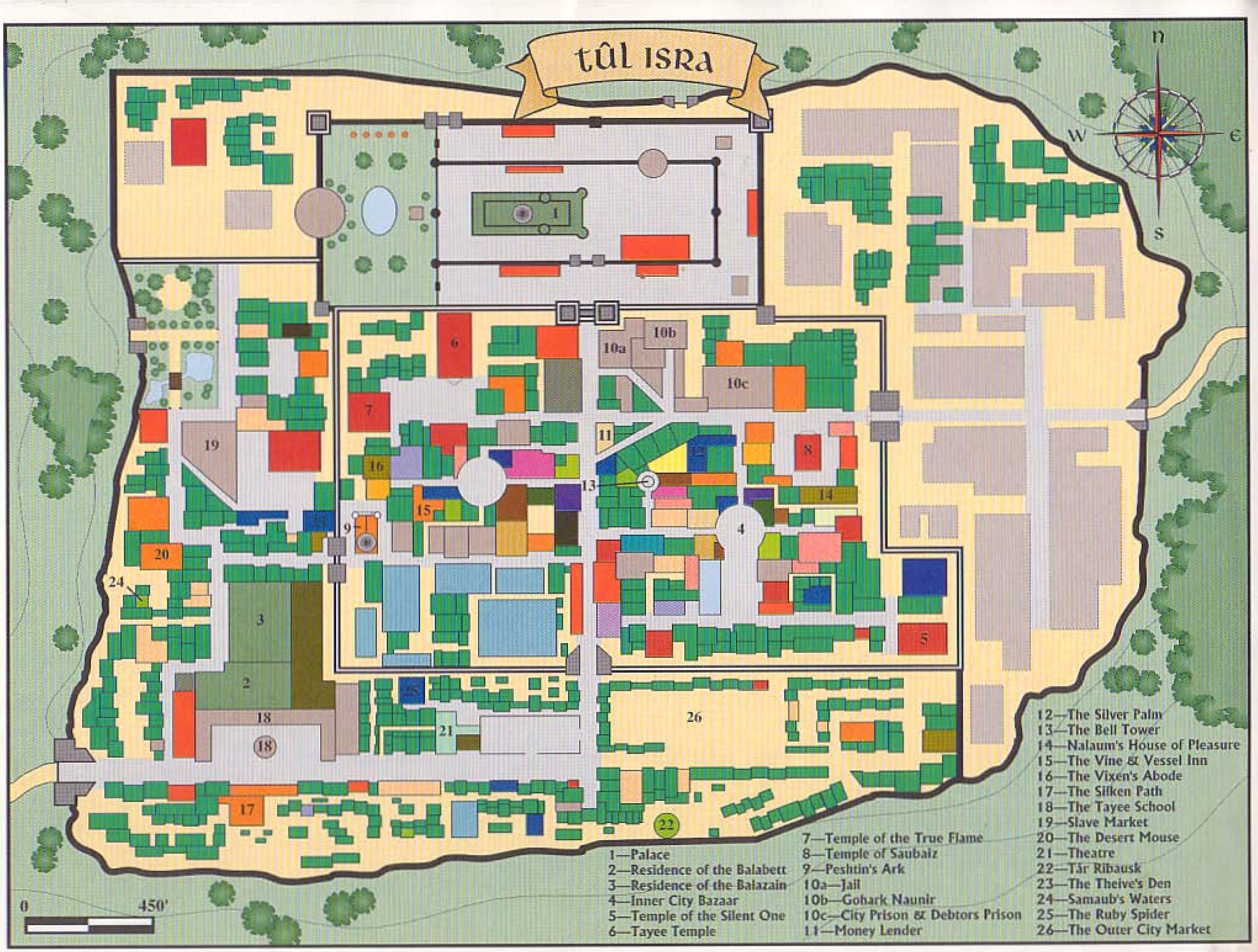
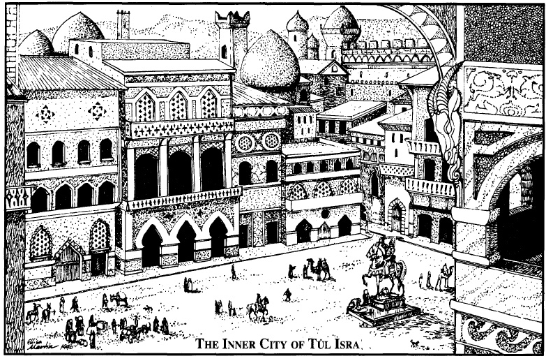
- tul isra
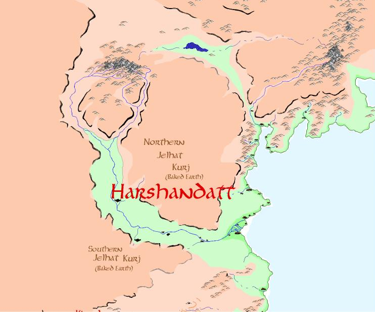
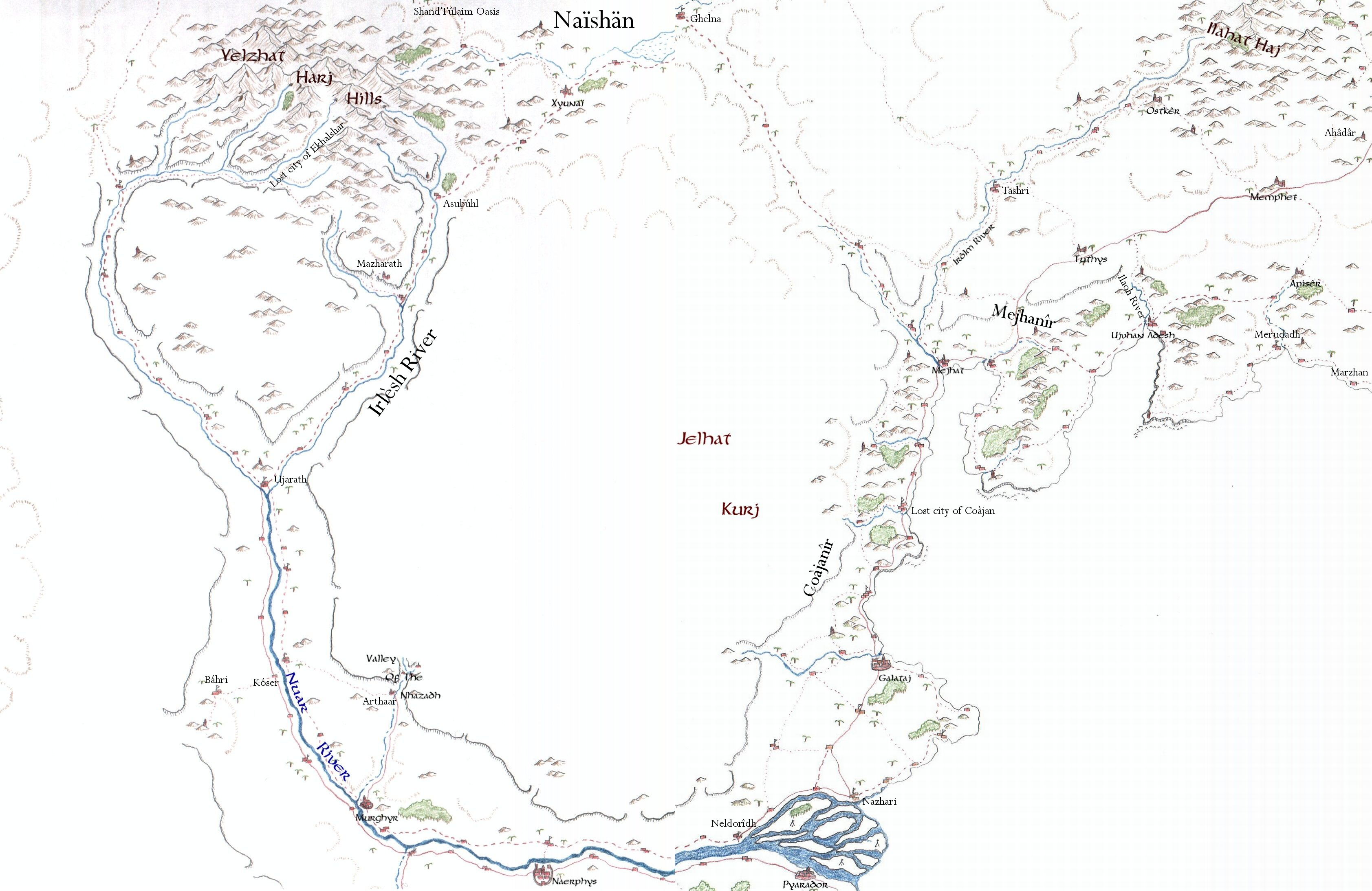
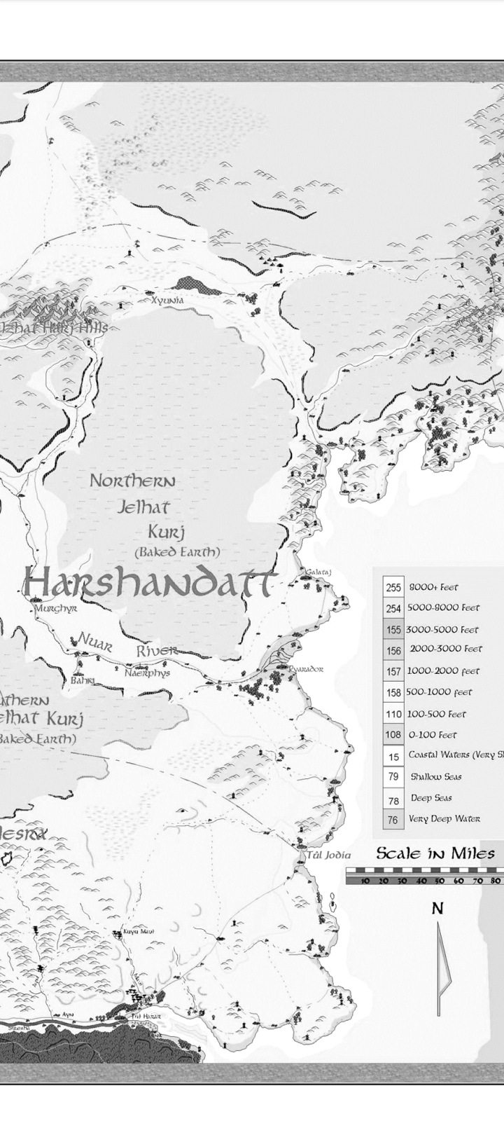
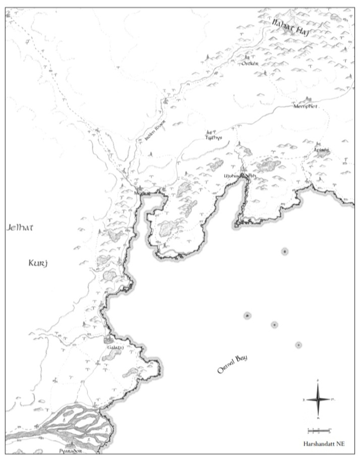
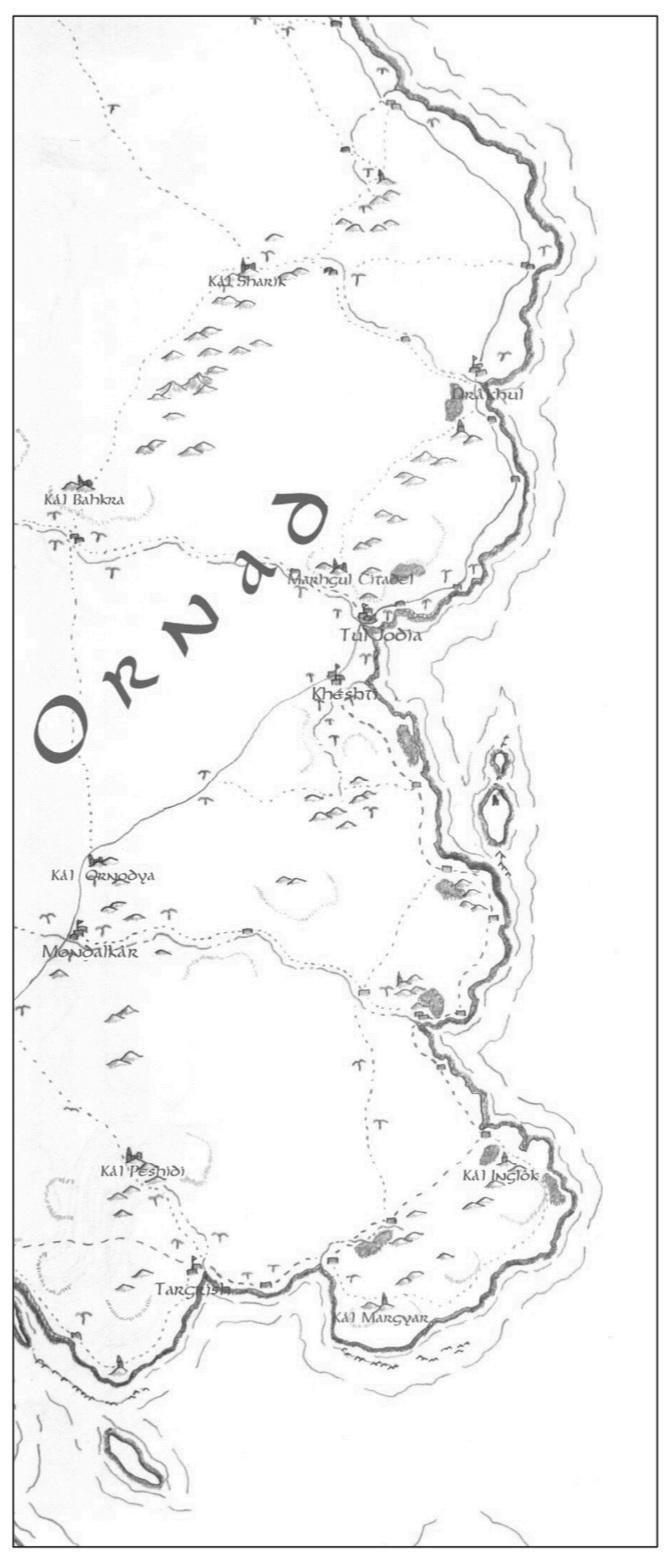
Harshandatt


- Cities
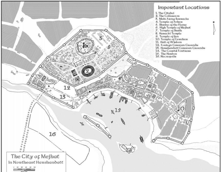
- Mejhat
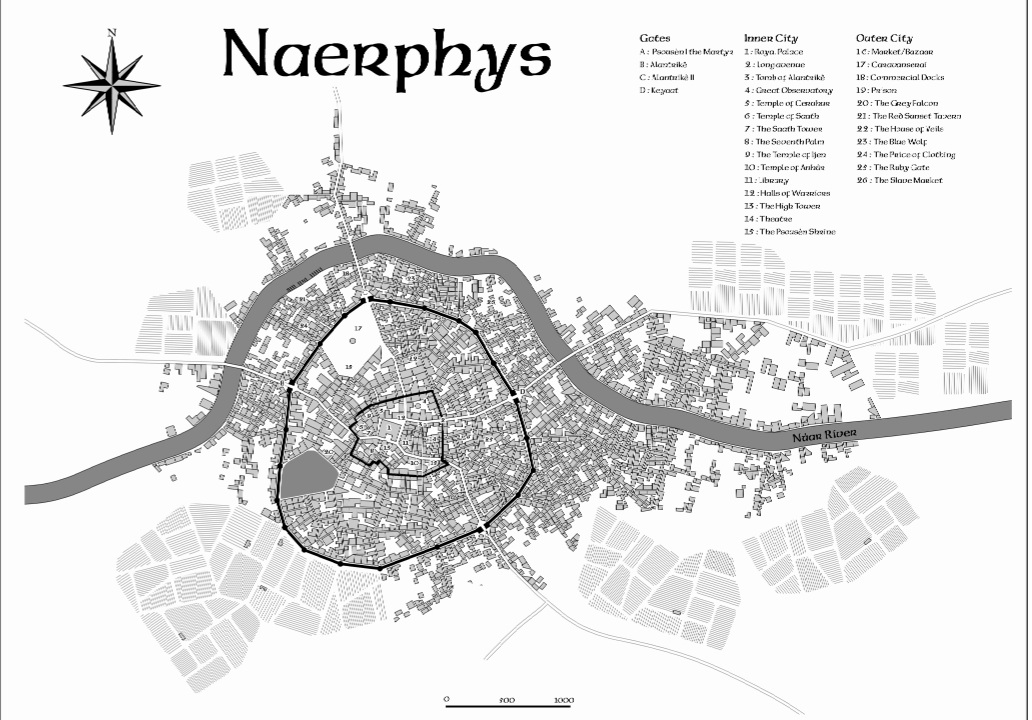
- Naerphys
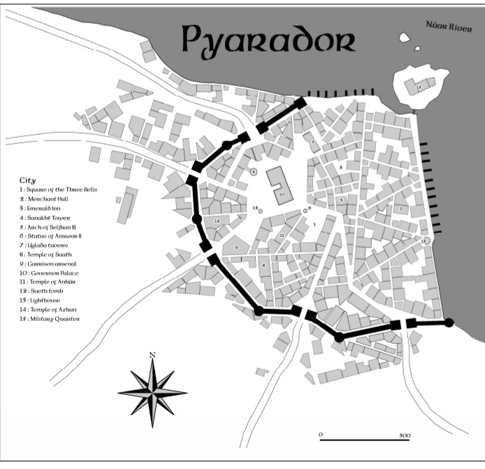
- Pyrador
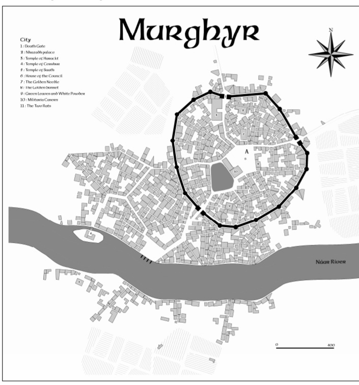
- Murghyr
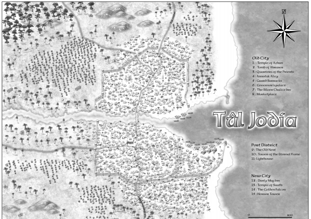
- Tûl Jodia
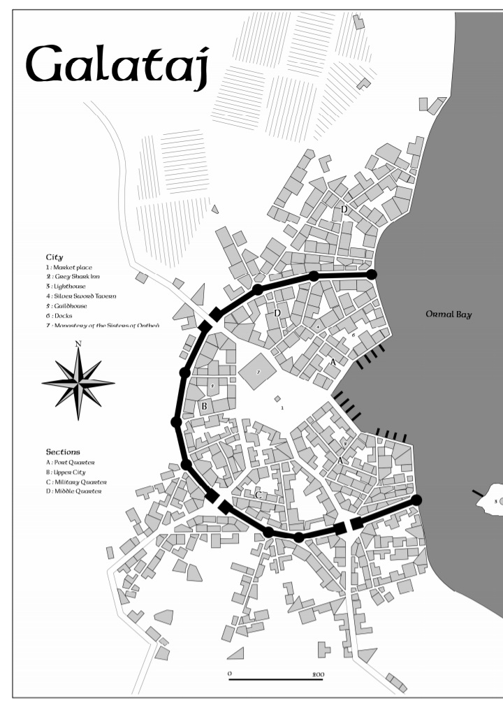
- Galataj
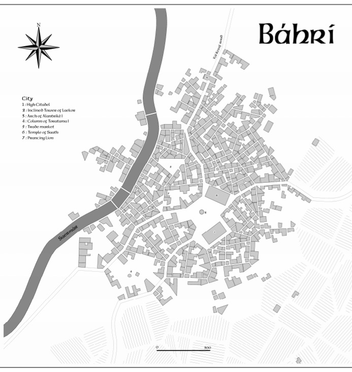
- Bahri
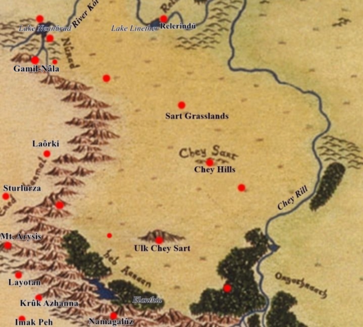
Chyan Empire


- Cities
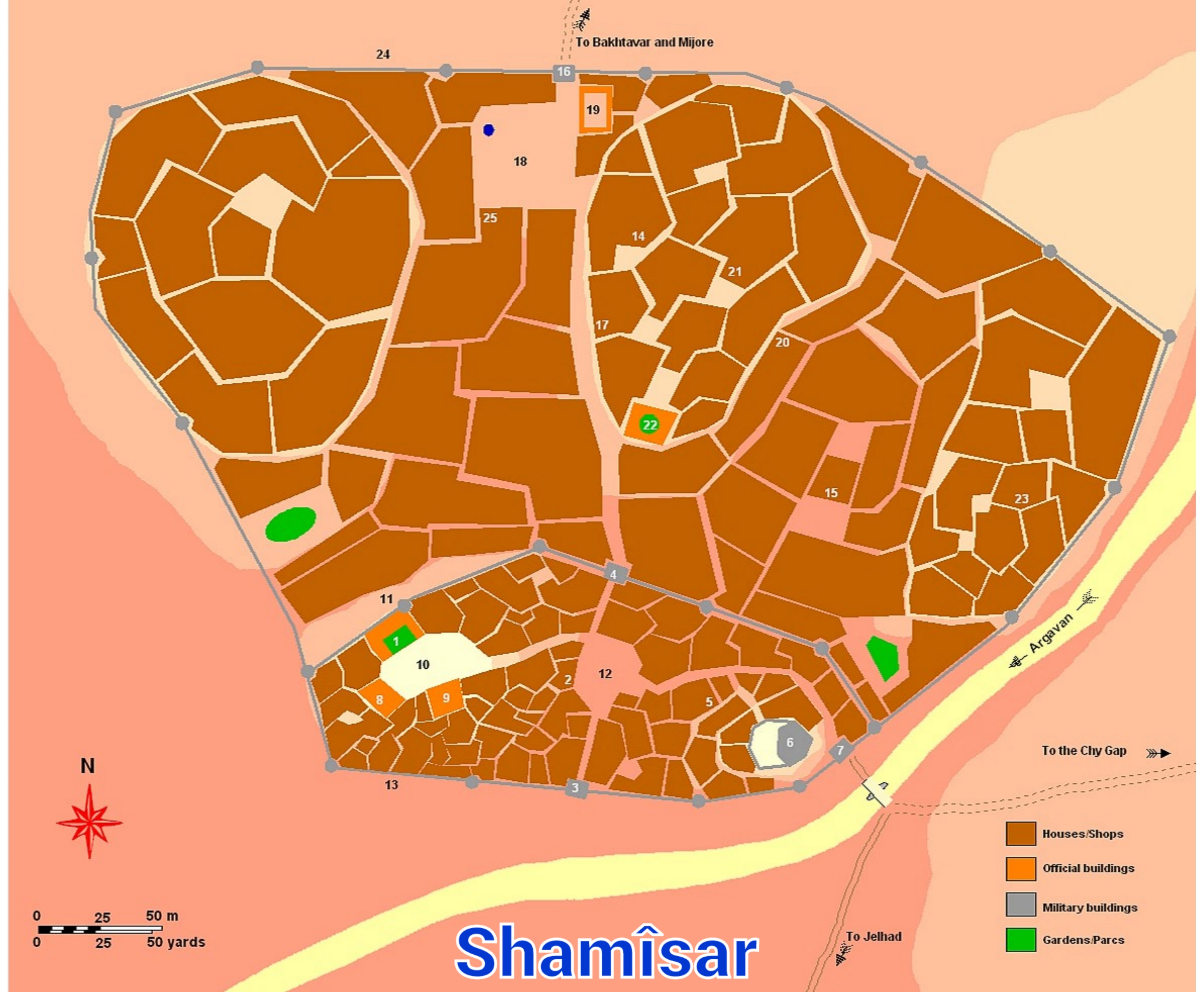
- shamîsar
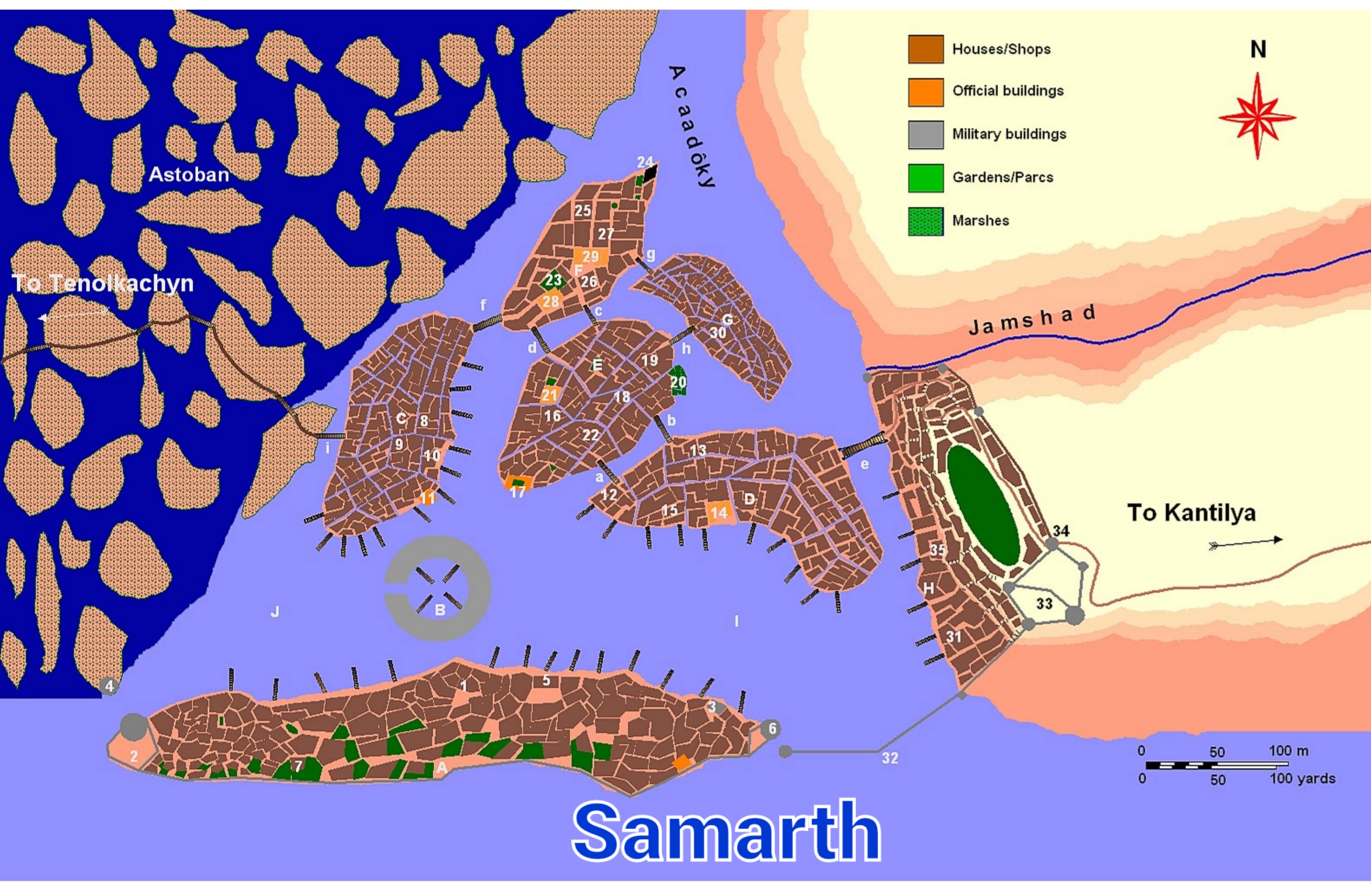
- samarth
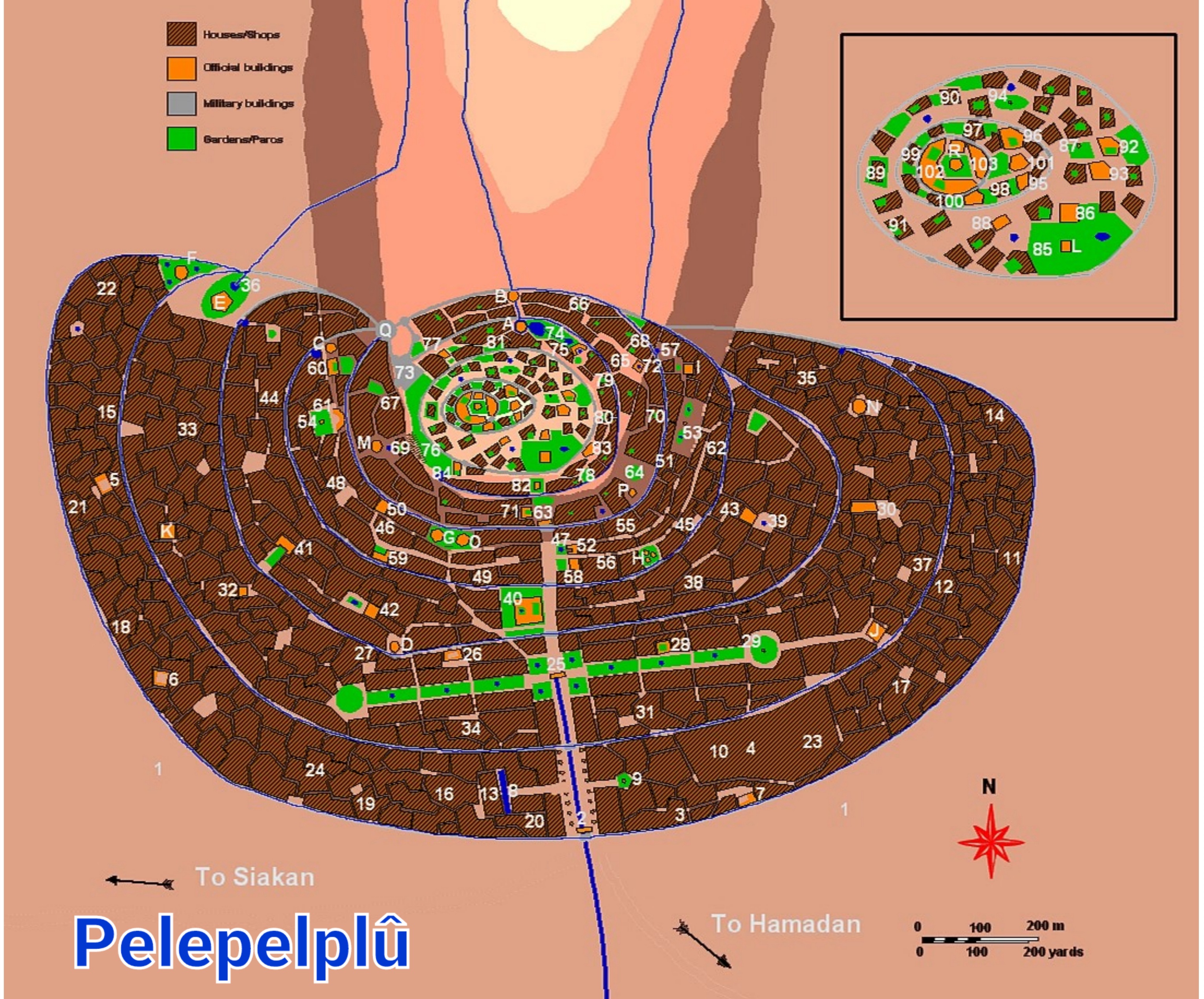
- pelepelplû
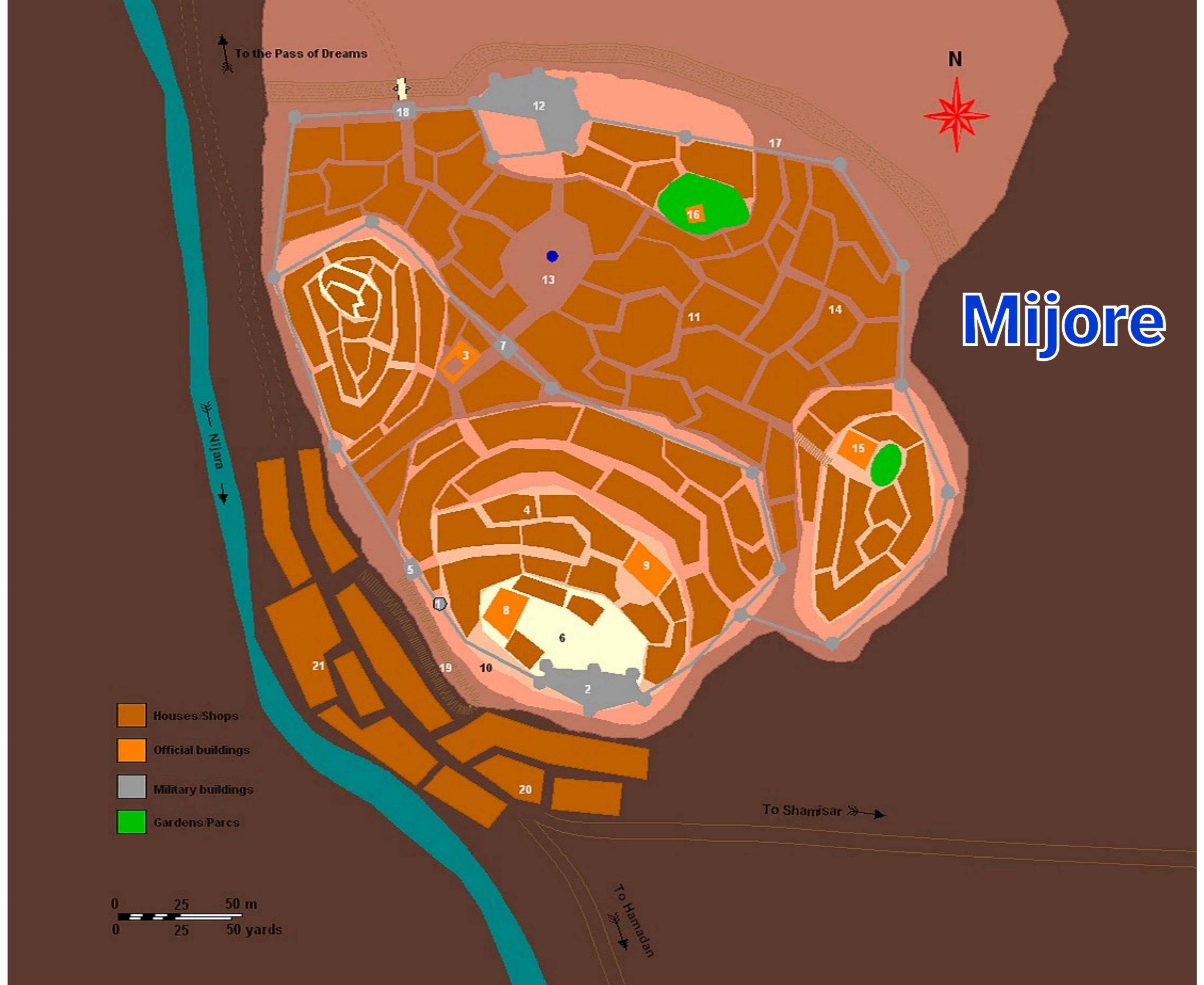
- mijore
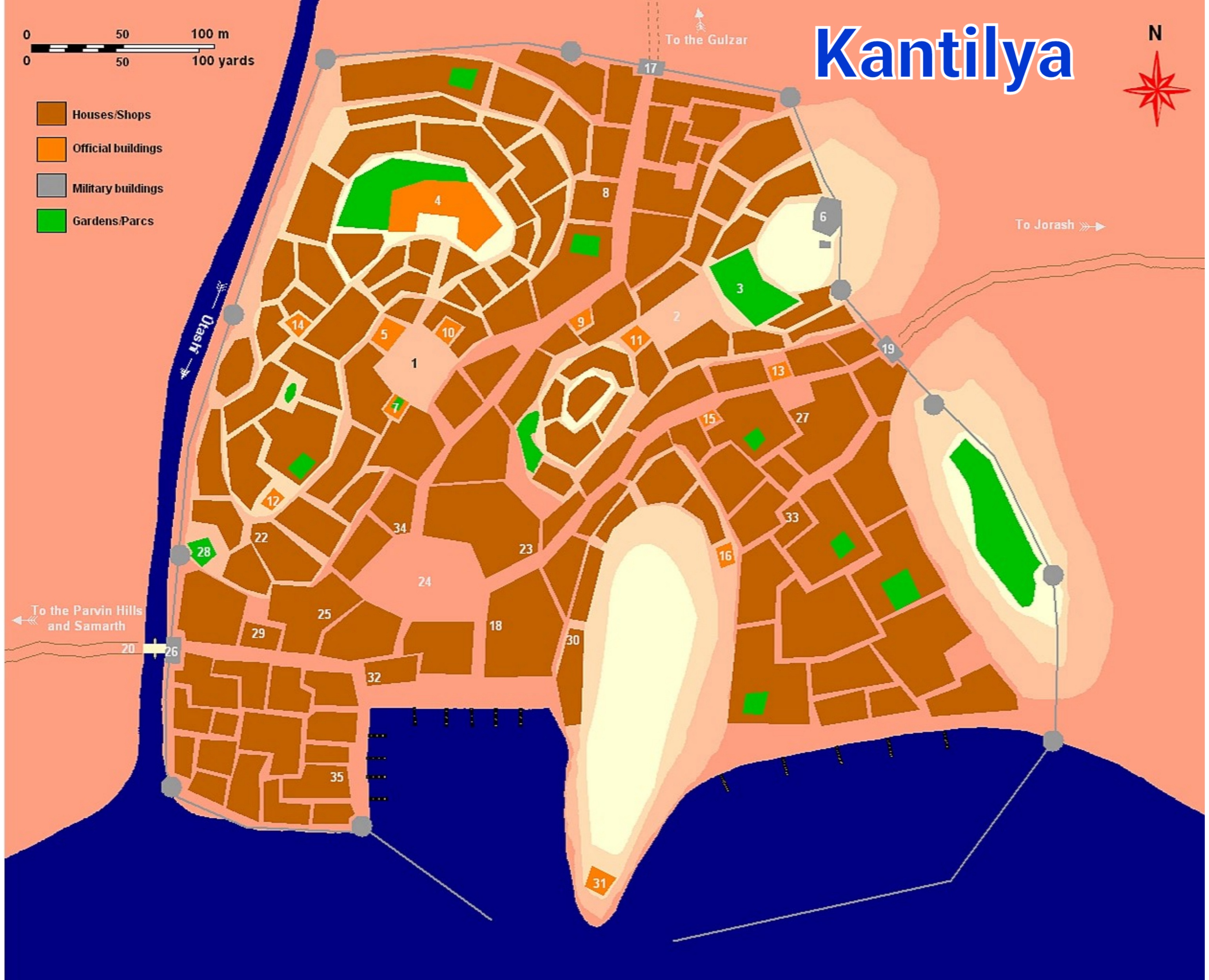
- kantilya
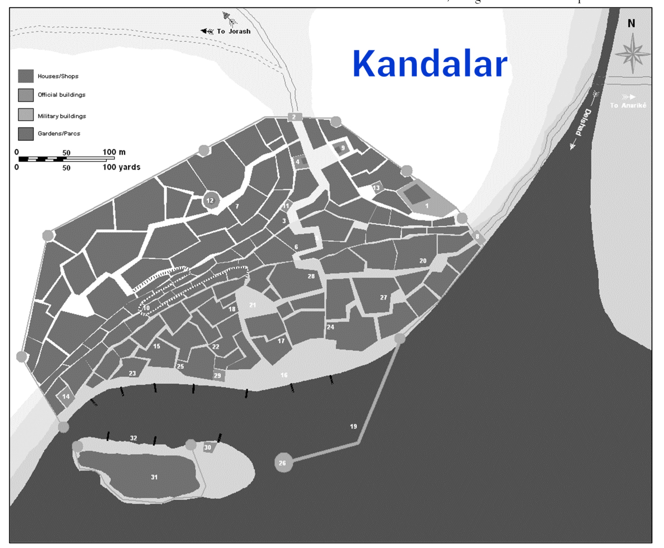
- kandalar
- jorash
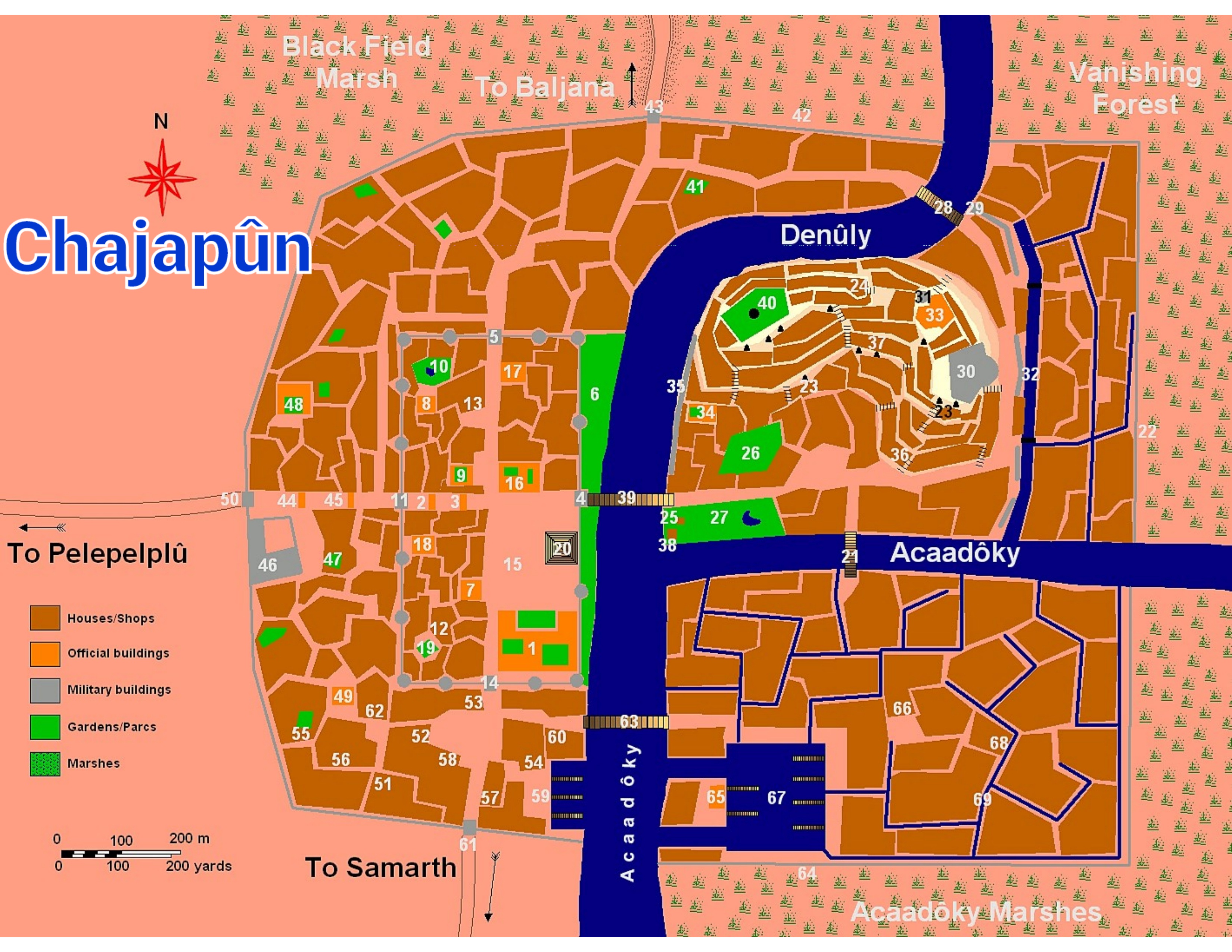
- chajapûn
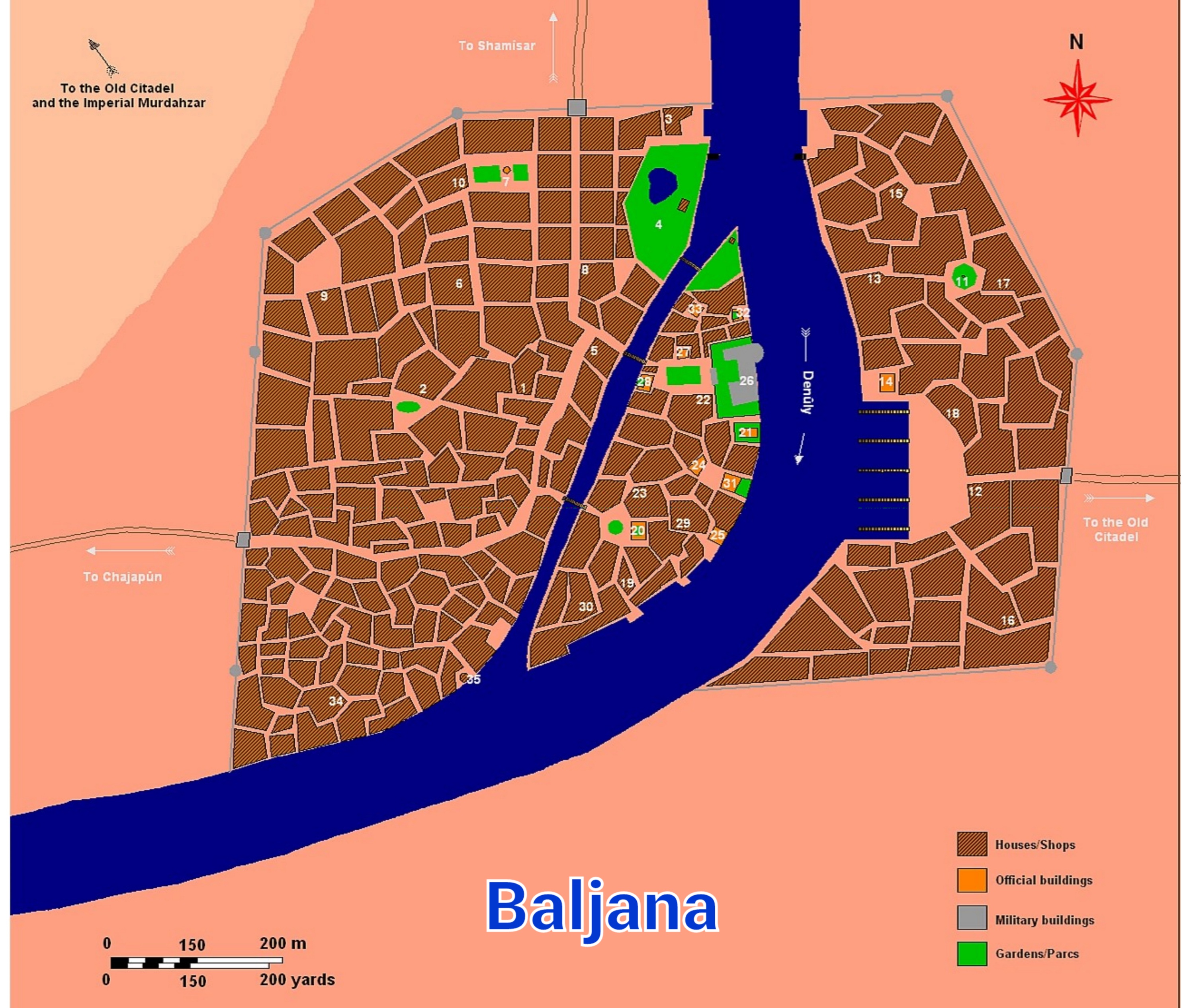
- bal jana

Anbalukkhor
- Zajuntak
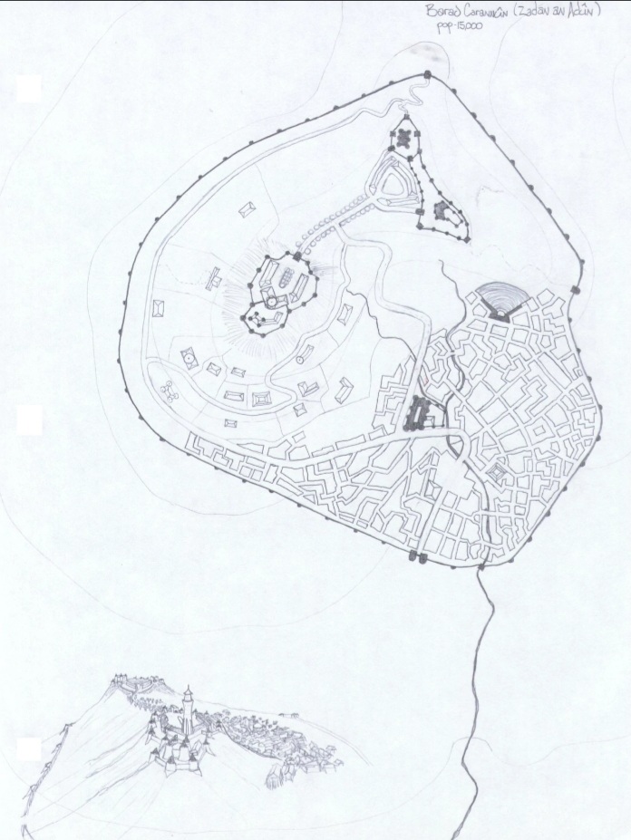
- zadan-an-adun Map: Q12 - Rebuilt by Paurgiliath Peacekeepers as Outpost PK#7 in alliance with local tribes. Some rather nasty cannibals ruled the area from the ruins, and the rest of the peoples in the area were delighted to be out from under their yoke. They begged the Peacekeepers to stay, and work with them as local support and auxilliaries. The rebuilding is a mix of original styles adapted to sound defensive practice from Free Imperial standards, and commands the river nicely.


- Norpûl Estuary

- Kadar An Kharadûn
- The modern fortress on this site is IN#40, guarding a harbor and the mouth of the Norpul River. Whatever the Nûmenoreans had once built here, the ruins are no longer evident. The local jungle tribesmen are strongly pro-Empire, welcoming the protection of the Free Imperia Navy from the more warlike city states of Tulwang.

- Raishoul, ???
- Ashatur, ???


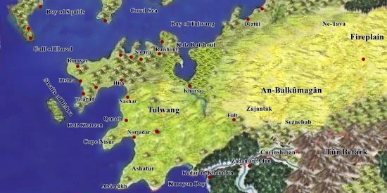
Tulwang

Sultanate of Raj
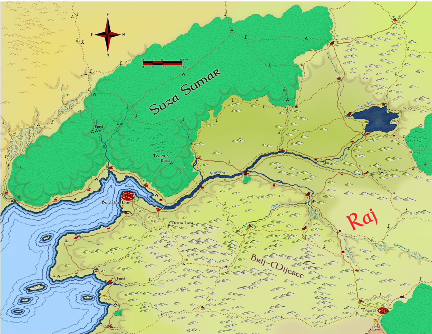
- Isfahan
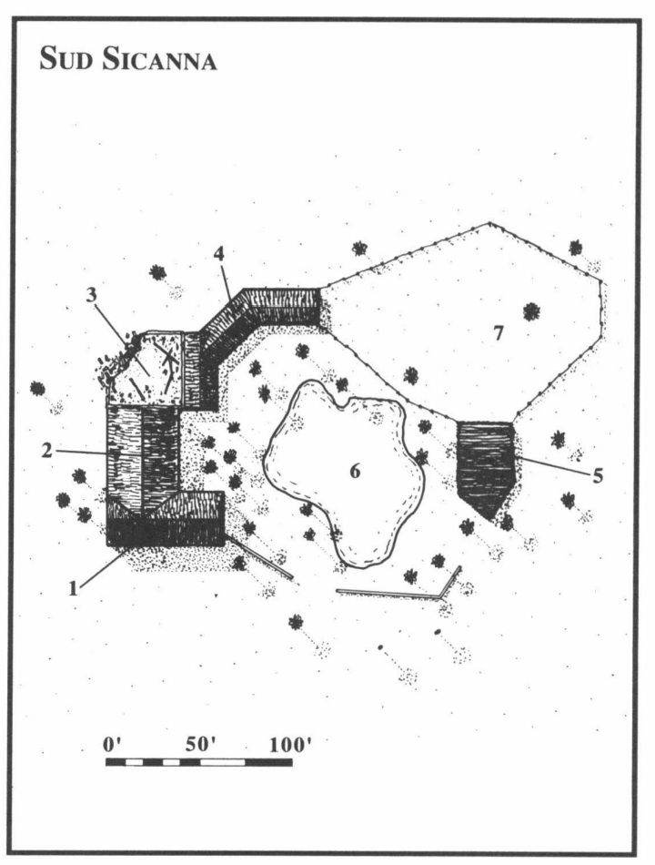
- sud sicanna Map: N13
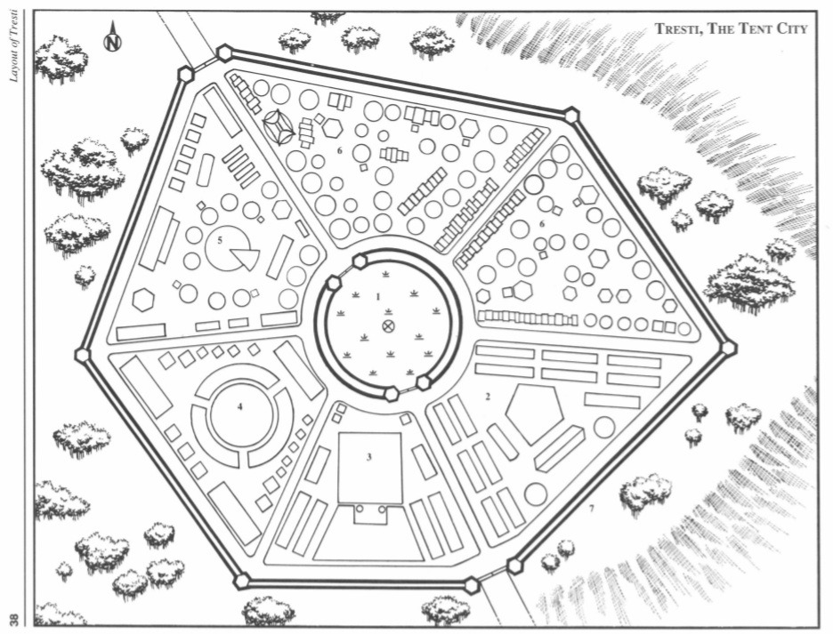
- Tresti
- tresti? Map: O13
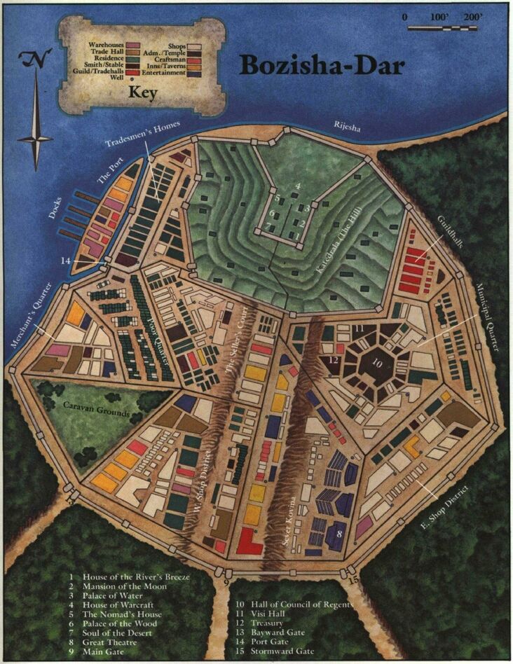
- Bozisha Miraz
- bozisha dar Map: O12
Bellakar
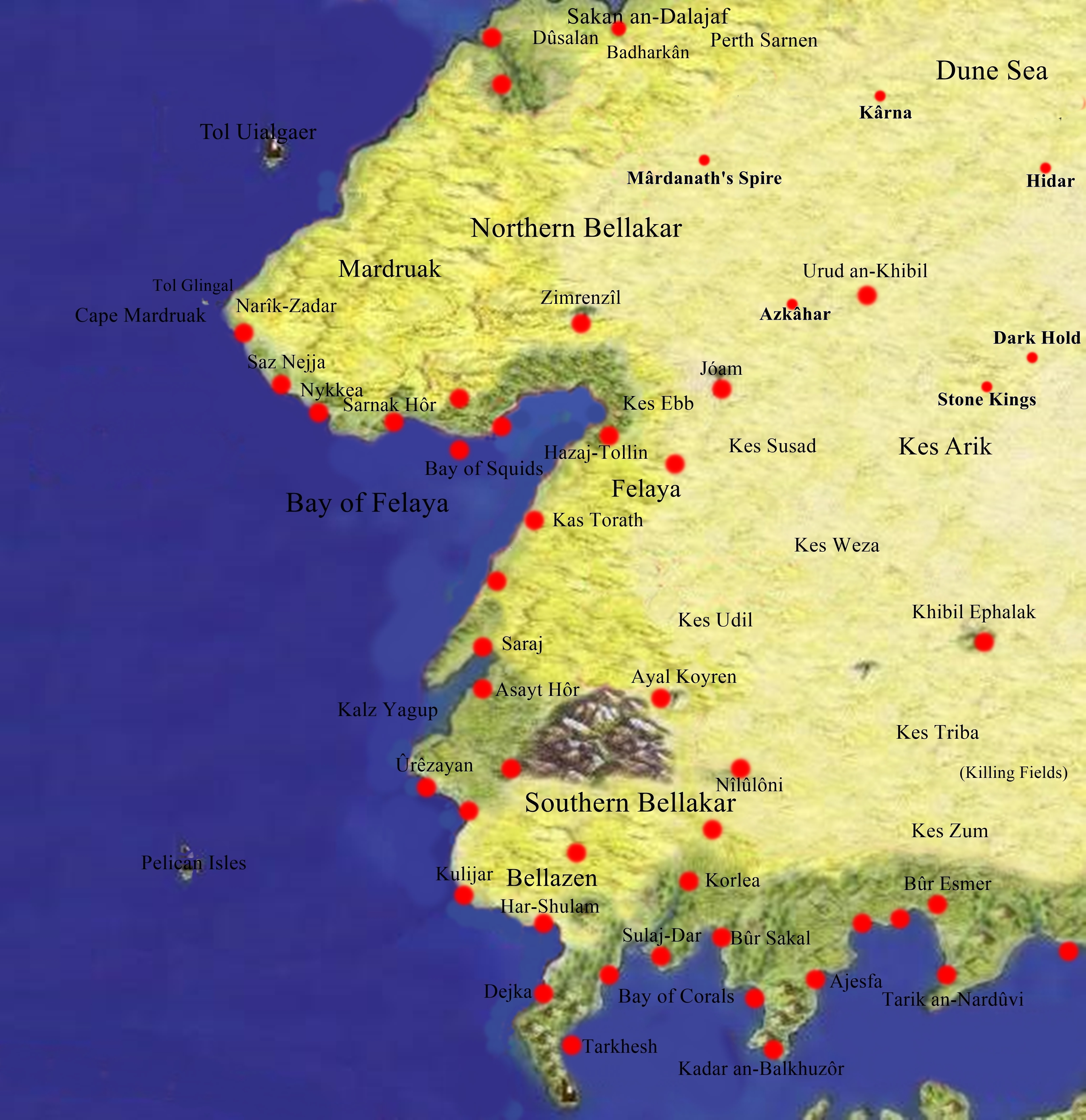
- Southern Bellakar
- nîlûlônde Map: O10
- bûr esmer Map: O11
- korlea Map: O11
- Bellazen
- ûrêzayen Map: O10
- Felaya
- hazaj tollen Map: M10
- Northern Bellakar
- zimrenzil Map: M10
- Mardruak
- nykkea Map: M9
- Sakal-An-Dalajaf
- dûsalan Map: M9
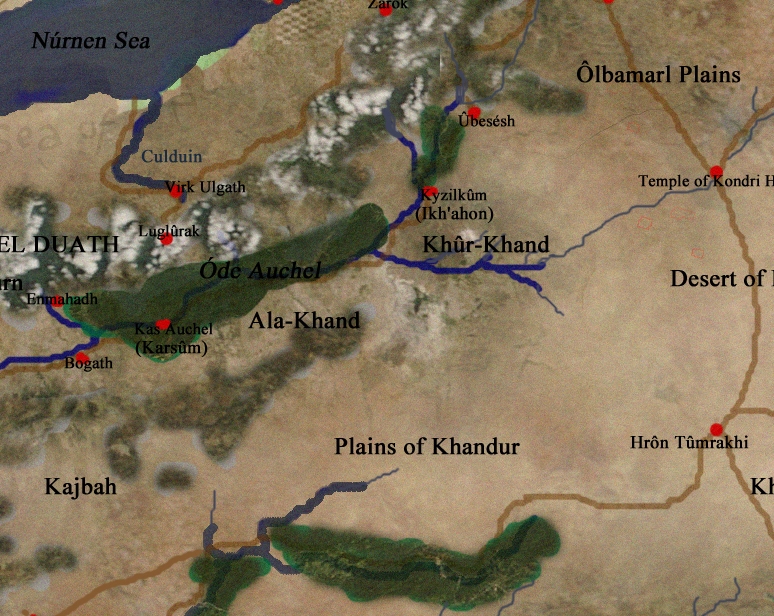
Khand

- Saikan
- ankruz
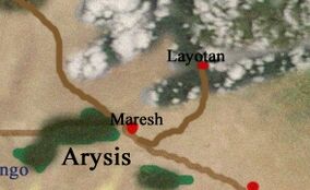
- Arysis
- maresh

- Nurad
- Nennûrhad Map: I17
- Greater Khand
- ammu khand Map: J17
- Lower Khand
- sturlurtsa khand Map: L16
- Now Sofular in Barony Tranth
- Upper Khand
- kyzilkum

- Lurmsakan
- enmahadh
- Pezarsan
- korandaj

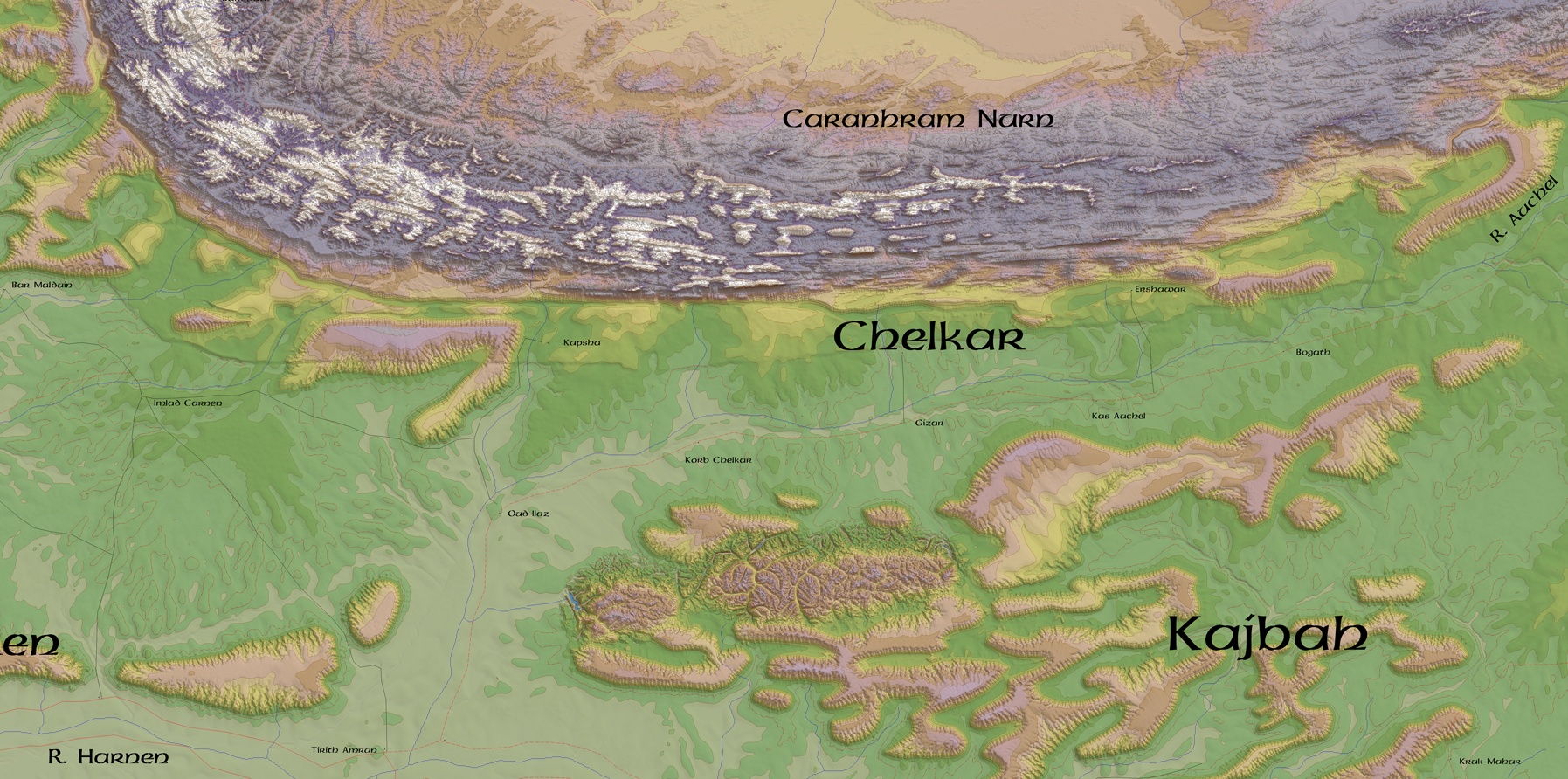
- Chelkar
- korb chelkar
- Haruzan
- amrûn / tirith amrûn Map: K13
Unknown East
PALISOR
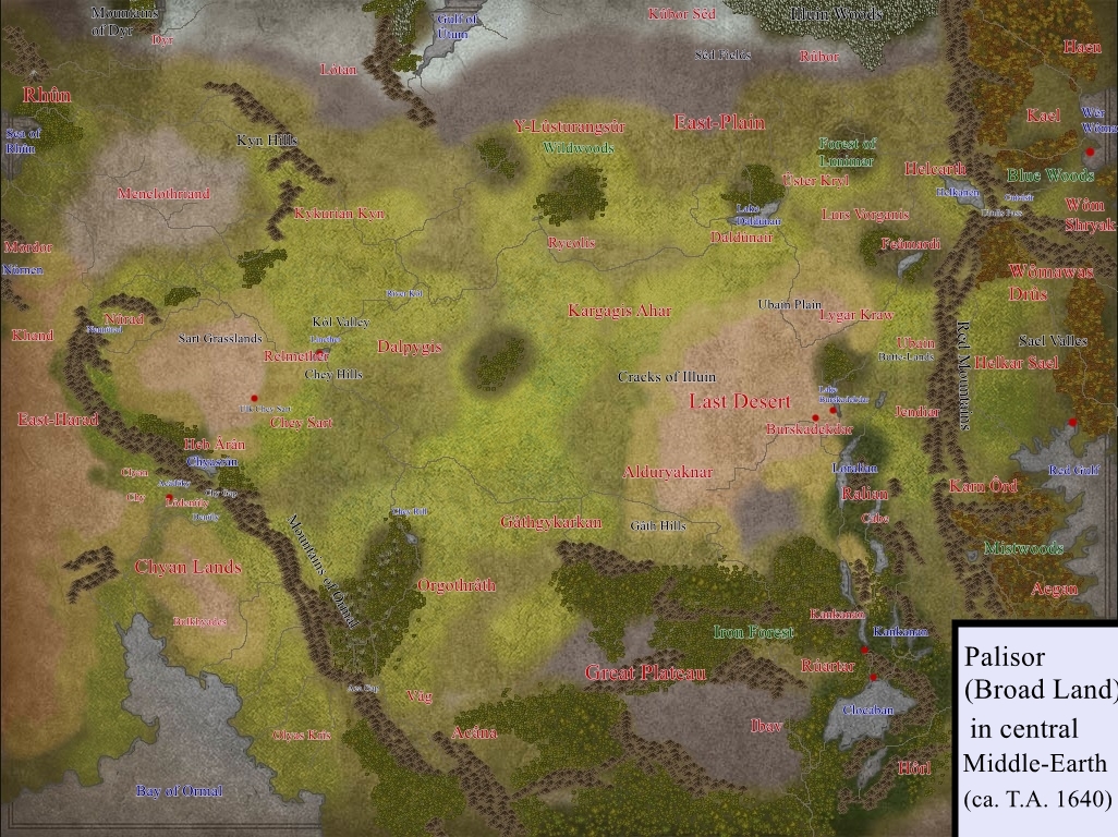
Khey Empire
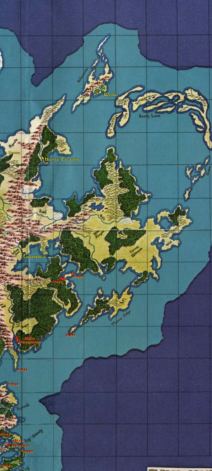
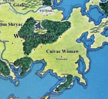
WÔMAWAS DRÛS


- Kael
- Astôs Map: G28
- Haen
- Haenac Tatawer Map: E27
- Rōlfandas
- Rôlâlk Map: C29
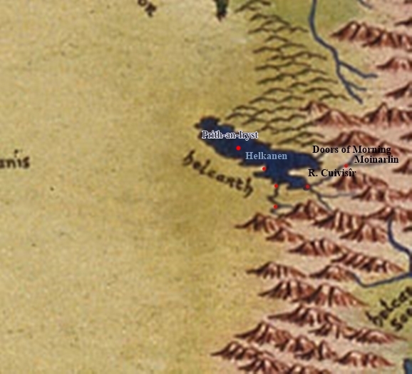
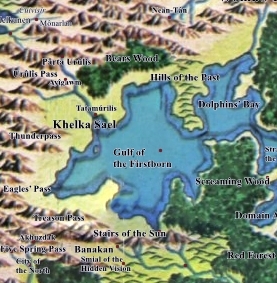
- Helcarth

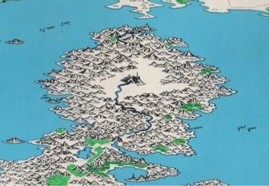
- Cuiviénen
- Doors of Morning
- Isle of Sunrises
- Huge earthen ringwall around lake area
- Church of Eru Ilùvatar Arda Heritage Historical Preservation site, fortifications being restored, large scale archeological works continue.
- Khelka Sael

- Tatamurilis Map: H27

LOCHAS DRÛS

RUURIIK
Utter South
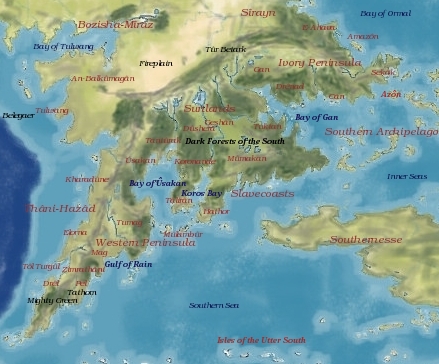
Thāni Hazād

- Elorna
- Fal Carth Map: T10
- Mag/Tumag
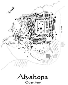
- Alyahopa Map: T12
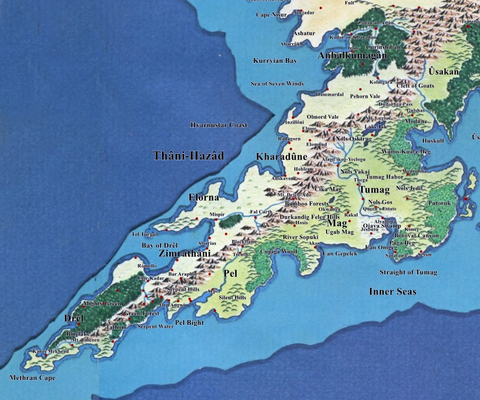

- Pel

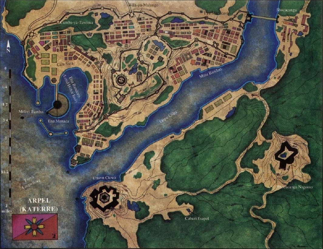
- Arpel Map: U10
- Mirëdor
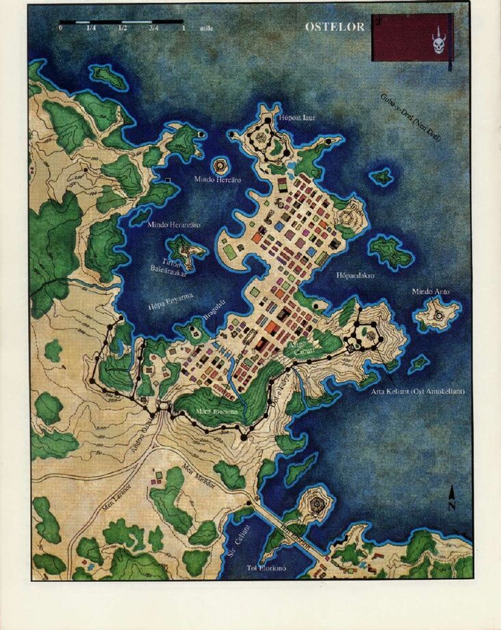
- Ostelor Map: U9
- Drel
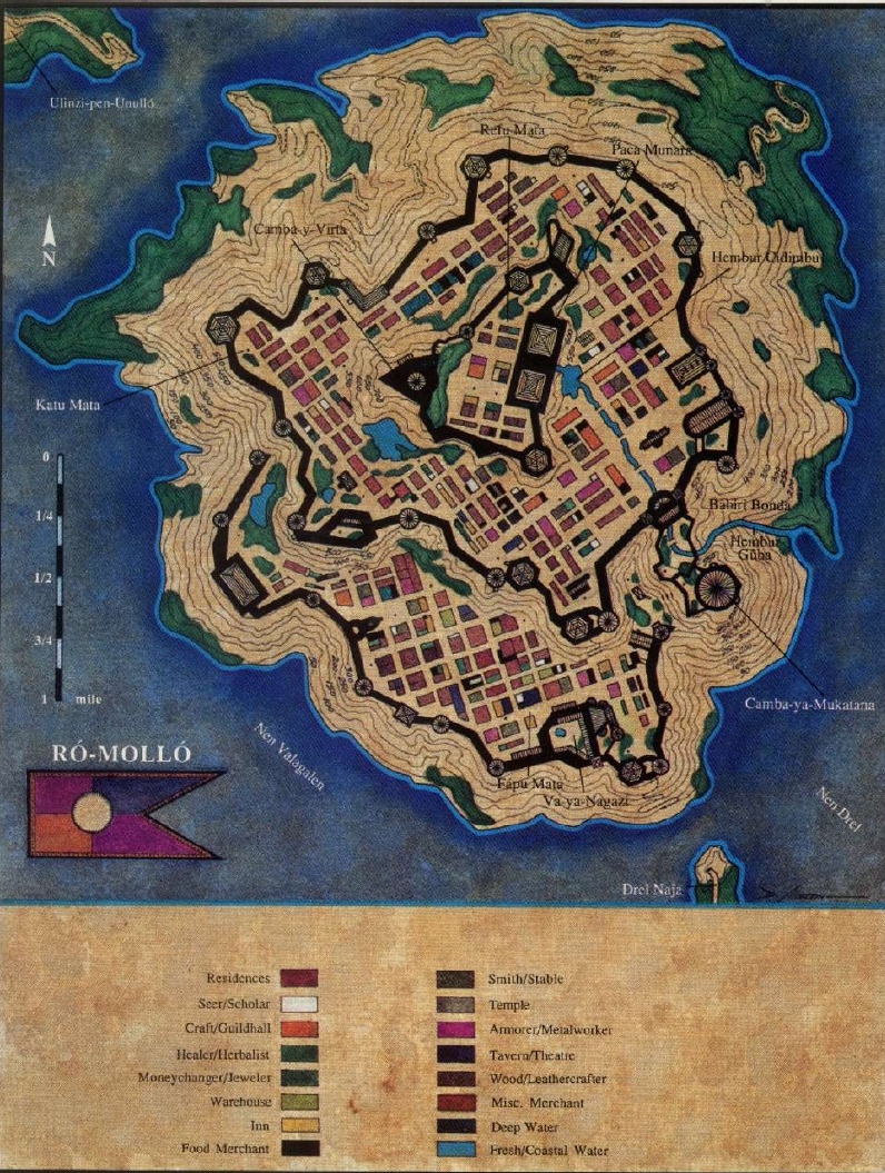
- Ro Mollo Map: T9
Farthest North
FORODWAITH
MUR FOSTISYR

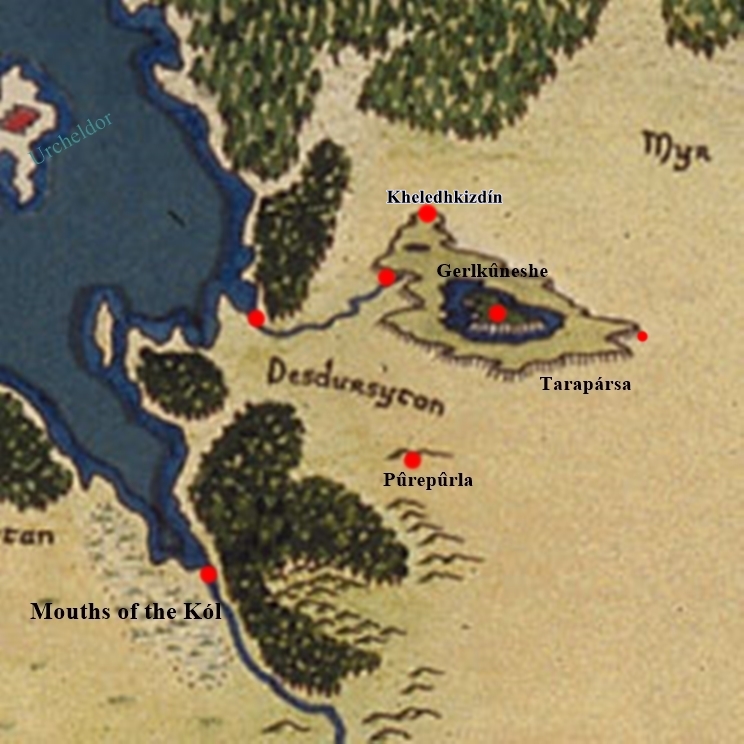
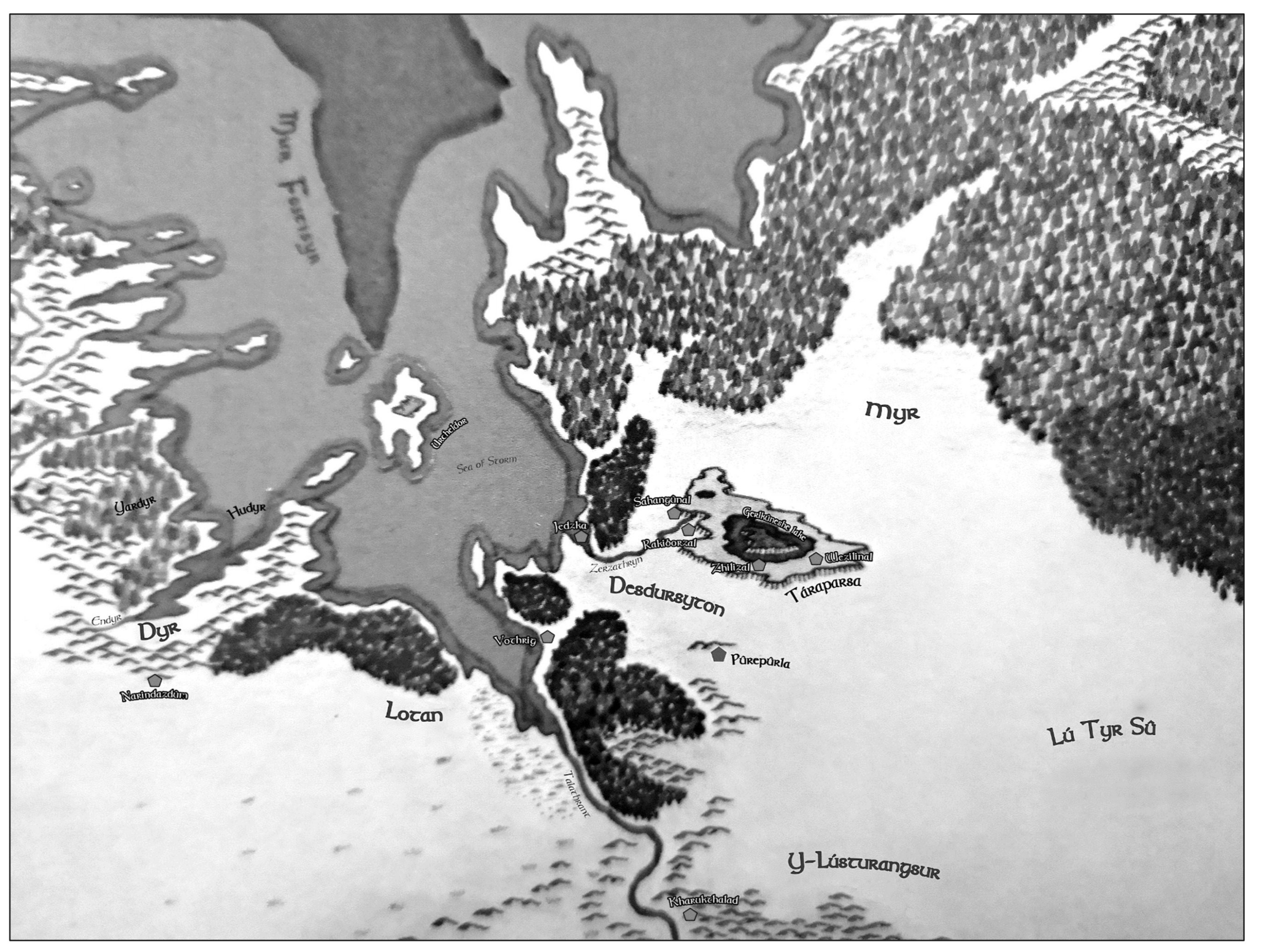
DESDÛRSYTON


- Cities
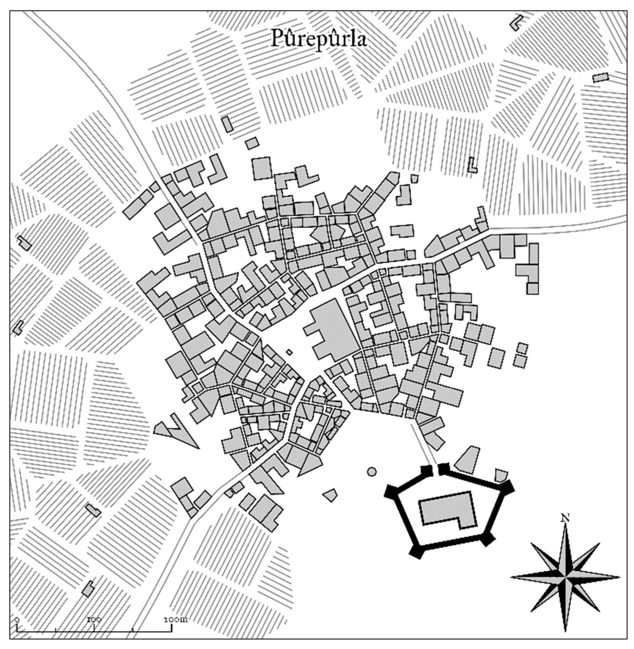
- Pûrepûrla Map: F20
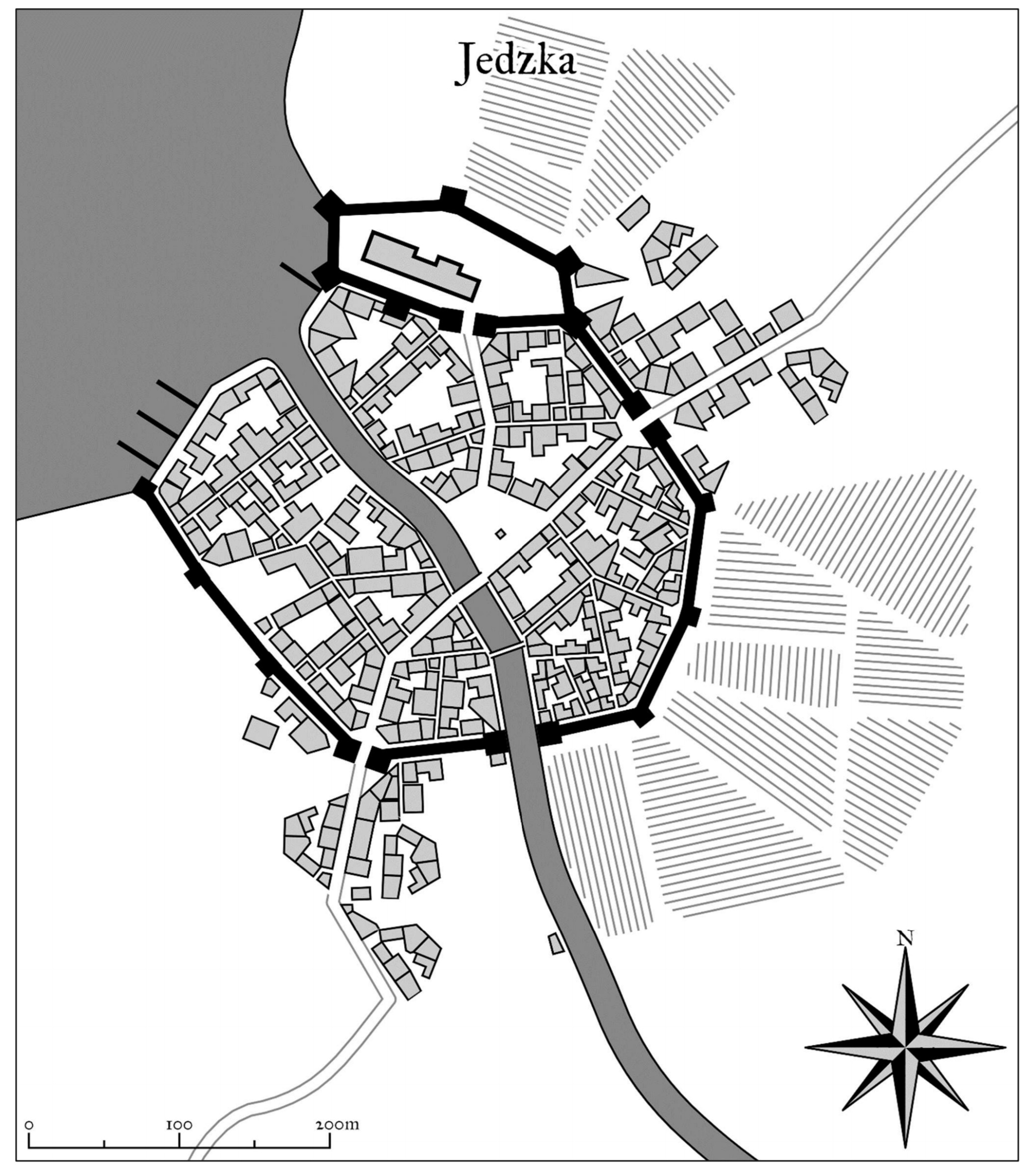
- Jedzka Map: E19
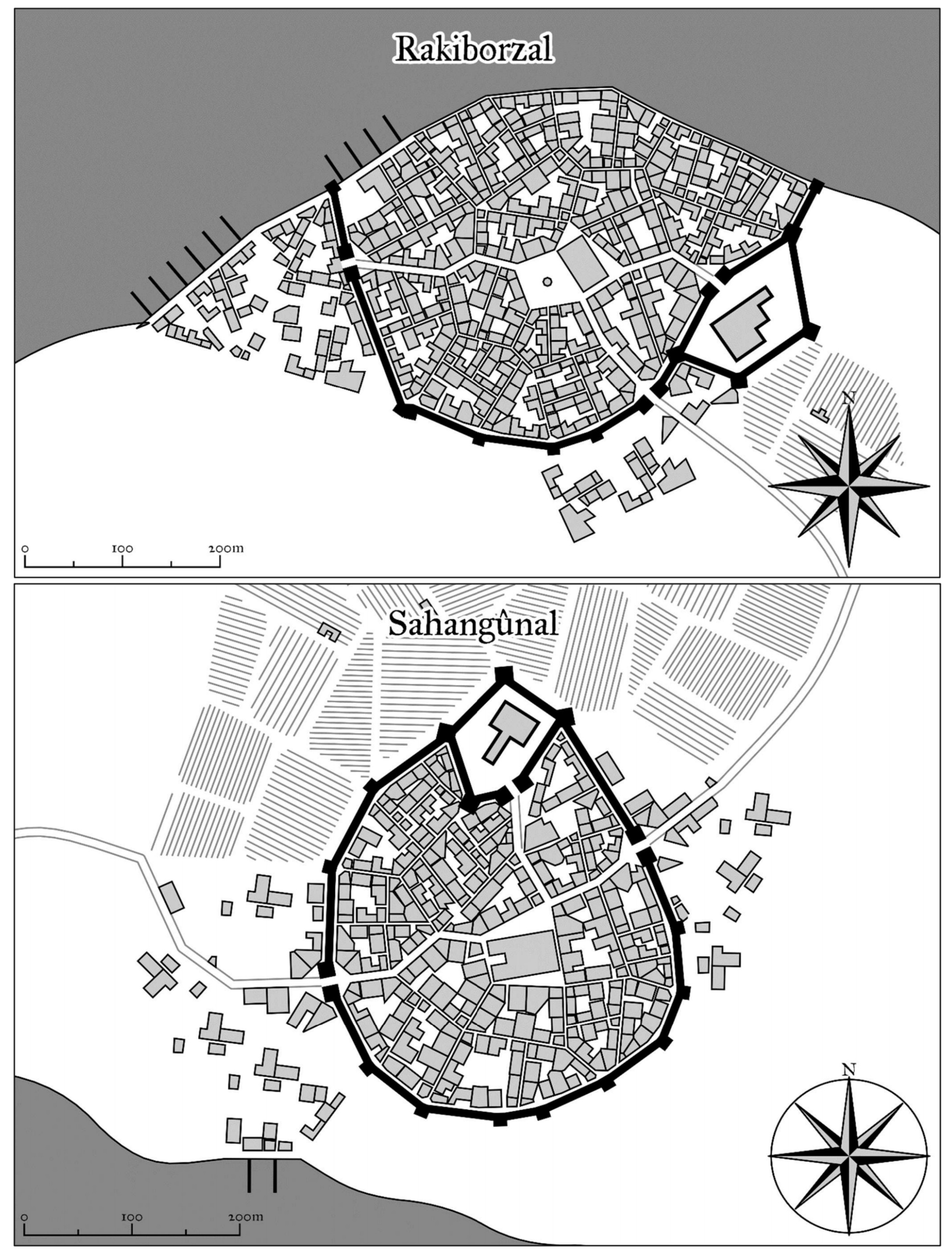
- Rakiborzal, Sahangûnal Map: E20
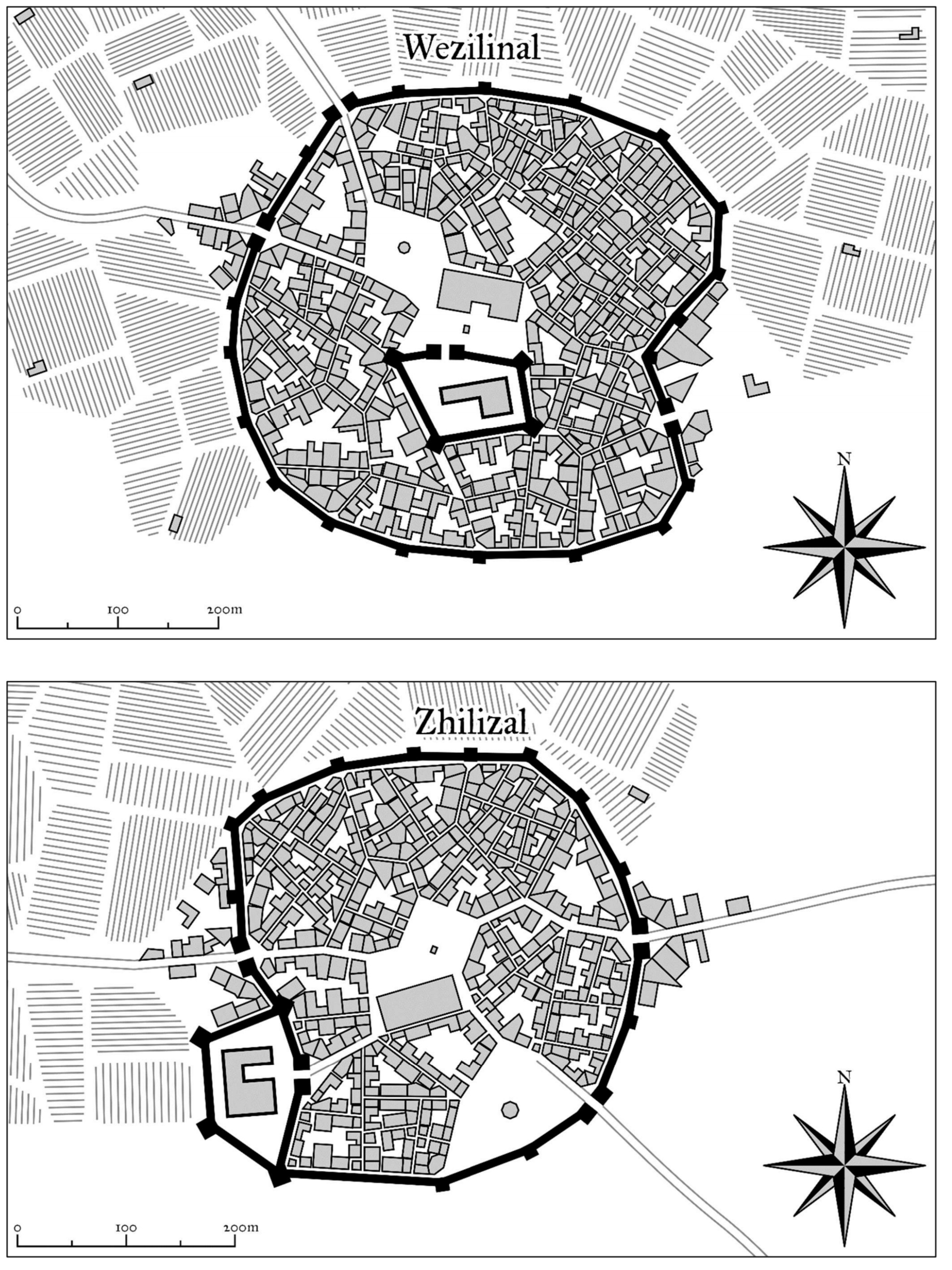
- Wezilinal, Zhilizal Map: E20
GREAT NORTHERN PENINSULA
ISKAHÚ
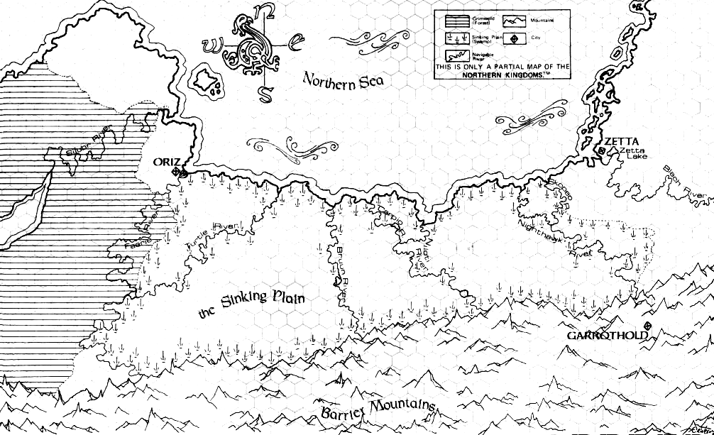
SINKING PLAIN
OTHER CONTINENTS
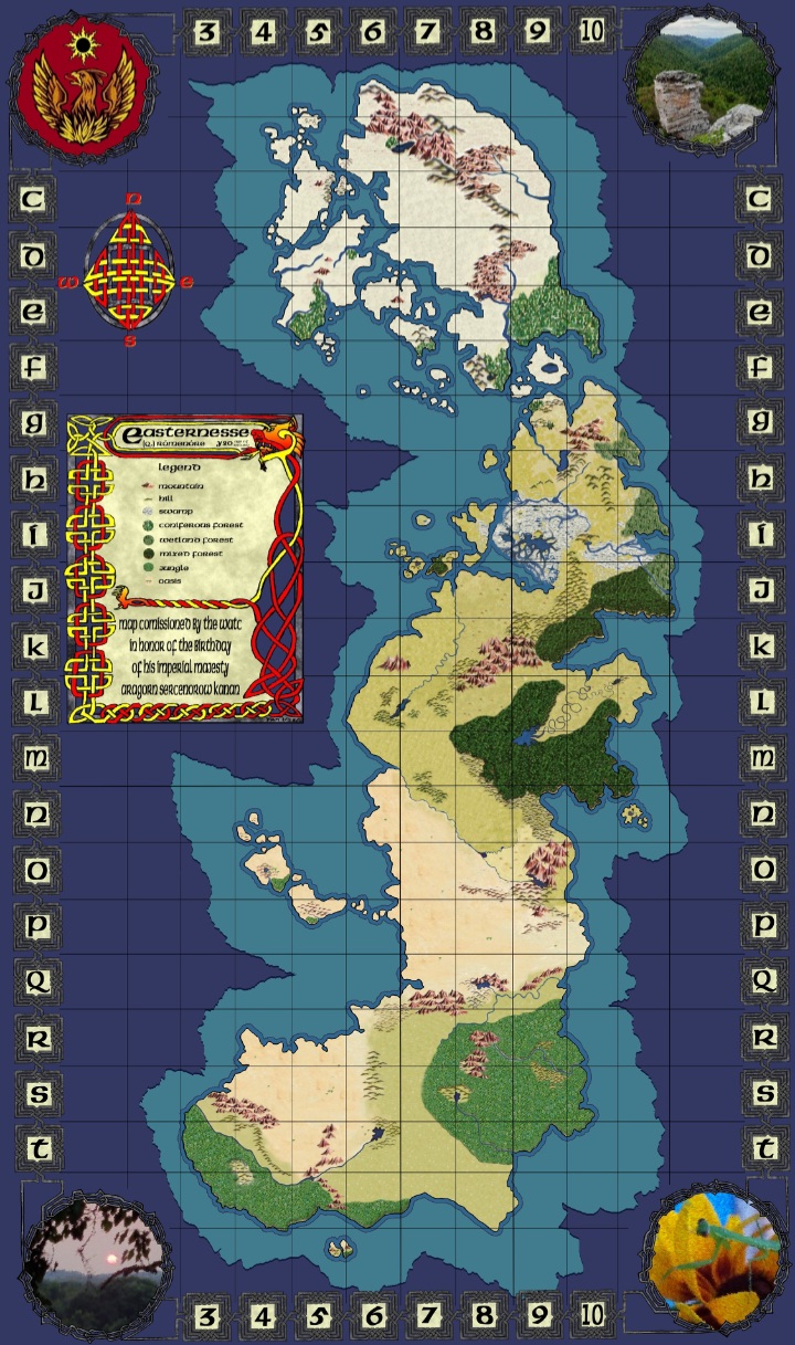
Easternesse
(Q) Rómenóre
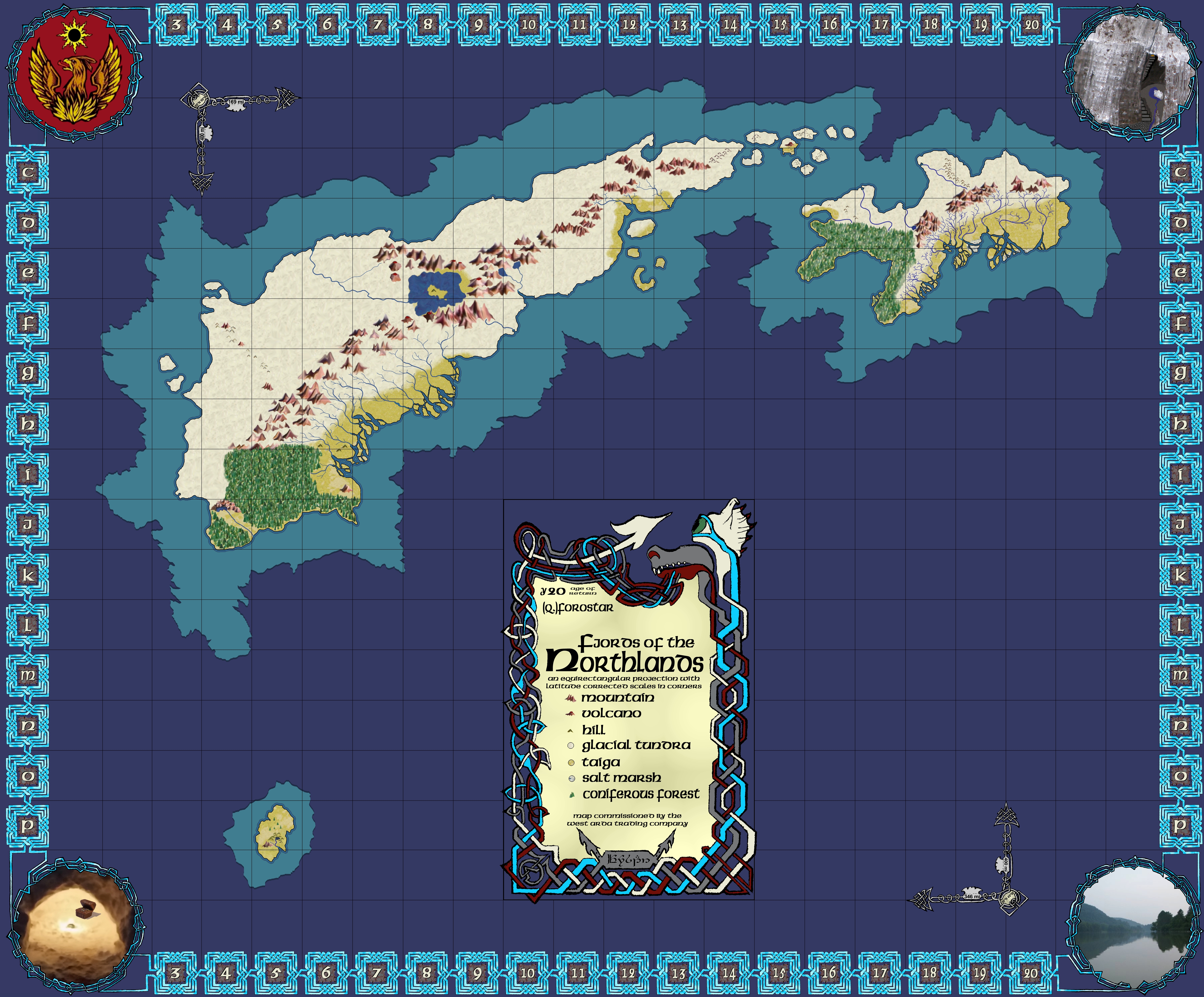
10ºN to 63°N, 55ºE to 80ºE
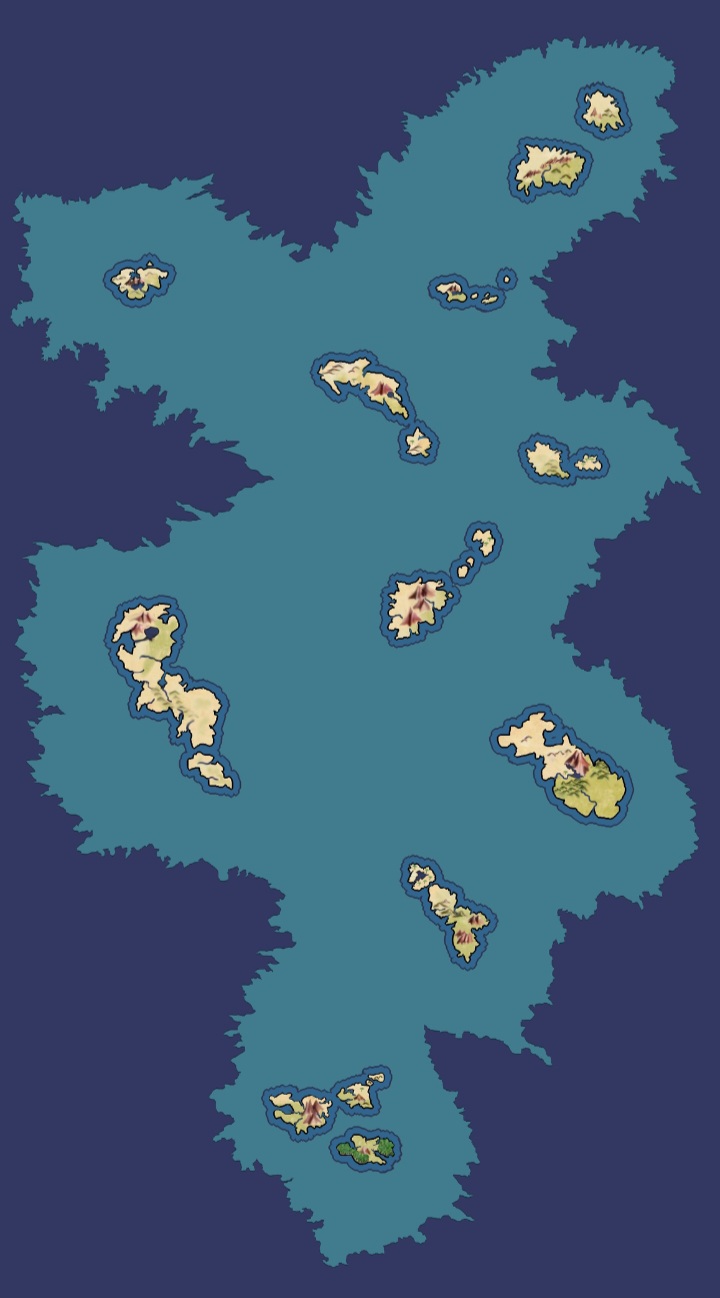
Near Isles
(Q) Tolli Belero
8ºN to 33°N, 40ºW to 51ºW
The Northlands